The 2010 edition of Carlson Software is a few weeks away from general release and is slated to have approximately 400 new features and enhancements. Suffice it to say, there should be something for just about everyone with this release. While by no means exhaustive, here are just a few of the new features that will be found in Carlson 2010 (a few of which were mentioned in the Coming in Carlson 2010 post):
- Support for IntelliCAD 6.6 and the AutoCAD 2010 product line – Carlson 2010 will continue to ship with a complimentary copy of IntelliCAD now based on the 6.6 code stream from the IntelliCAD Technology Consortium. Work continues on the migration to the IntelliCAD 7 release which is expected later this year or early in 2010. Carlson 2010 will also support the AutoCAD 2010 family of products including AutoCAD, AutoCAD Map, et. al. Since Land Desktop was officially retired in summer, 2008, now is a great time for organizations to look at Carlson as an alternative to the Land Desktop upgrade path.
Side note observation… For those Carlson IntelliCAD users out there, don’t forget to inquire about your complimentary Carlson-IntelliCAD GIS Starter Kit from ESRI!
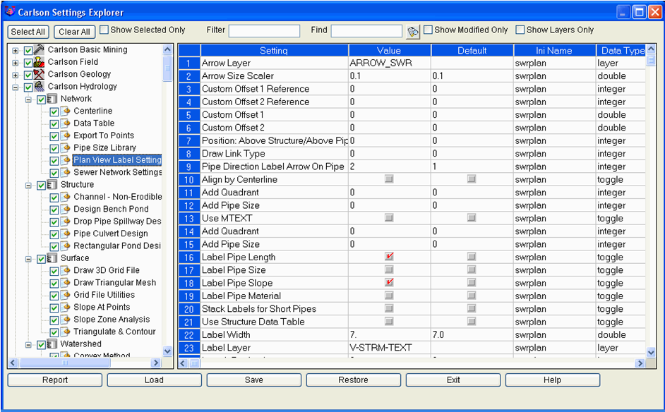
- Settings Explorer for CAD Managers – Carlson 2010 introduces an efficient Settings Explorer that allows CAD Managers and users alike to examine, set and migrate settings from machine to machine within an organization.
Carlson Settings Explorer - Layout Manager and Field Text for CAD Drafters – Geared for deliverable output, the Layout Manager and Field Text routines helps automate the creation of plot-ready maps.
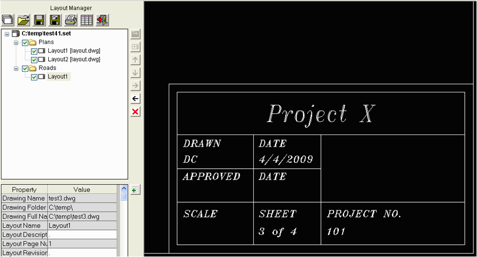
Create and manage layouts complete with "field text." - Smart Annotation for CAD Drafters and Surveyors – Carlson 2010 helps simplify the annotation typically applied to subdivisions.

Simplify drawing annotation - Merging of C&G into Carlson Survey for Surveyors – The long-awaited integration of Carlson’s C&G product line with the more traditional Carlson Survey routines provides land surveyors with arguably the most comprehensive collection of survey routines available today.
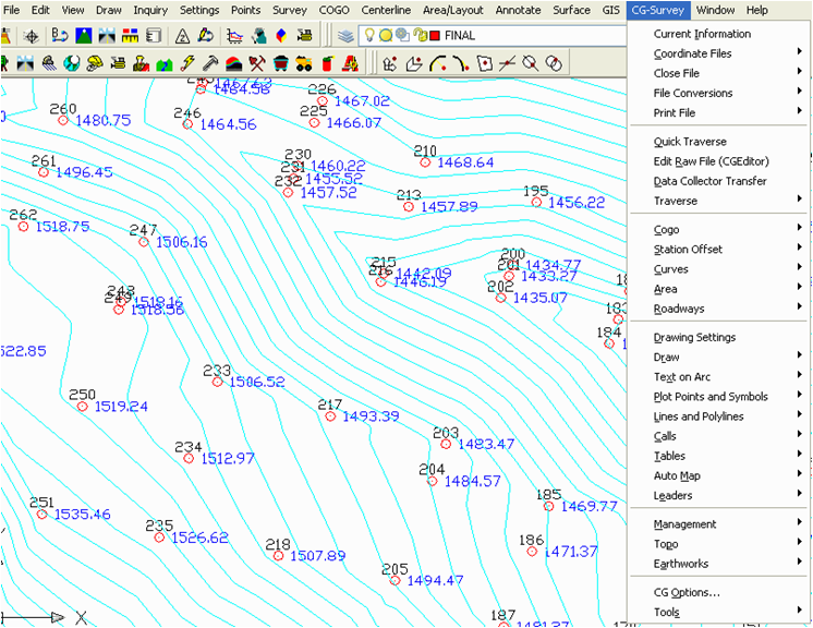
Carslson Survey with C & G - Drawing Inspector Multi-select for everyone – The highly useful Carlson Drawing Inspector is becoming even more useful with the ability to now display multiple information categories at once.
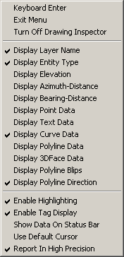
Select multiple Drawing Inspector options 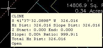
- Multi-option Drawing Inspector
- Template Grade Table for Engineers – In an effort to augment the highly flexible and powerful Template Transition, Template Point Centerline and Template Point Profile routines found in Carlson Civil, a new Template Grade Table provides robust functionality that can be used to design a variety of roadway scenarios. Additionally, the information found in the Template Grade Table can also be utilized in Carlson SurvCE beginning with the 2.5 version of the product.
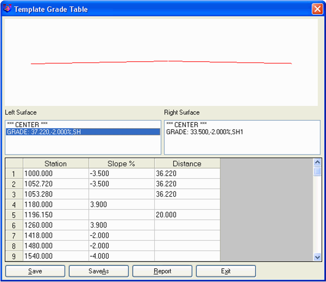
Template Grade Table - Edge of Pavement Profiles for Engineers – The ability to produce the graphical results of edge of pavement profiles is now much simpler with Carlson 2010 by giving engineers the ability to extract profile information from the imperical design values that contribute to the vertical aspect of the roadway design.

Easily create profiles of Edge of Pavement - HydroCAD Linkage for Hydrologists – As originally announced at the 1st annual Carlson User Conference, the data collaboration between Carlson Hydrology and HydroCAD will help users “save time on repetitious data entry, increasing their accuracy, and giving them access to HydroCAD’s extensive rainfall libraries and stormwater chamber specifications.”
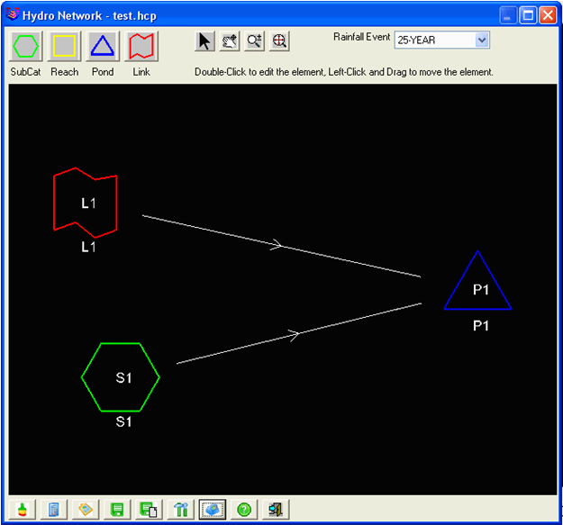
Carlson Hydro now links to HydroCAD - Improved Watershed Delineation for Hydrologists – Watersheds in Carlson 2010 can be delineated by three levels: drainage, land use and soil type.
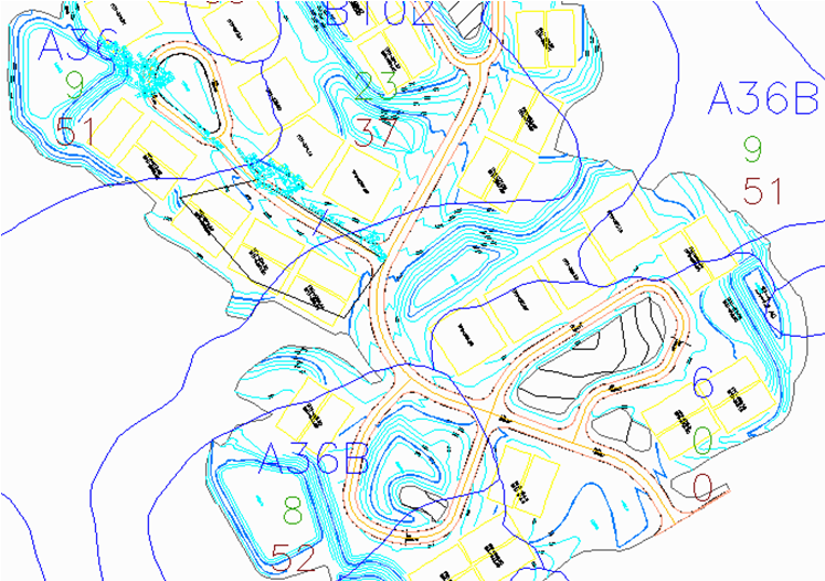
Watershed Delineation
For Carlson Mining clients that might also happen to come across this post, Carlson 2010 offers new functionality for you, too! Check with your Carlson Mining specialist for additional details.
To summarize, Carlson Software is continuing to offer responsive solutions to client-requested technology needs and is standing ready to assist you! Check out our wide-array of technolgy solutions by visiting us on-line at http://www.carlsonsw.com!