They’re Back!! ESRI, I mean!

cad softwareI got a nice surprise a few weeks ago – a call from Donny Sosa, a Survey Industry Specialist with ESRI. Donny was nice enough to come to North Carolina and present a session at my end-of-year workshops a few years ago.

Even though he gets it, I’m sure Donny groans when he hears the joke that “GIS means Get It Surveyed”… because he & I originally met after he and Brent Jones made their Why GIS Needs Surveyors presentation at a Carlson User Conference in 2009. Since then I’ve understood that he is committed to getting surveyors to provide survey-quality data to public and private GIS-systems so that the quality of the data we all rely on continues to improve.

Donny called because he remembered that a lot of my customers were excited about, and took advantage of, the free GIS Starter Kit that ESRI offered to Carlson’s IntelliCAD users after that presentation and wanted to let me know that the program is back in place.

Here are the details – effective… NOW!

Those currently using Carlson with IntelliCAD are eligible for a FREE “GIS Starter Kit” from ESRI.

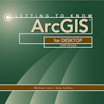
The Kit includes 3 books:

  • ArcGIS for Desktop Basic
  • A to Z GIS: An Illustrated Dictionary of Geographic Information Systems
  • Getting to Know ArcGIS for Desktop, Third Edition

To take advantage of the offer, call 1-800-GIS-XPRT FREE (1-800-447-9778 FREE) and request the Carlson-IntelliCAD GIS Starter Kit and please have your Carlson Serial Number available.

You can learn more about ESRI’s commitment to survey and engineering by attending the Esri AEC Summit or by visiting www.esri.com.


Carlson Tip: Using Carlson Software? Here’s what to look for in a new computer

Problem: You’re running Carlson Software and need a new computer… What do you need and how much do you need to spend?

The shortest answer is to follow this link to Carlson’s website: Carlson Software System Requirements

The short answer, if you’re running one of Carlson Software’s programs with embedded AutoCAD/OEM or on top of a full AutoCAD, is to follow Autodesk’s system recommendations/requirements for the platform. The Carlson part that runs on top has a relatively light footprint compared to the AutoCAD underneath, so you’ll need to make sure your new computer can run the AutoCAD-engine and the rest will be fine.

Carlson running on top of IntelliCAD also has a pretty light footprint compared to anything developed by Autodesk. Unless your drawings are loaded with a lot of layout tabs and viewports, there’s a very good chance an off-the-shelf computer from Best Buy or Wal-Mart will be sufficient.

Since I’m a self-described hardware “dummy” and that’s not the most technical answer, I asked Leonid Entov, the Assistant Director of Office Software Development at Carlson Software, for a better, layman’s-terms answer:

In one sentence, I would summarize recommended computer as i7 processor, discrete graphics (not integrated), preferably Nvidia chip since we seen more of driver issues with ATI/AMD and 8 gb of RAM (Windows tends to eat too much of 4gb these days). You do not have to go to gaming computers, something like this would be possible to find in $700+ range in laptops.

Since there are too many CPUs on the market, this site helps to compare individual CPUs : http://www.cpubenchmark.net/cpu_list.php

Thanks Leonid!

And I can’t post this without reminding everyone that Carlson’s tech support team is great and will be happy to answer any specific questions you have. Their tech support is free, all the time, whether you’re using a 30-day trial or if you’ve already purchased and whether you’re using the most current version of the software or one that’s 10 years old.

Click here to request a 30-day trial of Carlson Software


2014 That CAD Girl Workshop – Time to Register!


It’s workshop and PDH time again!

We’re mostly following the same calendar as last year with a 1/2 day in Asheville and 2 full days in Statesville and Raleigh. Each event includes drinks, snacks, lunch, door prizes/giveaways and “day-of-show” pricing for Carlson Software including new seats and maintenance renewals.

Register for the Statesville events by Sept 30th or for the Raleigh events by Oct 31st for early registration discounts. Late fees will be applied to registrations within one week of each event.


Carlson Software Workshop in Asheville NC, Monday Nov 17th
View Announcement  –  Register Now!

Statesville Workshop for Surveyors and Contractors, Tuesday Nov 18th
View Announcement   –  Register Now!

Statesville Workshop for Engineers and Designers, Wednesday Nov 19th
View Announcement  –  Register Now!

Raleigh Workshop for Surveyors and Contractors, Tuesday Dec 9th
View Announcement  –  Register Now!

Raleigh Workshop for Engineers and Designers, Wednesday Dec 10th
View Announcement  –  Register Now!


Carlson TerraVision 2014

Carlson Takeoff 2015


Carlson Tip of the Day… Virtually “printing” to PDF, DWF, JPG and PNG files

Penwill CartoonsIf you’ve recently switched from an AutoCAD-based program to Carlson with IntelliCAD, one thing you may miss is having the ability to virtually “plot” your drawings to PDF, DWF, JPG and PNG files instead of to paper. This functionality is not included in IntelliCAD and, from what I understand, including it would have significantly increased the price of each license so the developers decided to leave it out and allow users to purchase add-on programs if needed the functionality.

So, if you need to print to one of these formats, how can you do it?

If you primarily need to create PDF files and don’t mind spending some kinda-big bucks, you can purchase a program such as Adobe AcrobatAcrobat is a standalone program but it also installs as a virtual printer into Windows-based programs like Carlson, AutoCAD and even Microsoft Windows and Outlook.

If you need to print to PDF, you could save some money and consider other after-market programs such as CutePDF or PDF995 (or many others) that essentially serve the same purpose – installing as a PDF printer into Windows-based programs. Most of these programs have a free version but there’s usually a catch such as a watermark on each PDF that says something like, “This document printed with …”. If you purchase one of their other products, the watermark goes away. I currently use Adobe Acrobat but used Win2PDF for years.

If you need to print to PDF but also to other formats such as PNG, JPG and TIF, you may want to take a look at PDF Creator from SourceForge. I know this is the utility recommended by several of the tech support team at Carlson but I haven’t used it myself.

I am not sure if the other programs that I listed above (PDF995, CutePDF and Win2PDF) allow you to “print” to formats other than PDF and I can’t tell from their websites but, if anyone knows and wouldn’t mind passing that information along to me, I’ll update this post with the additional information.

As mentioned above, having these PDF-creating programs installed like a printer directly in your Carlson programs makes them very convenient and handy – but there is most likely a cost associated with them all.

My final recommendation is free, but a little less convenient – it’s Autodesk’s DWG TrueView (this link changes all the time – apologies in advance). It’s free, but it allows you to use all the virtual printers included in AutoCAD such as DWGtoPDF, DWGtoJPG, DWGtoPNG and DWF ePlot. In addition, TrueView also includes the oh-so-cool DWG TrueConvert program that enables you to convert one or more DWG files from any version to pretty much any other version. The downside to using this program is that it’s a standalone program so you must save your drawing and then open again in TrueView in order to plot.

Happy Plotting!


Carlson Tip of the Day… List of improvements in Carlson 2015 programs

carlson2015splash


General

  • AutoCAD 2015 – Added support for this new version.
  • IntelliCAD 8.0 – Direct support for 2013 DWG file format. Added 64-bit version. New features including support for dynamic entity reactors, layer states and  improved ddvpoint interface.
  • Google Earth – Added support for exporting 3D Faces.
  • Import 3D View Model File – New command to create drawing entities from a 3D model file.
  • Export 3D View Model File – New command to create a 3D model file from selected drawing entities.
  • 3D Model Library – New command to prepare the 3D models to use in the 3D Viewer commands.
  • Toolbar Manager – New command to save status of toolbars and allow migrating toolbar settings between versions.
  • File Selection – Added list of subfolders within current folder and button to move up a folder level. Added option for warning when selecting a data file that is not within the current project folders.
  • Textures – Added 40 new textures for 3D viewing.
  • Settings File Manager – Added function to compare two settings files and report differences.
  • Leader With Text – Added option for horizontal tick and option to create with Mtext.
  • Join Nearest – Added filters for common colors and linetypes.
  • Join Polyline By Trace – New command to join linework into a polyline with prompts at intersections


Survey Commands

  • Field To Finish – Added special pipe feature coding with ability to create pipe network (.sew) file. For tree feature coding, added option for drip as diameter instead of radius, added option for solid circle for trunk and option for relative tree size for the symbols. Added control for separate layers for the point attribute block and point node. Added new AFIT special code for making a curve tangent through a series of three curve points. Added method for dynamic templates with variable horizontal and vertical offsets by using the OH and OV special codes. Added settings file default distinct point layer prefix/suffix. Added separate text size settings for attribute text labels and point block attributes.
  • SurvNET – Added error report for individiaul observations to track down blunders. Added import for TDS GPS vectors.
  • Edit Process Level Data – Added support for processing with zero horizontal distances.
  • Carlson Cloud – New command for communicating with SurvCE for sending messages, data files and crew locations.
  • Report Distance Scale – Added methods for grid/ground factors on-the-fly in addition to a fixed factor.
  • 3D Transformations – Added 3D coordinate transformations.
  • Point Group Manager – Added method to create point group by offset distance from alignment polyline.
  • Move Point Attributes With Leader – Added controls for attribute order and ability for curved leaders.
  • Import Text/ASCII File – Added method import from text with fixed widths and method to use inclusion/exclusion perimeters.
  • Legal Description – Added method to report station/offset using a reference centerline. Added method for reporting with geodetic mean angle and geodetic distances.
  • Cut Sheet – Added method to get station/offset from the point description coding. Added field for design point description.
  • Offset Points By Interval – New command to create offset points along an alignment.
  • Label Coordinates – Added options to include a description, to use Mtext, to draw the labels at an angle and option for mleader.
  • Draw Legend – Added method to put each symbol or a specific layer.


Civil Commands

  • Draw Profile – For paper space profiles, added method to use an existing layout as a reference template for the new layout. For the horizontal label box, added option for horizontal text in addition to vertical. For pipe profiles, added settings to label inverts by left/right order, added option to draw cutoff style pipe extensions, added option to create labels as MText, added option for flow arrow in middle of pipe, new option for labels above the pipes, added justification settings per label, added setting for separate layer for pipe thickness than pipe profile and option to connect rims with a polyline for a simple surface profile. For Label Line/Point crossings, added option to label elevations at crossings, added method for labeling GIS attributes, added method to label points of selected descriptions within offset tolerance, added option to label CL deflections and added option to avoid label overlaps. Added special CL stations for break point station/elevation labels plus new prefix/suffix settings. For EOP profiles, added new break point and EOP leader style to the start of the labels, added option to label ground profile on road EOP profiles and added controls to select which profiles are EOP, road and ground. For the manhole name within circle option, added setting to put the name and number on separate lines and added the option to auto shift the labels to avoid overlaps.
  • Draw Sections – Added option to label cut/fill volumes per station. Added separate settings for pipe crossing layers for decimals on pipe size, offset and elevation.
  • Draw Plan View Sheets – Added option to set station range to draw.
  • Input-Edit Centerline – Added Fit Curve method to apply speed table to all PIs in centerline.
  • Input-Edit Profile – Added method to apply speed table for vertical curve lengths to all PIs in profile.
  • Label Station/Offset – Added method to use a TIN or grid surface for the elevation reference.
  • Draw Lot Setback – Added method for separate corner side setback amount.
  • Move Spot Elevations – New command to move spot labels and update elevation to new position on reference surface.
  • Line Of Sight Viewshed – New command to calculate line-of-sight from a point and eye height on a surface.
  • Draw Spot Elevations – Added option for label only and option to pick an entity instead of a point.
  • Cut/Fill Labels – For points method, added more options like separate layers for existing and design. For the TIN method, added options for deep cut/fill labels and option for marker symbol.
  • Smooth Polylines – Added method to smooth polyline between selected points.
  • Triangulation File Utilities – Added function to color TIN within inclusion perimeter.
  • Road Stripe Library – New command to setup named sets of road stripes with offsets, colors and styles.
  • Draw Road Stripes – New command to draw linework for road stripes.
  • Linear 3D Object Polylines – New set of commands to manage alignment polylines for 3D Viewer commands for linear 3D features such as fences or guard rails.
  • Label Profile On Centerline – Added label position by left/right in addition to above/below. Added prefix/suffix and station interval settings.
  • Offset 3D Polyline By Grade Table – New command to offset a 3D polyline using the distances and slopes from a template grade table.
  • Road Network – Added settings for station range to process for each road.
  • Mass Haul Analysis – For borrow pits, added offset from road to account for offset travel time.
  • Sections From 3D Polylines – New command to create cross sections from 3D polylines.
  • Surface 3D Viewer – Added option to show contours. Added functions to edit triangulation by swapping edges, adding breaklines, removing points, removing triangles or editing point elevations.
  • Surface 3D Flyover – Surface model is kept in sync with any edits in CAD so that the 3D view is automatically updated. Added method to add models to the scene by screen picking plus the ability to pick models in the scene to edit properties (location, rotation, scale). Added function to record a movie. Added method to map textures by color and method to scale textures. Added run view mode for detached from moving vehicle. Added option to show contours. In pick mode, display real-time coordinate and elevation for mouse position on surface.
  • Motion 3D Viewer – New command to assign path polylines with speeds to 3D models and the camera.


Hydrology Commands

  • Design Detention Pond – New command with all steps for detention pond design plus support for multiple rain events.
  • Pipe Culvert Design – Added method for tailwater by channel or discharge rating and added overtopping analysis.
  • SCS Rainfall Library – New command to define an SCS data reference library for rain events.
  • Rational Rainfall Library – Added import of IDF tables from comma separated text files.
  • Collision Conflict Check – Added support for checking unlimited pipe networks and using the report formatter.
  • Sewer Network Design – Added option for junction loss for pipe connections including laterals. Added method for tailwater at each outlet. New method to set symbol rotation by screen pick. Added graphic preview during .sew file selection.
  • Lateral Design – Allow for multiple lateral connections at manholes.
  • Identify Pipe Polylines – New command to ID or list pipe data assigned to 3D polylines.
  • Import Network From 3D Polylines – Added method to control order of names by design order, elevation or polyline direction. Added method to set rim elevation by depth.


GIS Commands

  • Label GIS Point Data – New command to create text labels or block with attributes for selected GIS attributes.


Field Commands

  • Drivers: Upgraded many drivers from the SurvCE updates.


Geology Commands

  • Define Mining Model – Added Mine Model collection of surfaces for modeling only mineable strata already adjusted for recovery, roof/floor gain/loss and minimum parting. Renamed “Pre-Calc Model” to “Geologic Model”.
  • Geologic To Mining Model – New command to adjust a Geologic Model to make a Mining Model.
  • Drillhole Database – Added support for MS Access .accdb format.
  • DHDB – Added drillhole database import/export to DHDB format.
  • Import From Coal Section – New command to create pit/channel samples from coal sections.
  • Configure Section Info – Added method to set folder for section drawing to allow storing the section info on a server.
  • Import/Export Coal Sections From Text File – New commands to import/export coal sections from/to text files.
  • Grid Files – Added option to store .grd files as binary to improve read/write speed.
  • Grid File Utilities – Added method to call other GFU macros and pass parameters from another macro. Added sin() and cos() functions for grid math. New dialog interface including dialog for creating IF statements. Added 3D window to show grid while modified.
  • Draw Geologic Column – Added method to draw in  3D with strata sections sized based on grade parameters. Also added 3D draw method as 3D lines. Added method to label grade names and added separate layer settings for attribute labels. For labels in 3D, added options for rotate labels vertical and draw label leaders. 3D Viewer Window now shows 3D text generated by Geologic Column.
  • Drillhole Report – Added method to report grades for each strata.
  • Drillhole Core Images – Added method to draw the report to the drawing and added option for labeling depth or elevation.
  • Draw eLog – New command to draw graph of selected attributes from an eLog LAS file.
  • Create Drillhole from eLog – New command to create drillholes with strata classification using the eLog paramters.
  • Trim Isopach Within Fault Zone – New command to isopach elevations and break contours at fault zones.
  • Draw Fault Labels – New command to label fault deltas.
  • Draw Fault Symbols – New command to draw +/- symbols for faults.
  • Apply Faults To Grid – Added method to handle thrust faults. Added method for processing multiple grids at a time.
  • Surface Mine Reserves – Added Adjust Pits Manager for adjusting pit perimeters with real-time quantity updates.
  • Draw Grade Boundary – New command to draw boundary polylines around area with specified grade.
  • Block Model Statistics – Added min/max/average elevation and depth to the report. Added level # to report name.

Surface/Underground Mining Commands

  • Ribbon – Added a mining ribbon for running with AutoCAD 2012 and higher.
  • Import Pit Points – Added method for user-defined input file formats.
  • Import Polyline File – Added method to draw 3D polylines from sequence of top/bottom points for blast holes.
  • Label Property Lines – Added option to label owner or id labels and added setting for label layer.
  • Surface Equipment Timing – Improved calculation speed by 25%. Added method to use table of production targets with variable equipment usage to adjust to meet the targets.
  • Underground Timing – Added option for transparent hatching and for buffer hatching.
  • Dozer Push – Added support for push cut area by closed polyline. Added method for reporting single, average push. Added option to keep existing polylines, to draw centroid symbol and to label total push distance. Added settings for label text size, layer, style, decimals and prefixes.
  • Regrade Backfill – Added bench option to cross section regrade design.
  • Range Diagram – Added dimensions for all angles and distances. Added options to output final profile and to output parameters to sequence file.
  • Design Ramp Profile – New command to create a ramp profile between two surfaces.
  • Ramp Bench Polyline Generator – New command to design bench pits using polylines.
  • Edit Dragline Sequence – New command to edit the steps for pit cuts.
  • Make Solid From Points – New command to create a solid model from a cloud of points.
  • View Solid – New command to view a solid model in the 3D viewer.
  • Draw 3D Mine Model – Added method to make model from coal sections and pillar/perimeter polylines.
  • View 3D Surface History – Added support for displaying TINs.


Construction Commands

  • Define Layer Target/Material/Subgrade – Added support for up to 7 subgrades.
  • Color TIN By Layer – New command to color the surface TIN using the color assignments in Define Layer Target.
  • 3D Drive Simulation – Added method to apply textures to design layers in addition to colors for viewing in 3D.
  • Tag Segments To Skip Linear – New command to tag polyline segments to skip for material linear quantities.


CADNet Commands

  • Merge Raster Files – Added method to automatically select control points.
  • Import SketchUp File To Drawing – New command to create drawing entities from a SketchUp file.
  • Import PDF File – New import engine with ability to use layers for PDFs with layers.
  • Drawing to 3D PDF – New command to create a 3D PDF from selected drawing entities.
  • 3D Viewer to 3D PDF – New command to create a 3D PDF from a 3DX file from the 3D Viewers.


Point Cloud Commands

  • Faro – Added direct import method uses Faro toolkit.
  • E57 – Added support for importing industry standard e57 format.
  • PLY – Added import for PLY format.
  • LAS – Added method to use LAS classification for coloring and selection.


Data Conversions

  • 12D – Added import and export for pipe networks plus support for some more entity types.
  • Canada – Added support for NTv2-NAD27-83
  • Geoids – Added support for Canada CGG2010 and CGG2013n83, Sweden 08_rh2000, Sweden 08_rh70, Poland 2011 and Georgia 2012
  • Iowa – Added projections for Iowa Regional Coordinate System
  • Ireland – Added national grid projection.
  • KOF – Added function to draw linework from KOF files.
  • MDL – Added support for binary data within FSC file.
  • Norway – Added support for N2000 format.
  • SketchUp – Added import for SketchUp models in Surface 3D FlyOver
  • SurvCE – Added import for points with photos in Google KML format as created by SurvCE


Carlson 2015 Has Been Released!

Carlson posted the 2015 versions of their for CAD (IntelliCAD or AutoCAD 2004-2015) on Tuesday afternoon… you can Download Carlson 2015 products with IntelliCAD here. The 2015 versions of embedded AutoCAD products (Survey and Takeoff OEM) will be released later this summer.

If your maintenance contract is current or you have purchased 2014 products within the past 90 days, you’re automatically eligible for an upgrade to 2015. Click here to look up your 2015 serial number using your 2014 serial number.

Click here to review the list of all improvements

Click here to read about updates in Carlson Survey 2015

Click here to read about updates in Carlson Civil and Carlson Hydrology 2015

Click here to read about updates in Carlson Takeoff Suite 2015 – including Construction, CADNet, Trench and GeoTech

There are price increases with 2015 products. Click one of these links if you would like to Request a Demonstration or Request a Custom Proposal to upgrade to 2015 or purchase new software.

Please follow this link to see if you’re eligible for our monthly webinars including CAD and Carlson Tips & Tricks, Intro to Survey and GIS and What’s New in Carlson 2015.


Robert Green’s “An Open Letter to CAD Software Companies” and a Response from IntelliCAD

If you’re one of the many folks out there who don’t believe that the developers of your CAD software are listening to you… you’re not alone and you should take the time to read Robert Green’s “An Open Letter to CAD Software Companies” in Cadalyst. And, as to the part about feeling like you’re all alone, here is Robert’s follow up describing the overwhelming response to his open letter.

I receive email versions of Robert’s bi-weekly CAD Manager newsletters but had fallen behind and didn’t see the original post until yesterday. If I’d read it when it was first released, my response would have been, “Amen brother!”.

Just yesterday morning I had a conversation with a colleague whose company does Landscape Architecture, Civil Design and Land Planning. They are fully invested in Civil 3d (including much blood, sweat and tears in addition to money, money, money) but they’re as productive as any company I know of with the program. Their main complaint? They feel like Autodesk is pushing them toward Revit and they have no need for the software.

In my own experience, I see the push toward NavisWorks and 3ds Max. I had two seats of Civil 3d until I downgraded one of them to Map last year – only to be “rewarded” with an upgrade to Infrastructure Design Suite (and more money for Subscription) this year. This was supposedly something that owners of a Civil 3d and a Map license were able to opt-in to. I didn’t opt-in. So, it took me several days to get them to un-opt-me-in and revert my licenses back to what I’d purchased. Is it any wonder I’m suspicious of any “bonuses” that come my way because of this?

I don’t know how much Robert intended to point the finger at Autodesk in the original column but, with my experiences described above, the references to BIM (which we’ve long argued was a way for Autodesk to avoid talking about Esri and GIS) and Cloud and other buzzwords, that’s certainly the connection I made in my mind.

Because the Carlson Software I sell now includes IntelliCAD, an alternative to AutoCAD, I passed links to the open letter and the responses to a few folks to get their reaction. Dave Lorenzo, the Development Director for the ITC (IntelliCAD Technology Consortium) took the feedback to heart and, considering the interest in the future of IntelliCAD the past few years, I asked his permission to post his response. I very much appreciate his willingness to let me do so…

I agree that the features mentioned are focused on AutoCAD, but the article is not so much about features as it’s really about the user’s perception if someone is listening. While Autodesk is moving too fast providing features that users don’t want or need, we are not moving fast enough to provide the basic productivity features users are requesting, so it appears we both are not listening to our users. That is the perception we need to fix too.

Our next release has several user requested productivity features and I hope our users will see we are listening. Actually we have always been listening but our rewrite of IntelliCAD 7 took so many resources that there was little time for new features – that situation is finally changing. I believe that there are a lot of unhappy AutoCAD users who want IntelliCAD to be successful, we just need to listen and add those remaining productivity features that are keeping them from making the switch.


End of Year Workshops – New format for 2013

After several years of the same format for our end of year workshops, we’ve changed it up a bit this year.

For the first time, we will have one full day in both Statesville and Raleigh NC dedicated to Surveying and GIS topics and an additional day focusing on Civil and Hydrology topics. Each day will also include a unique presentation of the popular CAD Tips & Tricks session that, hopefully, sends everyone home with something they can use the next day.

In addition, we’re conducting 1/2-day events in Wilmington and Hendersonville (Asheville area) covering a variety of topics.

Each full-day class will give NC licensed surveyors and engineers 8 PDH credits and the 1/2 day events are eligible for 4 PDH credits. All events include lunch, software pricing specials and giveaways.

November 11th, Hendersonville NC – $49 for 4 PDH credits
Download Hendersonville (Asheville) Announcement Here
Register for Hendersonville (Asheville) Workshop Here

November 12th, Survey & GIS Workshop, Statesville NC – $99 for 8 PDH credits
Download Statesville Survey/GIS Announcement Here
Register for Statesville Survey/GIS Workshop Here

November 13th, Civil & Hydrology Workshop, Statesville NC – $99 for 8 PDH credits
Download Statesville Civil/Hydro Announcement Here
Register for Statesville Civil/Hydro Workshop Here

December 9th, Wilmington NC – $49 for 4 PDH credits
Download Wilmington Announcement Here
Register for Wilmington Workshop Here

December 11th, Survey & GIS Workshop, Raleigh NC – $99 for 8 PDH credits
($89 registration thru 10/31/2013)
Download Raleigh Survey/GIS Announcement Here
Register for Raleigh Survey/GIS Workshop Here

December 12th, Civil & Hydrology Workshop, Raleigh NC – $99 for 8 PDH credits
($89 registration thru 10/31/2013)
Download Raleigh Civil/Hydro Announcement Here
Register for Raleigh Civil/Hydro Workshop Here


Does Carlson Still Work With AutoCAD?

File this under “Myths”…

I hope this isn’t widespread, but I received the following email yesterday and think it’s important to respond publicly. The email is posted in its entirety except for the name and contact info of the author.

Hello Jen & Jeremy,

I became acquainted with your site (and I believe Jen was on a “webcast” or video I had watched) when my former employer made the switch from Civil 3D to Carlson Civil several years back. I am an engineer and have been put into the role of upgrading AutoCAD and Carlson or making sure that my current company can continue to do what is necessary, which involves using CAD much less that in my consulting life.

A local Autodesk reseller paid us a visit and indicated that Carlson and Autodesk as companies have not reached an agreement to continue further compatibility. Sounds like a licensing ($$) agreement issue, to me, that may or may not be temporary. This salesperson also indicated that the new version of Carlson would not work with anything beyond AutoCAD 2010 which we are currently running with Carlson 2011. As a note, My former company did not update AutoCAD every year depending upon what features were actually new so I am very OK with not upgrading if not entirely necessary.

I would greatly appreciate any information or insight you could give on the subject. You can reach me via this e-mail or the phone number in the signature.

Kind regards,


I contacted Carlson and requested a direct reply:

Hi Jennifer,

Carlson Software is a current member of the Audodesk Developer Network (ADN) which gives access to the current Autodesk products. We expect to release Carlson’s 2014 products, including those running on top of IntelliCAD, AutoCAD 2014 and AutoCAD OEM, in the Summer of 2013.

Dave Carlson


Also, for the record, I currently run Carlson 2013 on top of IntelliCAD and on top of Civil 3d 2012.


Freebies from Esri for Users of Carlson with IntelliCAD

I’m re-posting this once more because of the continued interest.

For several years Esri has been offering a FREE “GIS Starter Kit” for anyone who uses Carlson with IntelliCAD. This program will not go on forever but, to my knowledge, is still active. [This offer ended on 12/31/2013]

There are a couple of limitations that I’m aware of: existing Esri customers are not eligible and you can only take advantage of the offer one time… Not once for every seat of Carlson with IntelliCAD that you purchase or own.

The GIS Starter Kit includes:

  • ArcGIS ArcView desktop software
  • A copy of the book A to Z GIS: An Illustrated Dictionary of Geographic Information Systems
  • A copy of GIS Tutorial: Workbook for ArcView 9, Third Edition


If you are a current user of Carlson with IntelliCAD and meet the requirements above, you can call 1-800-GIS-XPRT (1-800-447-9778) and request the Carlson-IntelliCAD GIS Starter Kit – You will want to have your Carlson serial number handy.