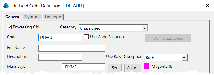
This is a “slightly known” feature that’s built into Carlson Software‘s Field to Finish feature. The Field to Finish command is available in the Carlson Survey, Construction and Takeoff programs. Please see the video below to learn how to use the DEFAULT field code to quickly identify and find points with random, non-standard, descriptions that may need your attention.
Are you using a DEFAULT field code in Carlson Field to Finish?
Managing your View Cube in Carlson 2024 with IntelliCAD
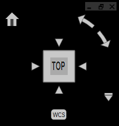
When I first launched Carlson 2024 with IntelliCAD, my first reaction was, “What’s that cube-thingy doing in my drawing screen?? And how do I turn it off?”. The formal name for the “cube-thingy” is a VIEW CUBE and, as I learned, turning it off wasn’t as easy as I thought.
Here is what Carlson’s IntelliCAD manual explains about the VIEW CUBE:
The view cube is a navigation tool that indicates the current viewing direction and allows you to switch between preset views and custom viewing directions. You can also use the view cube to change the coordinate system and switch between orthographic and perspective projections.
The view cube displays in the current viewport when working in 2D model space or a 3D visual style. It becomes active when you move the mouse over it, and it can display with transparency or not at all when inactive.
I decided to upload a very short video that shows you how to turn it off – in case, like me, that’s your preference!
That CAD Girl’s Webinar Series
– Company and Individual Subscriptions now available!
We’ve been working on the behind-the-scenes logistics of this for awhile and are finally ready to roll it out to everyone! We can now offer Company and Individual Subscriptions to our Webinar Series events.
Your company will still get a year’s access for up to 10 users with any purchase of a new license of Carlson Software through That CAD Girl or one of our trusted partners (more about this coming soon!).
Now, with our Company and Individual Subscriptions, we have more to offer those who don’t need more software.
Click here to see a list of our Upcoming Webinars
Click here for the details and all the fine-print
If you want to sit in on an upcoming webinar, please click here to request a Guest Registration.
That CAD Girl is heading west!
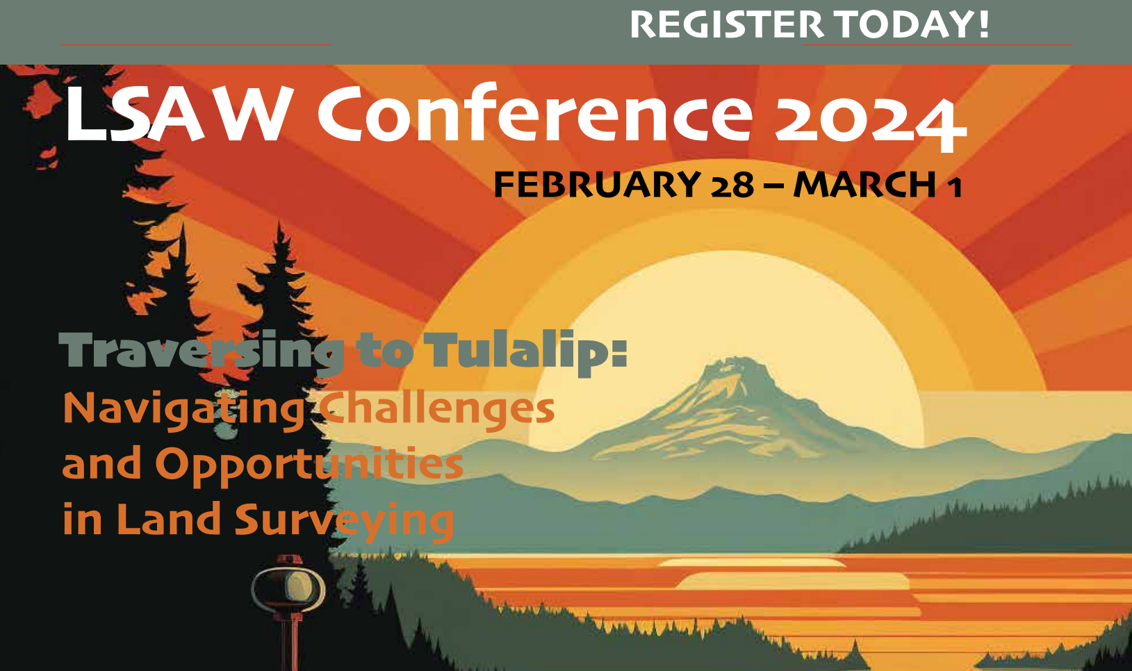
We’re very excited – and appreciative! – to the Land Surveyors of Washington (LSAW) and to the Western Federation of Professional Surveyors for inviting us to present sessions at their 2024 conferences!
We will have some fun and exciting events at our booth that you won’t want to miss, so make sure to come by while you’re there!
In Tulalip at the 2024 LSAW Conference, That CAD Girl will be presenting Survey Project from Field to Plotted Sheet with Carlson Software – tentatively scheduled on Wednesday, Feb 28th.
At the Western Regional Survey Conference in Las Vegas, we will also have fun ‘n’ games at our booth and will be presenting Survey Project from Field to Plotted Sheet with Carlson Software.
And you won’t want to miss our other session! In Dueling Piano… err, Dueling CAD Stations: Civil 3D vs Carlson Software with John Dingwall of CAD Masters, we will go head-to-head to demonstrate how each program handles your day-to-day Survey work.
Early registration is still open for both Conference, so register today!
If You’re Not Using LandXML – You Should Be (yes, all of you!)
This is a badly needed webinar… I don’t think I’ve done one specifically on this topic before and, for the life of me, I don’t know why. For years I’ve been speaking to large groups at conferences and trade shows and it never ceases to amaze me how few people know the benefit of using LandXML files!

This will be a little different from my regularly scheduled webinars because it’s FREE to everyone, there is no purchase required and the material presented will apply to everyone regardless of the civil/survey/construction software you use. Whether you know it or not, you’ve probably got everything you need already in your current software – you just need to put it to use.
So, what prompted me to finally schedule it? These poor people still using Land Desktop or Eagle Point calling me in a panic because their hard drives have finally crashed and they can’t get the old software installed on newer Windows machines. Don’t get me wrong, I don’t fault anyone for hanging on to something that works but the ones who call me never realized they had the tools to protect themselves and salvage years of project data all along.
You can register here (no strings attached – promise!) or keep reading for the full announcement…
Please join me in this free webinar while I explain the benefits of, and how to use, LandXML-formatted files to share and archive project-related data files regardless of the manufacturer or version of software you and other team members use.
Although many people do not realize it, LandXML is a tool that’s most likely in your hands now and won’t require any additional purchase.
This webinar is a MUST SEE for anyone still using Land Desktop, Eagle Point or other program that has been retired because it is increasingly difficult, if not impossible, to install these programs on newer computers.
The information provided in this webinar will apply equally to users of Carlson Software, Land Desktop, Civil 3d, TerraModel, Eagle Point and practically any other software for surveyors, engineers or contractors (including machine control systems).
==============
This webinar will last approximately 1 hour and there will be time for questions at the end.
It’s Trade Show Season – Come See Me!
It’s trade show season again and I am happy to get the chance to go visit old friends and meet new ones over the next few months…
Next one upcoming is the SAMSOG Technical Seminar in Atlanta later this week. I appreciate the opportunity to present my classes to this group for the first time and I understand it’s going to be quite a crowd; but they take walk-ins on the day of the event. I’ll be covering Tips & Tricks in CAD and Carlson and an Introduction to Field to Finish.
Next will be the NJ SurvCon in Atlantic City which starts on 2/4. I think this is my third year and I really enjoy seeing everyone although they all tell me I talk funny! Again, it’s Tips & Tricks but I’ll also be presenting How to Take a Project from Field to Finish with Carlson Survey.
February 11th thru 13th I’ll be in Columbus, Ohio for the 40th Anniversary of PLSO’s Annual Conference. I’ll be in the exhibit hall for most of the time but on Friday will be teaching CAD & Carlson Tips & Tricks. Make sure you visit my booth and see how your CAD skills match up to surveyors in other states!
And, lastly (I think), I’ll be in Murfreesboro TN at the TAPS 47th Annual Meeting & Exhibition from March 12-14. I’ll be in the exhibit hall most of the time but will also be teaching Field to Finish for Survey and GIS Collection from a GIS Dummy on Thursday March 12th.
It’s not a trade show but don’t forget Carlson’s 2015 User Conference at the end of April. I’ll definitely be there since it’s practically in the backyard of my hometown in Kentucky.
Looking forward to seeing everyone!
Google Earth/KMZ Overlays: Flood Zones, State Plane and UTM Zones
A CAD/Carlson Software buddy – Dent Cermak – passed along a response from FEMA to questions regarding the features available on FIRM maps. The FEMA rep recommended using National Flood Hazard Layer data to view flood data overlays on aerial, street and other imagery. The NFHL data is available via an online viewer here: http://fema.maps.arcgis.com/home/webmap/viewer.html?webmap=cbe088e7c8704464aa0fc34eb99e7f30.
Another way to access the NFHL data is to download it as a KMZ file that can be opened in Google Earth: https://hazards.fema.gov/femaportal/wps/portal/NFHLWMSkmzdownload.
So, I thought this was pretty cool and when I asked for Dent’s permission to share on my website, he passed along a couple more .kmz files that were even more cool! These are courtesy of Ladd Nelson at Carlson Software.
If you have Google Earth installed on your computer, you only have to double-click to open these files in Google Earth.
KMZ file with US State Plane NAD83 Zones overlay – ZIP file
KMZ file with UTM Zones overlay – ZIP file
2014 That CAD Girl Workshop – Time to Register!
It’s workshop and PDH time again!
We’re mostly following the same calendar as last year with a 1/2 day in Asheville and 2 full days in Statesville and Raleigh. Each event includes drinks, snacks, lunch, door prizes/giveaways and “day-of-show” pricing for Carlson Software including new seats and maintenance renewals.
Register for the Statesville events by Sept 30th or for the Raleigh events by Oct 31st for early registration discounts. Late fees will be applied to registrations within one week of each event.
Carlson Software Workshop in Asheville NC, Monday Nov 17th
View Announcement – Register Now!
Statesville Workshop for Surveyors and Contractors, Tuesday Nov 18th
View Announcement – Register Now!
Statesville Workshop for Engineers and Designers, Wednesday Nov 19th
View Announcement – Register Now!
Raleigh Workshop for Surveyors and Contractors, Tuesday Dec 9th
View Announcement – Register Now!
Raleigh Workshop for Engineers and Designers, Wednesday Dec 10th
View Announcement – Register Now!



Carlson Tip of the Day… Virtually “printing” to PDF, DWF, JPG and PNG files
 If you’ve recently switched from an AutoCAD-based program to Carlson with IntelliCAD, one thing you may miss is having the ability to virtually “plot” your drawings to PDF, DWF, JPG and PNG files instead of to paper. This functionality is not included in IntelliCAD and, from what I understand, including it would have significantly increased the price of each license so the developers decided to leave it out and allow users to purchase add-on programs if needed the functionality.
So, if you need to print to one of these formats, how can you do it?
If you primarily need to create PDF files and don’t mind spending some kinda-big bucks, you can purchase a program such as Adobe Acrobat. Acrobat is a standalone program but it also installs as a virtual printer into Windows-based programs like Carlson, AutoCAD and even Microsoft Windows and Outlook.
If you need to print to PDF, you could save some money and consider other after-market programs such as CutePDF or PDF995 (or many others) that essentially serve the same purpose – installing as a PDF printer into Windows-based programs. Most of these programs have a free version but there’s usually a catch such as a watermark on each PDF that says something like, “This document printed with …”. If you purchase one of their other products, the watermark goes away. I currently use Adobe Acrobat but used Win2PDF for years.
If you need to print to PDF but also to other formats such as PNG, JPG and TIF, you may want to take a look at PDF Creator from SourceForge. I know this is the utility recommended by several of the tech support team at Carlson but I haven’t used it myself.
I am not sure if the other programs that I listed above (PDF995, CutePDF and Win2PDF) allow you to “print” to formats other than PDF and I can’t tell from their websites but, if anyone knows and wouldn’t mind passing that information along to me, I’ll update this post with the additional information.
As mentioned above, having these PDF-creating programs installed like a printer directly in your Carlson programs makes them very convenient and handy – but there is most likely a cost associated with them all.
My final recommendation is free, but a little less convenient – it’s Autodesk’s DWG TrueView (this link changes all the time – apologies in advance). It’s free, but it allows you to use all the virtual printers included in AutoCAD such as DWGtoPDF, DWGtoJPG, DWGtoPNG and DWF ePlot. In addition, TrueView also includes the oh-so-cool DWG TrueConvert program that enables you to convert one or more DWG files from any version to pretty much any other version. The downside to using this program is that it’s a standalone program so you must save your drawing and then open again in TrueView in order to plot.
Happy Plotting!
Carlson Tip of the Day… Wiped Out Property Corner Symbols
I get this question quite a lot and thought it would be a good topic for Tips of the day…
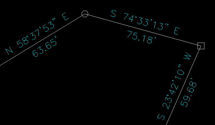
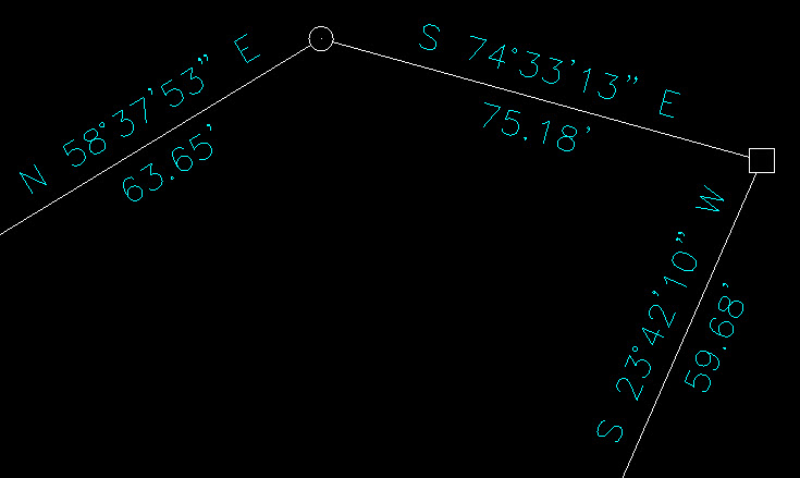
Problem: Lines or polylines of a boundary show up inside your open property corner symbols. See the image below for an example:
The additional problem is that, if you trim the lines inside the symbols to make it look cleaner, you’re actually modifying the length of property lines so the distances from corner-to-corner are no longer accurate.
Here’s an alternative: You can download a modified set of Carlson’s point symbols that include a “wipeout” entity that hides the lines behind/underneath the open symbols instead of trimming them and changing the length of the lines. Using the new set of symbols, the same property lines and symbols look like those in the image below (notice that the distances of linework are unchanged):
How to do this?
Here is the knowledge base article on Carlson’s website that includes a ZIP file with the new symbol DWG files and instructions on where the files must be saved.
