Year Recorded
Best Practices for Network Solutions with Carlson’s GNSS RTK Systems
Recorded 3/24/2021
This webinar, hosted by That CAD Girl and presented by Walt Wiles of Terrain Technology, provides a detailed walkthrough of Carlson Software’s drawing cleanup tools for preparing CAD files used in model building and construction staking. The session covers file optimization, layer management, polyline conversion, and best practices for ensuring clean, efficient data transfer to field devices. Key Topics: Carlson Software drawing cleanup process File optimization and size reduction Converting and managing polylines, layers, and entities Preparing DWG files for machine control and staking Handling Civil 3D and architectural files Descriptions, transcripts and other details of this recording have been AI-generated and may contain errors. This session was presented by Doug Aaberg on 03/24/2021.
Annotation in Carlson Software-the Basics
Recorded 10/18/2021
This webinar provides a foundational overview of annotation tools and settings in Carlson Software, focusing on text styles, scaling, and labeling techniques across modules. It demonstrates how to standardize annotation for consistent plotting and efficient drafting workflows. Key Topics: Text style management and configuration Annotation scaling and plotted size concepts Auto Annotate, area labels, and point text setup Managing offsets, leaders, and line/curve tables Practical annotation examples for survey and civil drawings Descriptions, transcripts and other details of this recording have been AI-generated and may contain errors. This session was presented by Jennifer DiBona on 10/18/2021.
Basics of Road Design in Carlson Civil
Recorded 3/11/2021
This webinar, hosted by That CAD Girl and presented by Mark Long from Carlson Software, provides a comprehensive introduction to road design using Carlson Civil’s Road Network tools. The session covers setup, configuration, template creation, and practical design workflows for roads, intersections, and cul-de-sacs. Key Topics: Introduction to Carlson Civil’s Road Network (RoadNet) Setting up surfaces, templates, and profiles Creating intersections and cul-de-sacs Managing cross sections and earthwork quantities Tips for efficient road design workflows Descriptions, transcripts and other details of this recording have been AI-generated and may contain errors. This session was presented by Mark Long on 03/11/2021.
Advanced Road Design in Carlson Civil
Recorded 4/8/2021
This webinar, hosted by That CAD Girl and presented by Mark Long from Carlson Software, provides an in-depth demonstration of advanced road design techniques using Carlson Civil. The session covers super elevation setup, template transitions, and template point center lines for complex roadway and drainage design scenarios. Key Topics: Super elevation design and configuration in Carlson Civil Template transitions for slope and grading adjustments Template point center lines for knuckles, parking, and sidewalks Stream impact minimization and slope control Integration with hydrology and future webinars Descriptions, transcripts and other details of this recording have been AI-generated and may contain errors. This session was presented by Mark Long on 04/08/2021.

Adv Field to Finish, Tree Surveys, Companion Codes and More
Recorded 4/22/2021
This webinar, hosted by That CAD Girl and presented by Doug Oberg, explores advanced Carlson Field-to-Finish techniques to improve survey drafting efficiency. Topics include companion codes, fixed parameters, templates, and tree survey automation for faster, cleaner CAD workflows. Key Topics: Carlson Field-to-Finish advanced setup Companion codes for connecting linework and symbols Fixed parameters and templates for curb and pavement Tree survey automation and drip line visualization Efficiency improvements and real-world examples Descriptions, transcripts and other details of this recording have been AI-generated and may contain errors. This session was presented by Doug Aaberg on 04/22/2021.
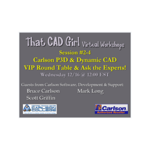
2020 Virtual Workshops Session 2-4 P3D Topo Hydro&Dynamic CAD Software VIP Round Table
Recorded 12/16/2020.
This virtual workshop session, led by Bruce Carlson, provides an in-depth demonstration of Carlson Precision 3D Hydrology (P3D Hydro) and its integration with Carlson CAD modules. The training covers intelligent TIN modeling, storm sewer and culvert design, hydrology analysis, and dynamic CAD synchronization for civil engineering workflows. Key Topics: Intelligent TIN surfaces and runoff coefficient mapping Integration between Carlson Hydrology and Precision 3D Hydro Storm sewer and culvert design automation Dynamic CAD linkage and real-time updates Channel and liner analysis, parking lot design automation Descriptions, transcripts and other details of this recording have been AI-generated and may contain errors. This session was presented by Jennifer DiBona on 12/16/2020.
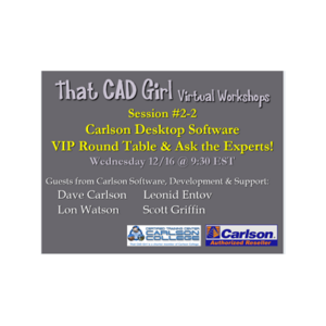
2020 Virtual Workshops Session 2-2 Carlson Desktop Software VIP Round Table
Recorded 12/16/2020
This Carlson Software virtual workshop featured a live “Ask the Experts” roundtable focused on desktop software, including Carlson Survey, Civil, Construction, and IntelliCAD. Developers and support leaders discussed common technical issues, new features, and user wishlist items for upcoming releases. Key Topics: IntelliCAD 10 graphics settings and troubleshooting Carlson Cloud communication and wishlist enhancements Road design and divided highway modeling Common tech support issues and fixes Dynamic labeling, MText improvements, and GIS integration Descriptions, transcripts and other details of this recording have been AI-generated and may contain errors. This session was presented by Jennifer DiBona on 12/16/2020.
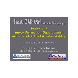
2020 Virtual Workshop Session 1-7 Survey Project from Start to Finish with Field to Finish & Surfaces
Recorded 12/15/2020
This Carlson Software virtual workshop, led by Jennifer DiBona, walks participants through a complete survey project workflow using Carlson Survey—from importing field data and creating coordinate files to deed entry, field-to-finish processing, surface modeling, and final sheet setup. The session emphasizes practical command usage, data organization, and troubleshooting techniques for real-world survey drafting. Key Topics: Importing and managing point data (CRD/CRDB files) Deed entry, correlation, and processing Field-to-Finish setup and drawing automation Surface modeling and triangulation Annotation, labeling, and sheet preparation Integration with Carlson GIS and Google Earth imagery Descriptions, transcripts and other details of this recording have been AI-generated and may contain errors. This session was presented by Jennifer DiBona on 12/15/2020.
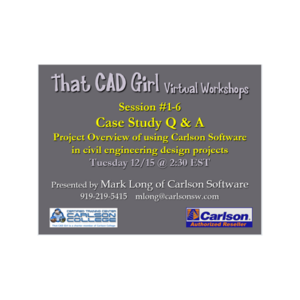
2020 Virtual Workshop 1-6 Case Study Q&A/Project Overview Using Carlson in Civil & Hydrology Design
Recorded 12/15/2020
This virtual workshop session features Carlson Software’s Mark Long demonstrating real-world civil engineering workflows using Carlson Civil Suite. The presentation covers subdivision design, grading, stormwater management, and road network modeling with practical tips and live demonstrations. Key Topics: Carlson Civil Suite workflow for civil engineering projects Subdivision and roadway design techniques Dirt quantity calculations and balancing Super elevation and North Carolina DOT standards RoadNet, templates, and intersection management Descriptions, transcripts and other details of this recording have been AI-generated and may contain errors. This session was presented by Mark Long on 12/15/2020.
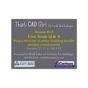
2020 Virtual Workshop 1-5 Case Study:Q&A/Project Overview of Using Carlson to Create Machine Control Models
Recorded 12/15/2020
This virtual workshop, led by Walt Wiles of Terrain Technology, provides an in-depth walkthrough of building GPS-ready 3D surface models using Carlson Civil and IntelliCAD. The session covers drawing preparation, data cleanup, layer management, and model triangulation for machine control applications. Key Topics: Carlson Civil and IntelliCAD setup for model building Data preparation and drawing cleanup Layer management and naming conventions Creating and editing 3D polylines and surfaces Exporting models for machine control (Topcon, Trimble) Descriptions, transcripts and other details of this recording have been AI-generated and may contain errors. This session was presented by Walt Liles on 12/15/2020.