FAQ
[FAQ303] What features & menus are in Carlson Civil? (a running thread)
Features and Benefits of Civil 2017
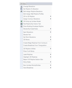
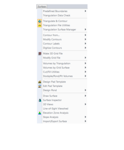
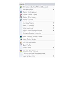
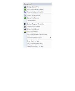
Carlson Civil is a fully dynamic, 3d civil design program that contains all the tools an engineer, designer or design build professional needs. Here are some of the things you can do with Carlson Civil:
- Utilize the very best Carlson software support tools for all your design build, site design & site grading, subdivision design & subdivision grading and road design & road grading needs,
- Perform tasks associated with civil BIM (Building Information Modeling),
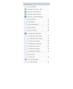
- Use the Lot Network feature to create a dynamic subdivision design that takes into account road centerline and right of way, building setbacks, wetland or poor soils areas and inserts one or more building footprints onto each lot,
- Use vehicle path tracking to ensure adequate roadway clearance,
- Create, define, edit and draw centerline alignments using a variety of methods including best fit,
- Easily elevate 2d, zero-elevation polylines from points, text or text with a leader for detailed site grading,
- Label elevation, slope and other properties of polylines,
- Design a centerline and profile along a surface that maintains a maximum slope,
- Import surfaces from Civil 3d and Google Earth®,
- Create surface model files for existing and proposed conditions,
- Design and balance cut and fill for one or more building pads at a time,
- Edit the contours generated from a surface model and automatically update the underlying TIN file,
- Calculate earthwork volumes between two surfaces including building pads, stockpiles and borrow pits,
- Report storage volumes for bench and valley ponds that can be designed using various design criteria such as adding multiple interior benches and automatically removing the berm in cut conditions,
- Use the layer-based SiteNet commands to calculate and report volumes and/or quantities:
- Of an entire site or within a perimeter Polyline,
- Of cut & fill dirt; of topsoil removal & replacement; of materials such as asphalt, stone, concrete and curb; and of pipe and structure depth,
- That can be exported directly to Microsoft Excel®,
- Create cut & fill color maps or a grid of cut and fill labels,
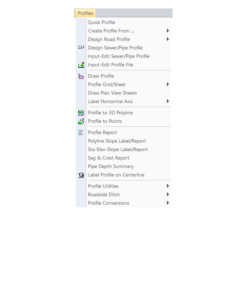
- Create, define, edit and draw profiles using a variety of methods including best fit,
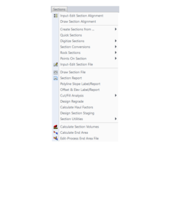
- Create, define, edit and draw cross sections using a variety of methods,
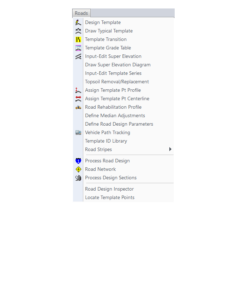
- Define, edit and draw typical cross sections to create a library of roadway templates that meet detailed design standards,
- Use the Road Network feature to dynamically design a network of highways or roads that automatically tie intersections together, allow detailed grading at each intersection and cul-de-sac and allow real-time volume determination as the road profile is adjusted,
- Design roads that that incorporate varying roadway widths, multiple templates, super elevation, topsoil removal & replacement, road rehabilitation including overlays after leveling or milling operations and more,
- Automatically elevate building pads and property lot lines using grading rules applied to a road design,
- Process Road Design for final sections, final contours and volumes,
- Pick a button to “Process” or have updates automatically occur when changes to centerlines or surfaces affect profiles, changes to profiles affect cross sections or changes to surfaces affect storm or sewer structures,
- Automatically generate a Carson software support plan and profile sheets in model or paper space where the plan and profile views can be shifted or rotated incrementally with the pick of a button,
- View your entities or surfaces in 3d or drive through them in a humvee, police car or school bus.

If you find the material on this website helpful, please consider supporting That CAD Girl or one of Our Trusted Partners, by purchasing or referring others to us for CAD and desktop software support and training.

