FAQ
[FAQ301] What features & menus are in the non-OEM Carlson Survey program? (a running thread)
Survey 2017 with IntelliCAD or for your AutoCAD

Features and Benefits of Survey 2017
Carlson Survey is a comprehensive, CAD software program containing all of the tools that a surveyor needs. Here are some of the things you can do with Carlson Survey:
- Access both the Carlson Survey and the full C & G menus,
- Utilize the very best software tools for all your site design & subdivision design needs,
- Enter deed descriptions and generate a variety of lot reports including fully customizable legal descriptions,
- Enter deed descriptions and correlate field located property corners with deed property corners to find the best fit orientation & alignment,
- Use the Deed Reader command to extract deed line and curve data from a text file (the text file can sometimes be generated using the OCR feature of scanning software),
- Use the Lot Network feature to create a dynamic subdivision design that takes into account road centerline and right of way, building setbacks, wetland or poor soils areas and inserts one or more building footprints onto each lot,
- Have full point management capabilities including data collector download/upload, import/export points in text and most other formats including Civil 3d,
- Process raw data files using various methods via CAD software including SurvNet Least Squares,
- Perform dozens of COGO functions,
- Use Field to Finish (F2F) to process automatic linework and description key/description code definitions,
- Utilize dozens of time-saving point stake out commands,
- Import surfaces from Civil 3d and Google Earth®,
- Create surface model files for existing and proposed conditions,
- Edit the contours generated from a surface model and automatically update the underlying TIN file,
- Design and balance cut and fill for one or more building pads at a time,
- Calculate earthwork volumes between two surfaces including building pads, stockpiles and borrow pits,
- Create, define, edit and draw centerline alignments using a variety of methods including best fit,
- Create, define, edit and draw profiles using a variety of methods,
- Automatically update stationing when centerlines change, profiles when centerlines or surfaces change, etc,
- Automatically generate plan and profile sheets in model or paper space,
- Import, edit and export GIS shape files,
- Import a variety of image files including MrSid and geo-referenced TIF and JPG files.
Menus in Survey 2017
Menu bar in Survey 2017 showing the compact version of the CG Survey menu

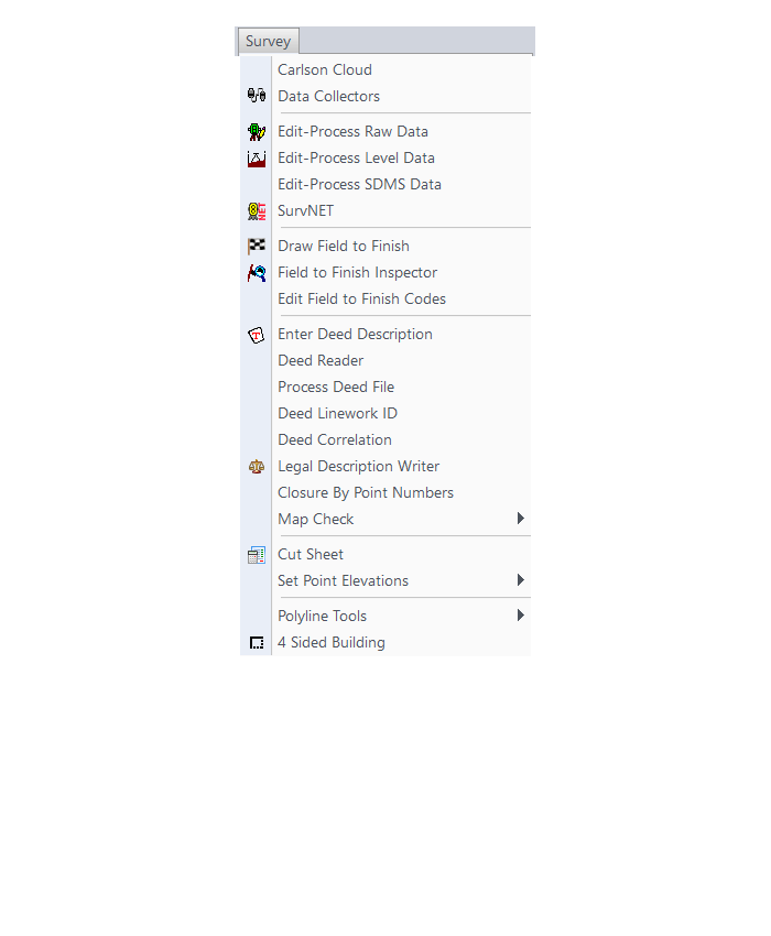
Survey Menu
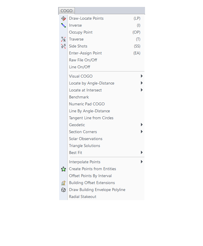
COGO Menu
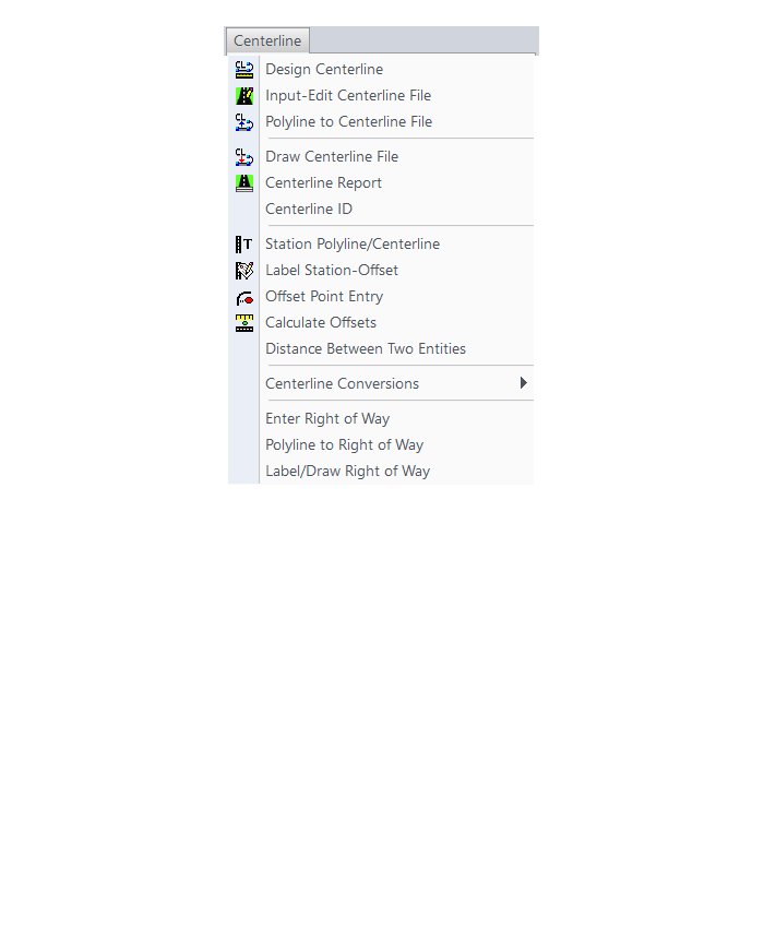
Centerline Menu
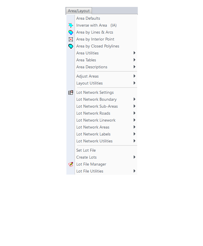
Area/Layout Menu
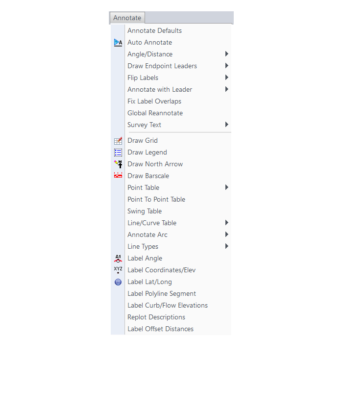
Annotate Menu
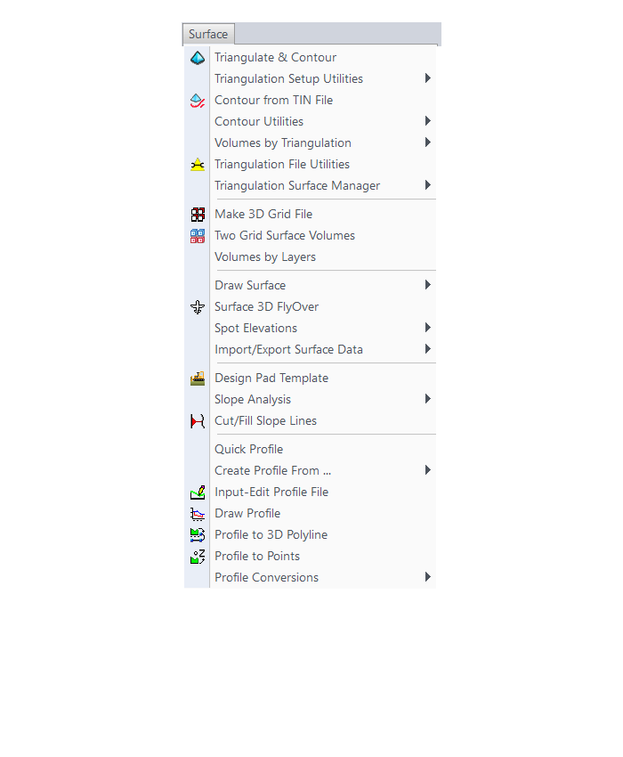
Surface Menu
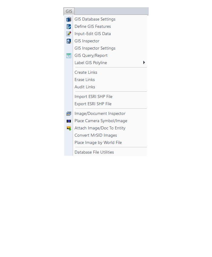
GIS Menu
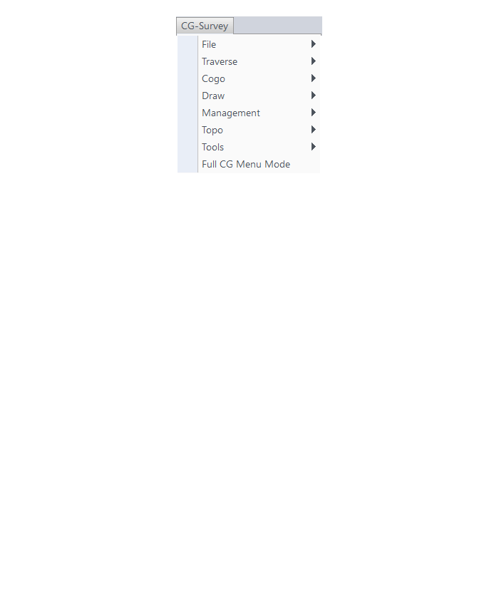
CG-Survey Menu
Menu bar in Survey 2017 showing the expanded version of the CG-Survey menu

The menus below are available when using the expanded version of the CG-Survey menu
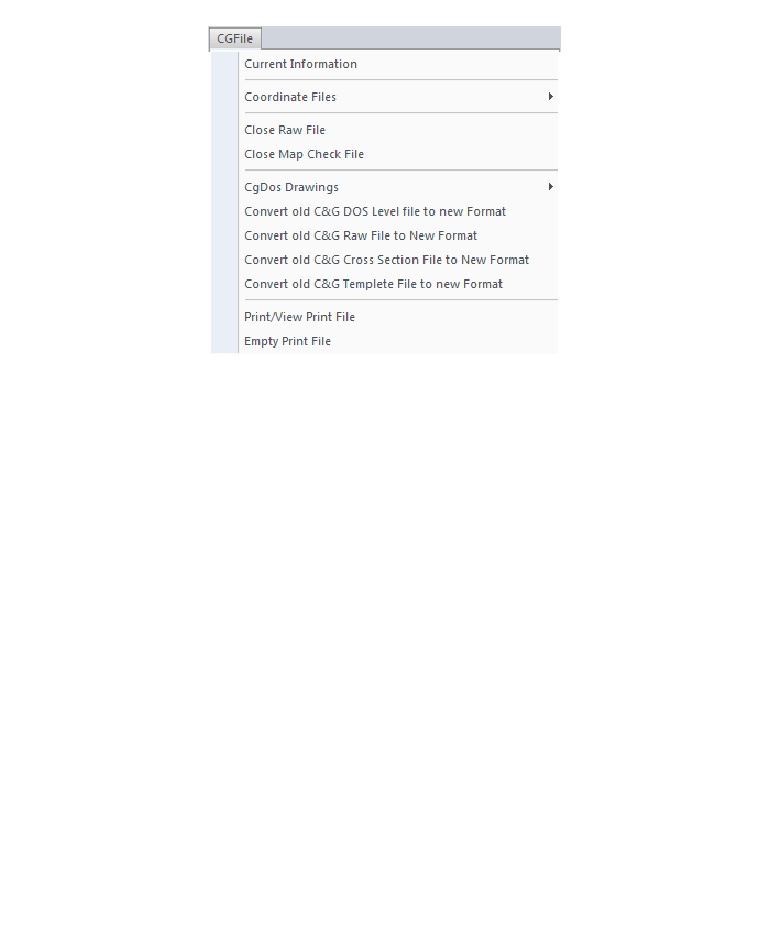
CG File Menu
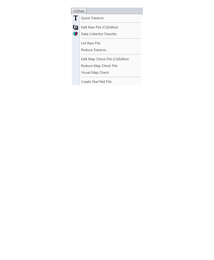
CG Trav Menu
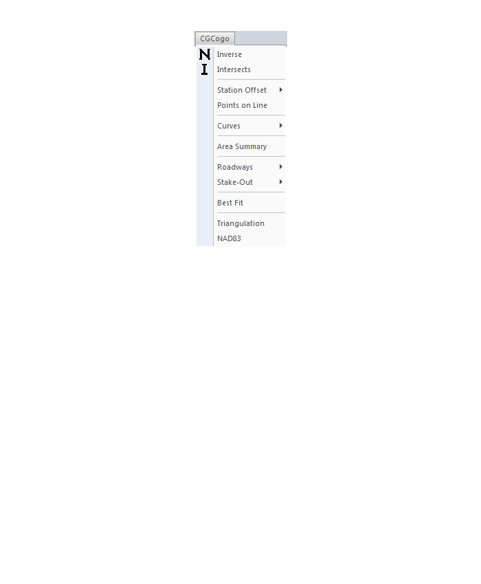
CG Cogo Menu
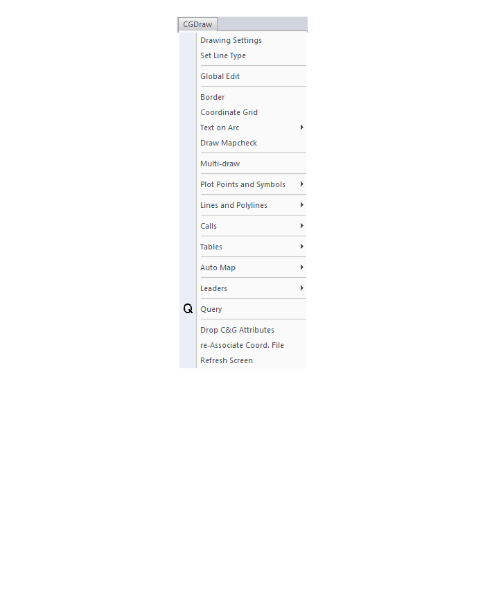
CG Draw Menu
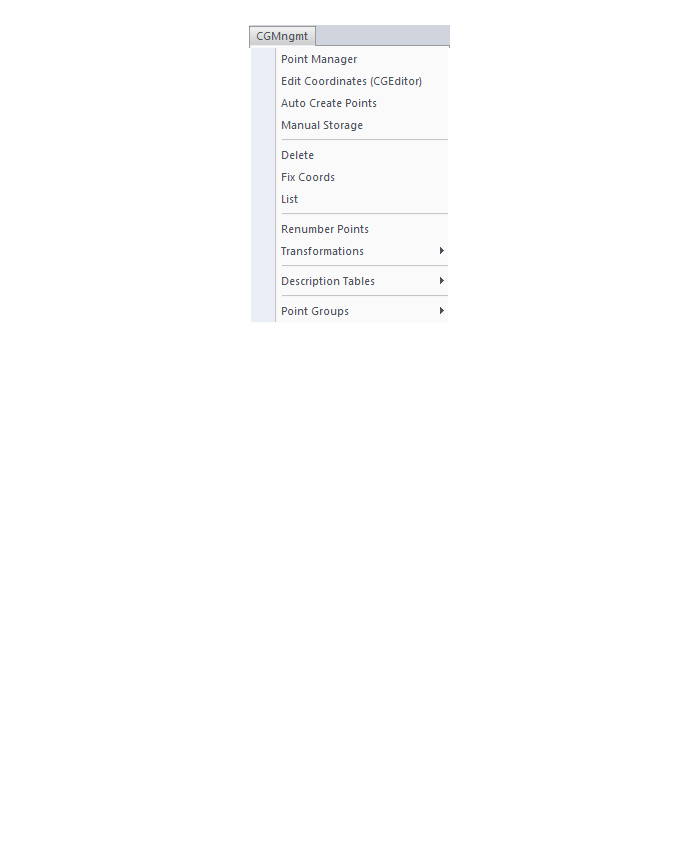
CG Mngmt Menu
CG Topo Menu

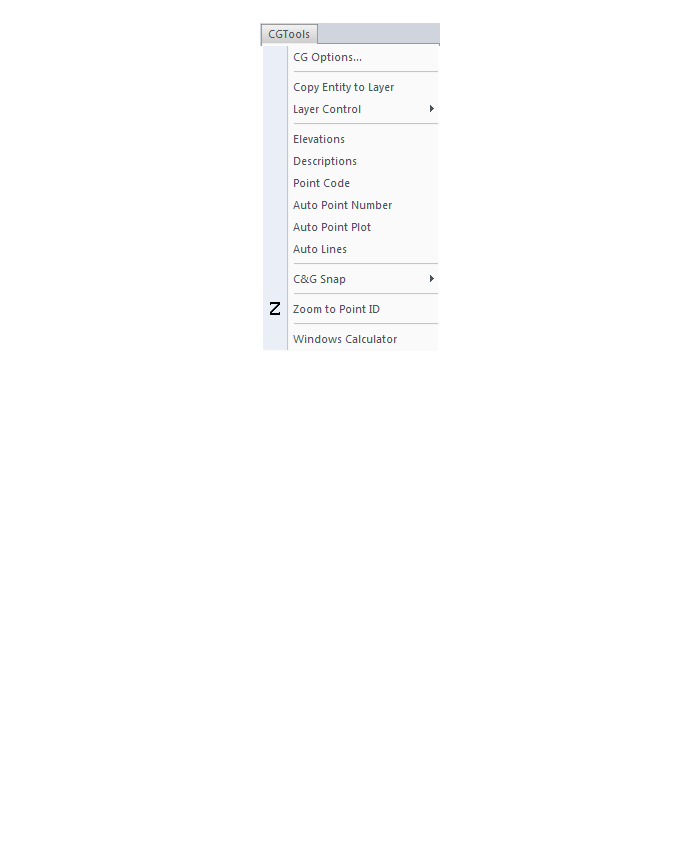
CG Tools Menu
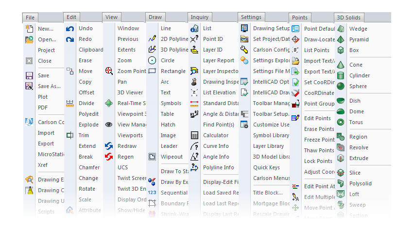
The menus below are in all non-OEM programs of Carlson 2017 desktop software
(Click image to see more)
If you find the material on this website helpful, please consider supporting That CAD Girl or one of Our Trusted Partners, by purchasing or referring others to us for CAD and desktop software support and training.