
Video Category: # of Sessions
Introduction to Carlson Software – Settings, Setup, Configuration & Points
A Virtual Webinar Using Carlson Software - Learn Carlson setup and point annotation workflows This recorded webinar by That CAD Girl provides an in‑depth introduction to Carlson Software, including installation configuration, data folder management, use of templates, annotation scaling and practical CAD workflow tips for survey and civil users. Attendees
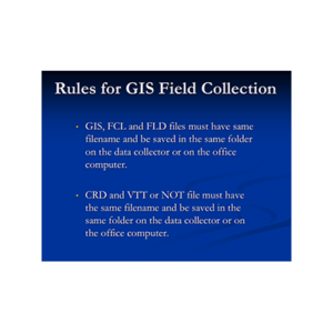
GIS Data Collection for Surveyors
A Virtual Webinar Using Carlson SurvCE and SurvPC - Learn to Collect GIS Data for Esri This training webinar demonstrates how surveyors can collect, manage and exchange GIS data with municipalities using Carlson SurvCE and SurvPC. The session walks through exporting Esri data, importing it into Carlson software, collecting attributes
Field to Finish
A Virtual Webinar Using Carlson Software - Learn to Set Up Field to Finish Code Tables and Layers This recorded webinar features Carlson Software’s Doug Aaberg demonstrating the complete setup and workflow of the Field to Finish process within Carlson Survey. The session teaches how to configure code tables, manage
Working with Carlson Hydrology Drafting Pipes and Structures
A Virtual Webinar Using Carlson Software - Learn Carlson Hydrology Storm Sewer Drafting for Pipes and Structures This webinar introduces the foundational drafting tools and network-design capabilities in Carlson Hydrology. It covers setup, surface integration, centerlines, profiles, sewer network creation and labeling workflows essential for building storm and sanitary systems.
Working with Carlson Hydrology Drafting Pipes and Structures
A Virtual Webinar Using Carlson Hydrology - Learn storm sewer drafting for pipes and structures This webinar introduces the process of drafting pipes and structures using Carlson Hydrology and related Civil tools. It covers creating sewer networks, profiles and surface interactions for accurate drainage and utility design workflows. Key Topics:
Dirty Data Transfer between Carlson and other programs
A Virtual Webinar Using Carlson Software - Learn to Transfer Civil 3D Data into Carlson with LandXML This webinar explains practical methods to exchange point, surface and project data between Carlson Software and Autodesk Civil 3D. It covers handling proxy entities, converting data formats and using LandXML files for reliable
Coordinate Transformations & Localizations
A Virtual Webinar Using Carlson Software - Learn to Transform and Localize Coordinates for GPS Control This recorded webinar features Jeremy Taylor demonstrating Carlson Software tools for performing coordinate transformation and localization tasks in both desktop and field applications. Attendees learn practical workflows for translating, rotating, aligning, scaling and localizing
Centerlines, Profiles & Overview of RoadNet
A Virtual Webinar Using Carlson Software - Learn to Create Centerlines and Profiles and Design Roads with RoadNet This webinar provides a complete tutorial on creating and managing centerlines and profiles in Carlson Civil and Survey, followed by a practical overview of the RoadNet module. Participants learn manual methods for
Centerlines, Profiles & Overview of RoadNet
A Virtual Webinar Using Carlson Software - Learn to Create, Station and Label Centerlines and Profiles This webinar demonstrates how to manually create and edit centerlines and profiles in Carlson Survey and Civil, and then automates those tasks using Carlson RoadNet. Participants learn configuration settings, linking logic, drawing options and
Centerlines, Profiles & Overview of RoadNet
A Virtual Webinar Using Carlson Software - Learn to Create Centerlines and Profiles and Design Roads with RoadNet This webinar by That CAD Girl provides a detailed walkthrough of creating centerlines, profiles and complete road networks in Carlson Civil. It demonstrates both manual methods and automated workflows using the Carlson