
FAQ
Faq category: Buying Guide
SEARCH THAT CAD GIRL SITE
Which Topcon / MAGNET software do I need in the field?
+Note: With the v2026.0 release, Topcon returned its office and field software to the MAGNET name. Topcon Office is now MAGNET Office, Topcon Field is now MAGNET Field and version numbers now follow the year (for example, MAGNET Office 2026.0).
Topcon provides four primary field software options designed around distinct job roles and construction phases:
- Topcon Field supports full survey and advanced layout workflows using GNSS and optical instruments.
- Topcon Field Mobile delivers core layout and verification tools in a simplified mobile friendly experience.
- Pocket 3D focuses on grade checking, earthwork verification and machine control support.
- Topcon Digital Layout is purpose built for vertical building layout by concrete, steel and MEP trades.
Side by side selection guide
This overview highlights how each field application aligns with different responsibilities on the jobsite. Many organizations deploy multiple tools across crews rather than relying on a single solution.
| Selection factor | Topcon Field | Topcon Field Mobile | Pocket 3D | Topcon Digital Layout |
|---|---|---|---|---|
| Primary focus | Survey grade data collection and advanced layout | Everyday construction layout and verification | Earthwork checks and production support | Interior and vertical building layout |
| Typical users | Survey crews and advanced layout teams | Foremen, supers and project engineers | Grade checkers, operators and site supervisors | Concrete, steel and MEP trade crews |
| Common jobsite use | Topo, control, stakeout and as built surveys | Points and lines layout plus progress checks | Cut and fill checks, volumes and model validation | Anchors, walls, sleeves and BIM driven layout |
| Device platforms | Windows based controllers and tablets | Android and iOS devices | Windows, Android and iOS devices | Windows, Android and iOS devices |
| Learning curve | Best for experienced technical users | Designed for fast adoption | Minimal training required | Built for non survey professionals |
| Licensing approach | Perpetual or subscription options | Subscription based | Perpetual with annual maintenance | Subscription only |
How to choose the right field software
- Select Topcon Field when survey grade accuracy and combined GNSS and optical workflows are required
- Select Topcon Field Mobile when crews need layout and verification without full survey functionality
- Select Pocket 3D when earthwork, grade checking and machine control drive the jobsite
- Select Topcon Digital Layout when vertical construction trades need accurate layout without survey training

Some content on this website was prepared with AI assistance. Please verify important information with the manufacturer or original source before making purchasing or financial decisions.
If you find the material on this website helpful, please consider supporting That CAD Girl by purchasing our products or services.
If you are interested in purchasing products or services we do not offer, we would love to refer you to one of our Trusted Partners. Please click here to send us a message with your request.
Which Topcon / MAGNET software do I need for the office?
+Note: With the v2026.0 release, Topcon returned its office and field software to the MAGNET name. Topcon Office is now MAGNET Office, Topcon Field is now MAGNET Field and version numbers now follow the year (for example, MAGNET Office 2026.0).
Topcon offers five primary office software options designed around distinct workflows in survey processing, CAD production, modeling and construction takeoff:
- Topcon Tools is a lightweight, standalone desktop tool for file conversions, GNSS and total station processing, QA/QC, adjustments, localization, visualization and reporting. It is often used as a preprocessing step before Topcon Office or other CAD workflows.
- Topcon Office Base is the core desktop environment for import/export, data prep, basic QA/QC, reporting, and light drafting. It is the foundation product for adding Survey and or Site Prep modules.
- Topcon Office Base + Survey adds survey-grade computation, adjustments, GNSS processing, richer COGO, drafting, and professional survey delivery workflows. Topcon Survey includes all the functionality of Topcon Tools.
- Topcon Office Base + Site Prep adds modeling and construction takeoff capabilities for surfaces and corridors, volumes, and file prep tools for GPS-guided machine control systems.
- Topcon Office Base + Survey + Site Prep is the complete office suite that unifies survey computation and adjustment, drafting, surface and corridor modeling, quantities and volumes, and machine-control data prep. Topcon Survey includes all the functionality of Topcon Tools.
Side by side selection guide
This overview highlights how each office product aligns with different responsibilities. Many organizations start with Office Base then add Survey and or Site Prep as their needs expand. :contentReference[oaicite:0]{index=0}
| Selection factor | Topcon Tools | Topcon Office Base | Office Base + Survey | Office Base + Site Prep | Office Base + Survey + Site Prep |
|---|---|---|---|---|---|
| Primary focus | Survey data processing, QA/QC, localization, visualization, and reporting. A Swiss Army knife for converting file formats from one to another. | Core import/export, coordinate management, basic QA/QC, reports, light drafting | Survey-grade computation: GNSS processing, adjustments, robust COGO and survey deliverables | Modeling and takeoff: surfaces, corridors, volumes, machine control file prep | Full suite: survey computation + modeling, takeoff, design, and machine control prep |
| Typical users | Survey techs/processors, survey managers or PLS doing QA/QC and adjustments | CAD/BIM techs, party chiefs/field techs prepping stakeout lists, owner-operators | Survey manager/PLS, party chief or office survey lead handling control and deliverables | Estimators, takeoff specialists, surface modelers, CAD techs supporting grading and machine control | Survey leads, CAD/civil designers, site modelers, project engineers/PMs managing end-to-end workflows |
| Common office use | Import and QA GNSS/TS data, run closures and least-squares, apply localization/datum transforms, export reports, import and export files of different formats for outside project partners | Import field data, validate, set coordinate systems, cleanup linework/points, basic volumes/areas, export to field/clients | Control, traverse and least-squares adjustment, GNSS baseline checks, robust COGO, stakeout prep, record mapping and reporting | 3D surface/corridor modeling, quantity takeoffs from PDF or CAD, volumes, machine-control data prep, as-built comparisons | Corridor and site design, road rehab workflows, utilities/trenches, pads and grading models, takeoffs and QC across survey + construction |
| Common project types | Control and boundary surveys, GNSS/TS network processing, survey QA/QC prior to CAD/civil handoff | Small site development, utilities, topo mapping/updates, as-built checks, change orders | Boundary and ALTA, subdivision and land development, utility and ROW survey and mapping | Site development, roads/corridors, subdivisions, industrial pads, mass grading | Highways and overlays, airports and logistics pavements, commercial/industrial site development, design-build heavy civil |
| Licensing approach | 1- or 3-year subscription. Includes Enterprise check-in/check-out convenience | 1- or 3-year subscription. Includes Enterprise check-in/check-out convenience | Subscription (1 or 3 year) or perpetual. Includes Enterprise. Subscription supports check-in/check-out convenience | Subscription (1 or 3 year) or perpetual. Includes Enterprise. Subscription supports check-in/check-out convenience | Subscription (1 or 3 year) or perpetual. Includes Enterprise. Subscription supports check-in/check-out convenience |
How to choose the right office software
- Select Topcon Tools when you need a standalone “Swiss Army knife” for help converting to/from an expansive variety of filetypes, survey processing, QA/QC, least-squares adjustment, localization, and reporting without CAD production, modeling, or takeoff.
- Select Topcon Office Base when you need a core office hub for import/export, coordinate setup, cleanup, reports, and light drafting
- Select Office Base + Survey when your office delivers survey-grade computation including control, traverse, GNSS processing, adjustments, and robust COGO deliverables
- Select Office Base + Site Prep when your focus is surfaces, corridors, volumes, takeoffs, and machine control data prep
- Select Office Base + Survey + Site Prep when your team needs the complete suite for survey delivery plus modeling, takeoff, design, and machine control workflows
Some content on this website was prepared with AI assistance. Please verify important information with the manufacturer or original source before making purchasing or financial decisions.
If you find the material on this website helpful, please consider supporting That CAD Girl by purchasing our products or services.
If you are interested in purchasing products or services we do not offer, we would love to refer you to one of our Trusted Partners. Please click here to send us a message with your request.
That CAD Girl Active Coupon Codes (a running thread)
+Why Coupons...?
Prices shown in our online store reflects Carlson Software’s Minimum Advertised Pricing (MAP) policy but additional discounts may be available at checkout, using coupons, or by requesting a custom proposal.
Takeoff Suite
After adding Takeoff Suite to your cart, select the coupon Takeoff Suite at checkout for an additional discount.
Includes FREE Maintenance and FREE access to RECORDINGS of January 2024 Takeoff Training
Takeoff OEM
After adding Takeoff OEM to your cart, select the coupon Takeoff OEM at checkout for an additional discount.
Includes FREE access to RECORDINGS of January 2024 Takeoff Training
Free Virtual Classroom Training
With the purchase of any new license of Carlson Software, you will have the option of adding a FREE registration to an upcoming 2- or 3-day Virtual Classroom training event to your cart.
Free Maintenance
When adding select Carlson Software to your cart, you will have the option of adding 1-Year of Free Maintenance coupon to your cart.
That CAD Girl Online Store Pricing
After adding select Carlson Software products to your cart, add the online store coupon at checkout for additional discounts
Discounted Maintenance Renewals and Upgrades
Send us your report and receive an extra discount on maintenance renewals and OEM upgrades!
Click here to upload your current maintenance or OEM upgrade report and request pricing for your maintenance renewal –
Select Suite Pick 2
After adding Select Suite Pick 2 to your cart, select the coupon Pick 2 Special at checkout for an additional discount.
This offer will end on 10/31/2023
Black Friday Discount
Discount to add Survey, Civil, Hydrology, GIS, CADnet or Point Cloud Basic to any current license
(regular price $750)
Email [email protected] for custom proposal
Black Friday Discount
Coupon automatically applied at checkout after adding select Carlson Software to your cart
That CAD Girl Standard Discount
Coupon automatically available at checkout after adding select Carlson Software products to your cart
Extra $100 Off
After adding Select Suite Pick 3 to cart, a coupon for an extra $100 off will be available
Available through 12/31/2021
That CAD Girl Maintenance Discount
After adding select Carlson Software AND maintenance to cart, use Coupon Code tcgmaintenance at checkout for additional discount. Currently available for Carlson Survey, Civil, Civil Suite, Pick 2 and Pick 4
Black Friday Discount
Coupon automatically applied at checkout after adding Carlson Takeoff Suite to your cart
Discount Workshop Registration
With the purchase of any new license of Carlson Software, you will have the option of adding 2022 Virtual Workshop Registration to your cart.
At checkout, click on the coupon 2022 Virtual Workshop to apply a coupon for $100 off the registration price.
Free Maintenance
When adding select Carlson Software to your cart, you will have the option of adding 1-Year of Free Maintenance to your cart.
No Coupon Code is required for this discount.
Ends 12/31
EXTRA $500 off
After adding Civil Suite or Select Suite Pick 4 to your cart, use Coupon Code dogdays2022 at checkout for additional discount.
This offer will end on 9/1/2022
Extra $100 Off
After adding Select Suite Pick 6 to cart, a coupon for an extra $100 off will be available
Available through 12/31/2021
End of Year Discount
Coupon available at checkout after adding Carlson Takeoff Suite to your cart
Expires 12/31/2021
Extra $100 Off
After adding select Carlson Software AND maintenance to cart, use Coupon Code extra100 at checkout for additional $100 discount.
Currently available for Carlson Civil Suite, Pick 3 and Pick 4
Free Maintenance
When adding select Carlson Software to your cart, you will have the option of adding 1-Year of Free Maintenance to your cart.
No Coupon Code is required for this discount.
Expires 12/31/2022
Extra $100 Off
After adding Select Suite Pick 5 to cart, a coupon for an extra $100 off will be available
Available through 12/31/2021
End of Year Discount
Coupon available at checkout after adding select Carlson Software to your cart
Expires 12/31/2021
Black Friday Discount
Coupon automatically applied at checkout after adding select Carlson Software to your cart
That CAD Girl Manuals
$50 discount coupon will be automatically available at checkout after adding any new license of Carlson Software and That CAD Girl Self-Study Training Manuals to your cart
Extra $250 Off
After adding select Carlson Software AND maintenance to cart, use Coupon Code extra250 at checkout for additional $250 discount.
Currently available for Carlson Takeoff Suite.
That CAD Girl Maintenance Discount
After adding select Carlson Software AND maintenance to cart, use Coupon Code “tcgmaintenance” at checkout for additional discount
That CAD Girl P3D Hydro & Topo
After adding Carlson P3D Hydro & Topo to your cart, use Coupon Code tcgp3dextra at checkout for additional discounts
That CAD Girl Preferred Pricing
After adding select Carlson Software products to your cart, use Coupon Code “tcg preferred” at checkout for additional discounts
Some content on this website was prepared with AI assistance. Please verify important information with the manufacturer or original source before making purchasing or financial decisions.
If you find the material on this website helpful, please consider supporting That CAD Girl by purchasing our products or services.
If you are interested in purchasing products or services we do not offer, we would love to refer you to one of our Trusted Partners. Please click here to send us a message with your request.
What you should know about purchasing Carlson
+
About Carlson Software, the Company
Carlson Software, founded in 1983 and headquartered in Maysville, Kentucky, is a developer of CAD-based software for land surveying, civil engineering, construction and mining. The company provides desktop software, data collection solutions and OEM hardware integration through an extensive global dealer network. Carlson is known for delivering customer-focused software with perpetual licenses, low maintenance fees and long-term product support.
Click here to learn more about Carlson Software, the Company
About the Software
Carlson Software offers modular desktop solutions for land development professionals. Core modules for surveying, civil engineering and construction include Survey, Civil, GIS, Hydrology, Construction, CADnet, Trench and GeoTech.
Carlson works with both IntelliCAD and AutoCAD platforms and maintains full compatibility with DWG file formats. Specialized software is also available for 3D point cloud processing and embedded field data collection using Carlson SurvPC.
Carlson’s website
Operating System Compatibility
- Carlson 2020–2025 with IntelliCAD 9.x–12.x: 64-bit Windows 7, 8, 8.1, 10, 11
- Carlson on AutoCAD 2022 Embedded: Windows 10 and 11 (64-bit only)
- Takeoff R12, R13 / Survey OEM 2022–2025: Windows 10 and 11 (64-bit only)
- Vista and 32-bit versions are not supported
System Requirements
Carlson 2020–2025 with IntelliCAD 9.x–12.x:
- Minimum CPU: Intel Pentium 4 or comparable
- Recommended CPU: Intel i5 or i7 (use cpubenchmark.net for comparisons)
- Minimum RAM: 2 GB (64-bit Windows 7–11); 8+ GB recommended
- Graphics card: Compatible with OpenGL 1.4 or higher
- Recommended GPU: Discrete Nvidia Geforce preferred; ATI/AMD acceptable but less consistent driver support
- Not recommended: Nvidia Quadro and powerful gaming cards
Carlson with AutoCAD 2022 Embedded (including Takeoff R12, R13 / Survey OEM 2022–2025):
- OS: 64-bit Windows 10 or 11
- Processor: Basic 2.5–2.9 GHz; Recommended 3+ GHz
- RAM: 8 GB minimum, 16 GB recommended
- Disk Space: 10 GB free for installation
- Monitor: 1920 x 1080 or higher, up to 3840 x 2160
- Display card: Minimum 1 GB GPU with DirectX 11; Recommended 4 GB GPU with DirectX 12
- Browser: Internet Explorer 11 or later
Click here to learn more about Carlson’s System Requirements
CAD Platform Options
Carlson Software modules provide options for CAD platform:
- “for CAD” programs include a license of IntelliCAD
- Embedded AutoCAD (OEM) programs include a license of AutoCAD OEM
- Modules with IntelliCAD can also be installed on full AutoCAD, AutoCAD Map or Civil 3D
How and Where to Purchase
Carlson Software is available for purchase directly from Carlson or through an authorized dealer network.
Upgrades and Crossgrades
Carlson users can purchase upgrades from older versions at discounted prices. Crossgrades are also available for switching between platforms or changing product bundles.
Maintenance customers receive version upgrades annually (typically each fall). Users without maintenance can upgrade their perpetual license at any time.
License Types and Terms
- Perpetual Standalone: One-time purchase with two activations per seat
- Perpetual Network: Floating license with server-based access and license borrowing
Users may choose software modules individually or as part of bundled suites such as Survey/Civil, Civil Suite or Takeoff Suite.
Software Trials
Free 30-day trials of Carlson desktop software are available.
Support and Training Options
Carlson Software provides technical support by email and phone.
That CAD Girl offers a variety of training options for CAD and Carlson Software including live, custom training, recorded sessions and printed manuals.
Some content on this website was prepared with AI assistance. Please verify important information with the manufacturer or original source before making purchasing or financial decisions.
If you find the material on this website helpful, please consider supporting That CAD Girl by purchasing our products or services.
If you are interested in purchasing products or services we do not offer, we would love to refer you to one of our Trusted Partners. Please click here to send us a message with your request.
xxWhat you should know about purchasing Carlson Software
+

About Carlson Software, the Company
About Carlson, the Software
Carlson programs work natively and produce DWG format files. There is NO need to convert, import or export – only Open and Save.
The programs are primarily delivered as “vertical” modules that can be installed and run on top of a generic-CAD platform.
Carlson’s desktop modules for land surveying, engineering and construction are built to run on top of the ITC’s IntelliCAD and Autodesk’s AutoCAD platforms. The modules include: Survey, Civil, Hydrology, GIS, Geology, Underground Mining, Surface Mining, Natural Regrade, Field, CADnet, GeoTech, Trench, Construction and Point Clouds.
Additionally, Survey and Takeoff are developed and run on top of an embedded AutoCAD (OEM).
You Have Options!
Purchase Carlson with the Platform that's Best for You
Carlson’s desktop programs can be installed as a standalone program on top of IntelliCAD or on top of your separately-purchased, full-AutoCAD-based program.
Each purchase includes a license of the latest version of IntelliCAD – it doesn’t have to be purchased separately.
Your separately-purchased, full-AutoCAD-based program can be AutoCAD, AutoCAD Map, Land Desktop, Civil 3D or other vertical – but does NOT include AutoCAD LT.
The following modules are available with IntelliCAD/for YOUR AutoCAD: Survey, Civil, Hydrology, GIS, Geology, Underground Mining, Surface Mining, Natural Regrade, Field, CADnet, GeoTech, Trench, Construction and Point Clouds
Carlson Survey and Takeoff can be purchased and installed standalone with embedded AutoCAD (also known as the OEM version).
Each purchase includes a license of the latest version of embedded AutoCAD (OEM) – it doesn’t have to be purchased separately.
Note that embedded AutoCAD (OEM) is more similar to AutoCAD LT than AutoCAD – so, experienced AutoCAD users may end up missing much of the functionality they are accustomed to.
The embedded AutoCAD (OEM) programs do not include IntelliCAD and do not require a separate purchase of AutoCAD.
Importantly, although both programs can be installed on the same computer, programs installed with the OEM platform will be completely separate from those installed with IntelliCAD/your AutoCAD. This means that you will not be able to work in a DWG file and simply switch between menus – you’ll have to close the drawing in one program in order to open it in the other.
Carlson's Versions vs AutoCAD's Versions
Carlson Software will run on earlier versions of AutoCAD; however, you cannot run a version of Carlson that is older than the AutoCAD. For instance, Carlson 2024 will run on AutoCAD 2018-2024 but Carlson 2022 will only run on AutoCAD 2018-2022.
Which Program or Modules Do I Need?
FAQ: I’m a land surveyor. What software do I need?
FAQ: I’m a civil engineer. What software do I need?
Programs with embedded AutoCAD (OEM)
FAQ: What features & menus are in Carlson Survey with embedded AutoCAD (OEM)? (a running thread)
FAQ: What features & menus are in Carlson Takeoff with embedded AutoCAD (OEM)? (a running thread)
Desktop Programs with IntelliCAD/for YOUR AutoCAD
FAQ: What features & menus are in the non-OEM Carlson Survey program? (a running thread)
FAQ: What features & menus are in Carlson Civil? (a running thread)
FAQ: What features & menus are in Carlson GIS? (a running thread)
FAQ: What features & menus are in Carlson Hydrology? (a running thread)
FAQ: What features & menus are in Carlson Point Cloud? (a running thread)
FAQ: What features & menus are in Carlson Construction? (a running thread)
FAQ: What features & menus are in Carlson CADNet? (a running thread)
FAQ: What features & menus are in Carlson GeoTech? (a running thread)
FAQ: What features & menus are in Carlson Trench? (a running thread)
Carlson iCAD
Retail Pricing for Carlson Software
| Program | Retail Price of Standalone (effective 7/10/2024) | Retail Price of Network |
|---|---|---|
| Select Suite - Pick 6 (from Survey, Civil, Hydrology, GIS, Point Cloud Basic, CadNet) | $ 4,950 | $ 5,445 |
| Select Suite - Pick 5 (from Survey, Civil, Hydrology, GIS, Point Cloud Basic, CadNet) | $ 4,650 | $ 5,115 |
| Civil Suite or Select Suite Pick 4 (from Survey, Civil, Hydrology, GIS, Point Cloud Basic, CadNet) | $ 4,250 | $ 4,675 |
| Select Suite - Pick 3 (from Survey, Civil, Hydrology, GIS, Point Cloud Basic, CadNet) | $ 3,850 | $ 4,235 |
| Select Suite - Pick 2 (from Survey, Civil, Hydrology, GIS, Point Cloud Basic, CadNet) | $ 3,350 | $ 3,685 |
| Survey | $ 2,150 | $ 2,365 |
| Civil | $ 1,950 | $ 2,145 |
| Hydrology | $ 1,550 | $ 1,705 |
| GIS | $ 1,250 | $ 1,375 |
| Point Cloud Basic | $ 2,000 | $ 2,200 |
| Point Cloud Advanced | $ 6,000 | $ 6,600 |
| Takeoff Suite (Construction, CADNet, Trench, GeoTech) | $ 7,500 | $ 8,250 |
| Construction | $ 3,950 | $ 4,345 |
| CADNet | $ 1,750 | $ 1,925 |
| Trench | $ 1,595 | $ 1,755.50 |
| GeoTech | $ 1,595 | $ 1,755.50 |
| Takeoff with embedded AutoCAD (OEM) | $ 9,000 | $ 9,900 |
| Survey with embedded AutoCAD (OEM) | $ 3,250 | $ 3,575 |
Upgrading Carlson Software
Upgrades are managed through the Annual Maintenance Plan which, essentially. allows users to pre-pay for future upgrades. As long as your Maintenance is active at the time a new version is released, you are eligible for an automatic upgrade to the new version.
See additional information about Maintenance below…
Survey and Takeoff with embedded AutoCAD (OEM)
Maintenance is NOT available for these products so upgrades are only available after a new version has been released.
The cost to upgrade Carlson’s OEM products is subject to change each year and varies depending on the program and how many versions behind you are.
However, Carlson never charges more than 50% of the current retail price to upgrade any license to the latest and greatest version of the software.
Carlson Software Annual Maintenance
Every new license of Carlson with IntelliCAD/for CAD includes 90 days of free Maintenance. This is Carlson’s way of ensuring that anyone who purchases a new license inside of that 90-day window can be assured of getting the free upgrade.
Renewing Maintenance Before it Expires
Renewing Maintenance is optional for users.
However, if you prefer to keep your software up-to-date when new versions are released, keeping the Maintenance plan active is the best way to do that.
If it is renewed prior to expiration, maintenance costs 10% of the retail price of the software.
Renewing Expired Maintenance
If your Maintenance has expired, you can pay the regular 10% Maintenance fee plus the expiration fee to activate your Maintenance for one-year. While Maintenance is active, you’ll be eligible for an immediate upgrade to the current version AND for automatic upgrades to any new versions released during the Maintenance year.
How Old is Too Old (to Renew)?
For licenses of Carlson with IntelliCAD/for CAD that are more than 4 years old, users can pay 50% of the retail price to activate Maintenance for 1-year.
While Maintenance is active, you’ll be eligible for an immediate upgrade to the current version AND for automatic upgrades to any new versions released during the Maintenance year.
See the tables below for sample pricing for Carlson Maintenance.
Carlson Software Maintenance Fees – per Product
Carlson’s policy on Software Maintenance can be viewed by clicking here
| Program | Retail Price of Standalone (effective 7/10/2024) | Annual Maintenance for Standalone | Retail Price of Network | Annual Maintenance for Network |
|---|---|---|---|---|
| Select Suite Pick 6 | $ 4,950 | $ 495 | $ 5,445 | $ 544.50 |
| Select Suite Pick 5 | $ 4,650 | $ 465 | $ 5,115 | $ 511.50 |
| Select Suite Pick 4 | $ 4,250 | $ 425 | $ 4,675 | $ 467.50 |
| Select Suite Pick 3 | $ 3,850 | $ 385 | $ 4,235 | $ 423.50 |
| Select Suite Pick 2 | $ 3,350 | $ 335 | $ 3,685 | $ 368.50 |
| Civil Suite | $ 4,250 | $ 425 | $ 4,675 | $ 467.50 |
| Survey | $ 2,150 | $ 215 | $ 2,365 | $ 236.50 |
| Civil | $ 1,950 | $ 195 | $ 2,145 | $ 214.50 |
| Hydrology | $ 1,550 | $ 155 | $ 1,705 | $ 170.50 |
| Point Cloud Basic | $ 2,000 | $ 200 | $ 2,200 | $ 220.00 |
| Point Cloud Advanced | $ 6,000 | $ 600 | $ 6,600 | $ 660.00 |
| GIS | $ 1,250 | $ 125 | $ 1,375 | $ 137.50 |
| Takeoff Suite | $ 7,500 | $ 750 | $ 8,250 | $ 825.00 |
| Construction | $ 3,950 | $ 395 | $ 4,345 | $ 434.50 |
| CADNet | $ 1,750 | $ 175 | $ 1,925 | $ 192.50 |
| Trench | $ 1,595 | $ 159.50 | $ 1,755 | $ 175.50 |
| GeoTech | $ 1,595 | $ 159.50 | $ 1,755 | $ 175.50 |
Carlson Software Maintenance & Expiration Fees
Carlson’s policy on Software Maintenance can be viewed by clicking here
| Maintenance Status | Annual Maintenance (Percentage of Retail) | Expiration Fee (Percentage of Retail) | Total Fee to Renew (Percentage of Retail) |
|---|---|---|---|
| Active | 10% | 0 | 10% |
| Expired, up to 1 year | 10% | 10% | 20% |
| Expired, up to 2 years | 10% | 20% | 30% |
| Expired, up to 3 years | 10% | 30% | 40% |
| Expired, more than 3 years | 10% | 40% | 50% |
Sample Pricing for Active and Expired Maintenance Renewal Fees
Carlson’s policy on Software Maintenance can be viewed by clicking here
| Program | # of Years Expired | Retail Price | Total Fee (Percentage of Retail) | Total Fee to Upgrade and/or Renew Maintenance for 1 Year |
|---|---|---|---|---|
| Survey | Not expired, maintenance is current | $ 2,150 | 10% | $ 215.00 |
| Survey | Expired for less than 1 year | $ 2,150 | 20% | $ 430.00 |
| Networked Survey | Expired for less than 1 year | $ 2,365 | 20% | $ 473.00 |
| Civil Suite or Select Suite Pick 4 | Not expired, maintenance is current | $ 4,250 | 10% | $ 425.00 |
| Civil Suite or Select Suite Pick 4 | Expired for less than 1 year | $ 4,250 | 20% | $ 850.00 |
| Networked Civil Suite or Select Suite Pick 4 | Expired for less than 1 year | $ 4,675 | 20% | $935.00 |
Carlson Licensing
A purchase of Carlson Software grants a perpetual license to the owner. This means that, once purchased, you “own it” and never need to pay additional fees to use it.
Carlson allows users to “network” their licenses for an additional fee. The fee is 10% of the retail price of the software being networked.
When installing their desktop software, Carlson recognizes 5 different “Reasons for Installation”:
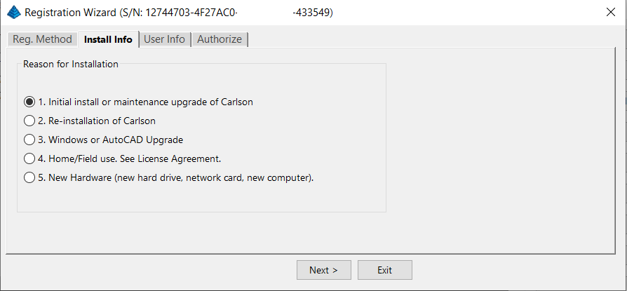
After installation and registration, Carlson provides a Registration Report that includes a “Change Key” and it’s a good idea to save the report and the change key.
And here’s a Pro-Tip for you! The Serial Number screen on your That CAD Girl Customer Portal has a “Customer Notes” section – that’s a great place to save your Change Key and other important information about each license!
FAQ: Does Carlson retire their products?
FAQ: What happens if I get a new computer and need to reinstall Carlson?
FAQ: Can I install my Carlson desktop software on two computers?
FAQ: Is it better to network Carlson than use standalone licenses?
FAQ: Does Carlson Software Still Offer Perpetual Licenses?
FAQ: How do I register my Carlson Software? And what are change keys?
System Requirements for Desktop Software
Technical Support & Training
You can see all the opportunities for training with That CAD Girl here and you can follow these links to see our FAQs about the training and technical support available from Carlson and That CAD Girl.
30-Day Trials
Once you decide to purchase, you won’t even need to uninstall. You can activate your software by simply updating your registration with your purchased serial number.
Frequently Asked Questions: What to Know Before Purchasing Carlson Software
1. What is Carlson Software and who should use it?
Carlson Software is a leading solution for land surveying, civil engineering, grading, and utility contractors. It offers powerful tools for site design, construction layout, data collection, and project management, making it ideal for professionals in land development and infrastructure projects.
2. What are the main features of Carlson Software for land development?
- Advanced survey data collection and processing
- 3D site modeling and earthwork calculations
- Road and subdivision design tools
- Utility and drainage design modules
- Seamless integration with GPS and total station hardware
- CAD drafting and mapping capabilities
- Automated grading and volume calculations
- Compatibility with DWG and DXF file formats
3. What types of licenses and versions are available?
Carlson Software offers perpetual, subscription, and network licenses. Choose from modules like Survey, Civil, Hydrology, GIS, and Takeoff. Bundle packages are available for comprehensive land development needs.
4. What are the system requirements and compatibility details?
Carlson Software runs on Windows-based PCs and is compatible with most CAD platforms, including AutoCAD and IntelliCAD. Check the latest system requirements on the Carlson website to ensure optimal performance.
5. How do I purchase Carlson Software?
You can buy Carlson Software directly from authorized dealers or the official Carlson website. Discounts may be available for multi-seat, educational, or government purchases.
6. Is technical support and training available?
Yes. Carlson provides extensive customer support, including phone, email, and online resources. Training options include webinars, tutorials, and in-person classes tailored for land surveyors and civil engineers.
7. Can I try Carlson Software before buying?
A free trial version is available for download. The trial allows you to explore core features relevant to surveying, civil engineering, grading, and utility design.
8. How are updates and upgrades handled?
Annual maintenance plans include software updates and technical support. Upgrades to new versions are available for users with active maintenance agreements.
9. What should I consider before purchasing?
- Ensure compatibility with your existing hardware and CAD platforms
- Identify which modules best fit your land development projects
- Review training and support options for your team
- Consider long-term maintenance and upgrade costs
10. Where can I find more information?
Visit the Carlson’s website or contact a local dealer for personalized advice on solutions for land surveying, civil engineering, grading, and utility contracting.
MicroSurvey Software: Your Questions Answered
About MicroSurvey
Who is MicroSurvey?
MicroSurvey is a Canadian software developer that has been creating software for land surveyors, engineers, and mapping professionals since 1985.
Software Platform Options
What makes MicroSurvey software unique?
MicroSurvey’s desktop programs run on 64-bit Windows computers and work natively with DWG files, eliminating the need for file conversion. Their software is built to run on various CAD platforms, including IntelliCAD, AutoCAD, and BricsCAD.
What are the different ways I can purchase and use MicroSurvey software?
- With IntelliCAD: MicroSurvey CAD can be installed as a standalone program with an embedded version of IntelliCAD included.
- With embedded AutoCAD (OEM): MicroSurvey embeddedCAD includes an embedded version of AutoCAD and is a standalone product. Note that its functionality is more similar to AutoCAD LT.
- With AutoCAD: MicroSurvey inCAD can be installed on top of your separately purchased, full version of AutoCAD-based programs (excluding AutoCAD LT).
- With BricsCAD: SurveyTools for BricsCAD can be installed on top of your BricsCAD, or you can bundle BricsCAD Pro with your purchase.
Licensing and Upgrades
What licensing options does MicroSurvey offer?
MicroSurvey provides both perpetual and subscription licensing. Licenses can be for a single user or floating (network) licenses that can be shared among users on the same network. Licensing is cloud-based, so no dongle is required.
How do software upgrades work?
Upgrades can be purchased for the current version from the previous version. Upgrades are also available to customers with an active Customer Care Package. Crossgrades to different editions or platforms may also be available.
Maintenance and Support
What is the MicroSurvey Customer Care Package (CCP)?
The CCP is a 12-month service plan that provides software updates and technical support. New software license purchases include one year of CCP.
Other MicroSurvey Products
What is MicroSurvey STAR*NET?
STAR*NET is software that adjusts and analyzes 2D/3D survey networks to improve accuracy. It runs on 64-bit versions of Windows 10 and 11.
What is MicroSurvey FieldGenius?
FieldGenius is data collection software for land surveyors that runs on Android and 64-bit versions of Windows 10 and 11. A legacy version for Windows devices is also available but is no longer updated.
Getting Started
How can I determine which MicroSurvey program is right for me?
It is recommended that you request a 30-day trial to test the software.
Carlson Software: Your Questions Answered
About Carlson Software
Who is Carlson Software?
Carlson Software, based in Maysville, Kentucky, has been a developer of software for land development professionals since 1983. They offer specialized modules for land surveying, civil engineering, construction, and mining industries.
Software Platform Options
What are my options for running Carlson Software?
Carlson’s desktop programs can be installed on top of IntelliCAD or a separately purchased full-AutoCAD-based program. A license for the latest version of IntelliCAD is included with each purchase. Compatible AutoCAD-based programs include AutoCAD, AutoCAD Map, Land Desktop, and Civil 3D, but not AutoCAD LT.
Does Carlson offer a standalone version with an embedded CAD engine?
Yes, Carlson Survey and Takeoff can be purchased with an embedded AutoCAD (OEM) version. This is a standalone product and does not require a separate purchase of AutoCAD. However, the functionality is more akin to AutoCAD LT.
Compatibility
What versions of AutoCAD are compatible with Carlson Software?
You can run Carlson Software on earlier versions of AutoCAD, but you cannot run a version of Carlson that is older than your AutoCAD version. For example, Carlson 2024 is compatible with AutoCAD 2018-2024, while Carlson 2022 works with AutoCAD 2018-2022.
Licensing and Upgrades
What type of license does Carlson offer?
Carlson Software offers perpetual licenses, meaning you own the software after purchase. They also provide network licensing for an additional fee.
How do software upgrades work?
Upgrades are managed through the Annual Maintenance Plan. If your maintenance is active when a new version is released, you receive an automatic upgrade. New licenses include 90 days of maintenance. The cost to upgrade OEM products varies.
Getting Started
Can I try the software before buying?
Yes, it is highly recommended to request a 30-day trial to test the software for your specific needs.
progeCAD Software: Your Questions Answered
About progeCAD
What is the story behind progeCAD?
Founded in 1985, progeCAD co-founded the IntelliCAD Technology Consortium (“ITC”) in 1999 to create a comprehensive and fairly priced alternative to AutoCAD. They offer a native DWG 2D/3D CAD software with a familiar interface and powerful features at a low cost.
progeCAD Software Features
What are the key features of progeCAD?
progeCAD works natively with AutoCAD DWG files without any conversion, ensuring complete compatibility. It features an “AutoCAD Like” interface and supports AutoCAD file types, fonts, and plotting styles. progeCAD Professional includes 3D ACIS Solid Modeling and realistic rendering. It also offers more functions than AutoCAD LT at a fraction of the price of other major CAD software.
Licensing Options
What licensing solutions does progeCAD offer?
- Single+ (SL): Allows installation and use on two computers by the same person, but not simultaneously.
- USB Portable (USB): Install on multiple computers and use the software on one computer at a time by plugging in a USB dongle.
- Network (NLM): Install on unlimited PCs on a network and use concurrently based on the number of licenses purchased. Licenses can be temporarily moved for offline use.
- Corporate One Site: Unlimited users at a single company location.
- Corporate Country: Unlimited users within the same country under one company name.
Maintenance and Support
What is iCARE?
iCARE is a one-year subscription-based maintenance and support program that provides all progeCAD updates, new versions, and free technical assistance.
Getting Started
Can I try progeCAD before I buy it?
Yes, it is highly recommended that you request a 30-day trial to test the software for yourself.
Why Buy from That CAD Girl?
Once you decide to purchase, you won’t even need to uninstall. You can activate your software by simply updating your registration with your purchased serial number.
Some content on this website was prepared with AI assistance. Please verify important information with the manufacturer or original source before making purchasing or financial decisions.
If you find the material on this website helpful, please consider supporting That CAD Girl by purchasing our products or services.
If you are interested in purchasing products or services we do not offer, we would love to refer you to one of our Trusted Partners. Please click here to send us a message with your request.
P3D? or Point Cloud? then Point Cloud Basic? or Point Cloud Advanced?
+Here is a handy chart – current as of the 2023 product release: Comparison: Point Cloud Basic vs Point Cloud Advanced
Point Cloud Advanced Videos
https://www.youtube.com/watch?v=d2Sgk21HnPw&t=34s
Carlson Point Cloud Advanced 2023 – Part 2
https://www.youtube.com/watch?v=ftIdxr9cPmU&t=36s
Carlson Point Cloud Advanced 2023 – Part 3
https://www.youtube.com/watch?v=fXchPkwVPcE&t=33s
I don’t know about you but the new Carlson product offerings for P3D Topo and Point Cloud Basic and Point Cloud Advanced confuse me. Admittedly, these are products I haven’t dived into much and have relied on Mark Long and Doug Aaberg for their advice and direction. So, I put the question to them, “Who Needs Point Cloud? And Who Needs P3D Topo?”
Doug Aaberg: I feel that while Carlson P3D topo is a good solution for producing, manipulating surface models as well as some hydrology capabilities while Carlson Point Cloud is a good solution for performing virtual surveys and extracting existing data out of a cloud. It is probably to simple to surmise by saying Engineers would like P3D while Surveyors would like Point Cloud but I sort of think that way. The truth is, there is a lot of overlap between the two products.
Mark Long says: Carlson P3D Topo is intended to take large point clouds and create surface models for design professionals via Drones or Lidar.
And as to the difference between Point Cloud Basic and Advanced? Doug says: Point Cloud Basic – designed to work within a CAD environment to manipulate and extract data from a point cloud. It has a very large capacity (up to a billion points) and is a great program for performing a “virtual survey” directly in a cloud. It allows the creation of Carlson points and 3D polylines utilizing a typical Carlson Field to Finish code table (FLD file) and draws entities directly into an open CAD drawing with no additional export function. A notable feature is Survey by Grid which sets points at any specified grid spacing.
Point Cloud Advanced – contains all of the functionality of Carlson Point Cloud Basic plus the ability to extract features such as trees, hydrants and poles. It also allows the creation of solids and utilizes typical Carlson cross section alignments (mxs files) to extract cross sections and profiles. You can select cloud data by color or elevation and create regions for isolating portions of a cloud for editing or extracting features.. A notable feature is the ability to simplify a TIN and create smoother looking contour lines.
Some content on this website was prepared with AI assistance. Please verify important information with the manufacturer or original source before making purchasing or financial decisions.
If you find the material on this website helpful, please consider supporting That CAD Girl by purchasing our products or services.
If you are interested in purchasing products or services we do not offer, we would love to refer you to one of our Trusted Partners. Please click here to send us a message with your request.
What features & menus are in Carlson Trench? (a running thread)
+Carlson Trench 2017
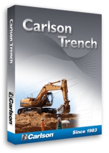
Features and Benefits of Trench 2017
Carlson Trench is for calculations related to installing pipes, sewers, or utility lines. The CAD software calculates the volume of the trench cut, the volume of backfill (excluding the pipe size), and the linear footage of pipe broken down by the pipe material, size, and/or depth.
Carlson Trench is fully integrated with Carlson Civil and Carlson Construction, and also Carlson Hydrology to meet the variety of customers’ needs.
Menus in Trench 2017
Menu Bar in Trench 2017

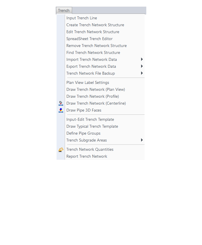
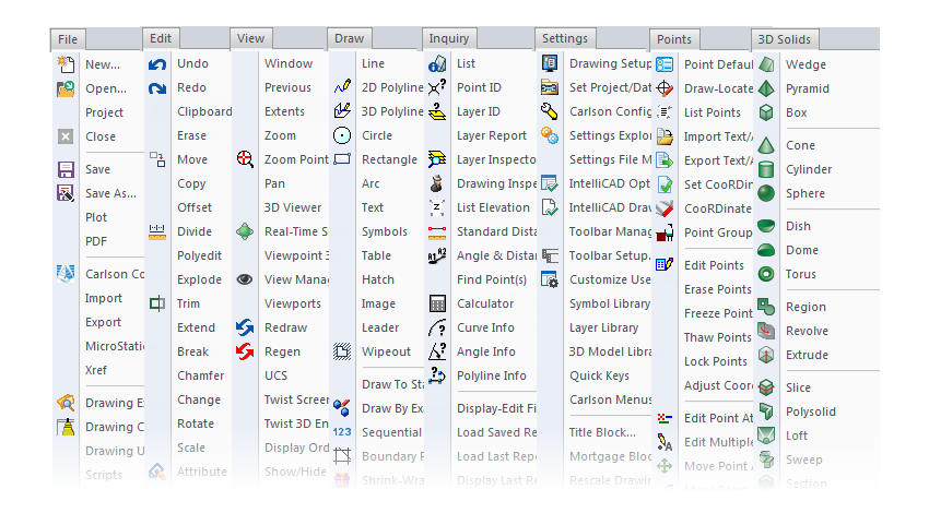
The menus below are available in Carlson Trench 2017
Trench Menu
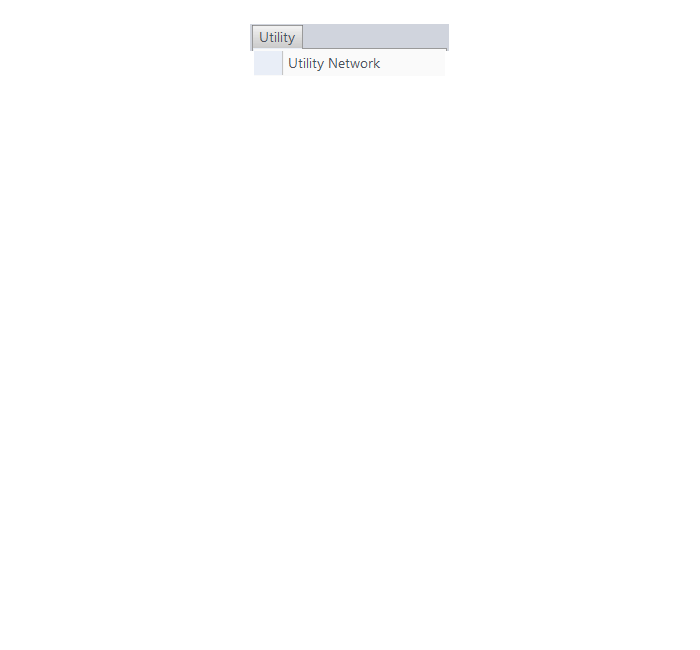
Utility Menu
The menus below are in all non-OEM programs of Carlson 2017 desktop software
(Click image to see more)
Carlson Trench 2020
Features and Benefits of Trench 2020
Carlson Trench is for calculations related to installing pipes, sewers, or utility lines. The CAD software calculates the volume of the trench cut, the volume of backfill (excluding the pipe size), and the linear footage of pipe broken down by the pipe material, size, and/or depth.
Carlson Trench is fully integrated with Carlson Civil and Carlson Construction, and also Carlson Hydrology to meet the variety of customers’ needs.
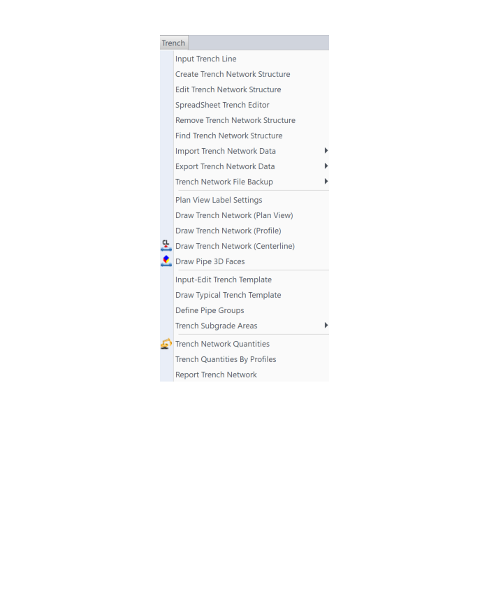
Menu Bar in Trench 2020

The menus below are available in Carlson Trench 2020
Trench Menu
Utility Menu

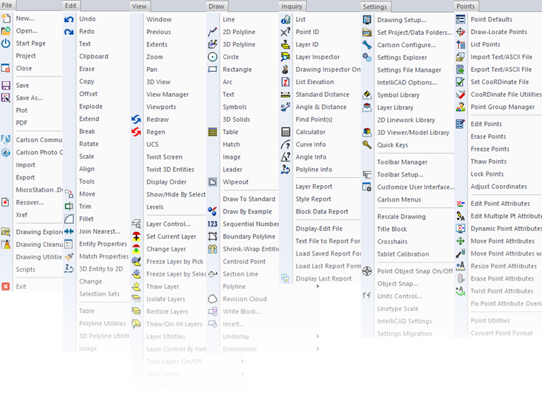
The menus below are in all non-OEM programs of Carlson 2020 desktop software
(Click image to see more)
Carlson Trench 2022
Features and Benefits of Trench 2022
Carlson Trench is for calculations related to installing pipes, sewers, or utility lines. The CAD software calculates the volume of the trench cut, the volume of backfill (excluding the pipe size), and the linear footage of pipe broken down by the pipe material, size, and/or depth.
Carlson Trench is fully integrated with Carlson Civil and Carlson Construction, and also Carlson Hydrology to meet the variety of customers’ needs.
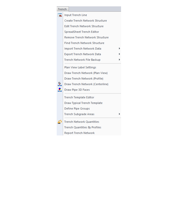
Menus in Trench 2022
Menu Bar in Trench 2022

The menus below are available in Carlson Trench 2022
2022 Trench Menu
2022 Utility Menu

The menus below are in all non-OEM programs of Carlson 2022 desktop software
(Click image to see more)
Carlson Trench 2024
Features and Benefits of Trench 2024
Carlson Trench is for calculations related to installing pipes, sewers, or utility lines. The CAD software calculates the volume of the trench cut, the volume of backfill (excluding the pipe size), and the linear footage of pipe broken down by the pipe material, size, and/or depth.
Carlson Trench is fully integrated with Carlson Civil and Carlson Construction, and also Carlson Hydrology to meet the variety of customers’ needs.
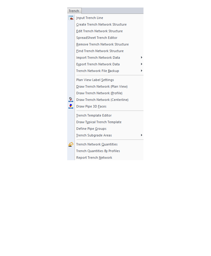
Menus in Trench 2024
Menu Bar in Trench 2024

The menus below are available in Carlson Trench 2024
2024 Trench Menu
2024 Utility Menu

The menus below are in all non-OEM programs of Carlson 2024 desktop software
(Click image to see more)
Some content on this website was prepared with AI assistance. Please verify important information with the manufacturer or original source before making purchasing or financial decisions.
If you find the material on this website helpful, please consider supporting That CAD Girl by purchasing our products or services.
If you are interested in purchasing products or services we do not offer, we would love to refer you to one of our Trusted Partners. Please click here to send us a message with your request.
I’m a land surveyor. What software do I need?
+But, I find a lot of surveyors also need Carlson GIS for bringing in aerial photos, images of quad and soils maps.
And, this is a little out of the box, but if you’re a surveyor who does a lot of construction staking, I highly recommend Carlson Civil as well. Carlson Civil has a lot of tools that are meant to be used for design but, in my experience, can be invaluable for stakeout.
Most of these tools are in the 3D Data menu of Carlson Civil and include:
- 2D to 3D Polyline by Points and by Text with Leader
- Assign Contour Elevations
- Pad Polyline by Interior Text
- Draw Building Perimeter Polyline
- Convert Spot Elevations to Points
- Points by Slope
If you need Survey plus any of these other programs, you will have to use Carlson Survey with IntelliCAD or For Your AutoCAD because Survey and Takeoff are the only programs available on the embedded AutoCAD (OEM) platform.
And if you need Survey plus any of these other programs, you may want to consider the Civil Suite because the bundled pricing is often better than buying 2 or more individual modules.
Some content on this website was prepared with AI assistance. Please verify important information with the manufacturer or original source before making purchasing or financial decisions.
If you find the material on this website helpful, please consider supporting That CAD Girl by purchasing our products or services.
If you are interested in purchasing products or services we do not offer, we would love to refer you to one of our Trusted Partners. Please click here to send us a message with your request.
I’m a civil engineer. What software do I need?
+Since all three of these modules are included in the Carlson Civil Suite, that’s usually the better deal.
Some content on this website was prepared with AI assistance. Please verify important information with the manufacturer or original source before making purchasing or financial decisions.
If you find the material on this website helpful, please consider supporting That CAD Girl by purchasing our products or services.
If you are interested in purchasing products or services we do not offer, we would love to refer you to one of our Trusted Partners. Please click here to send us a message with your request.
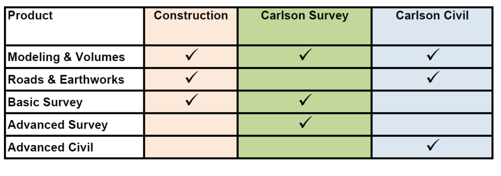
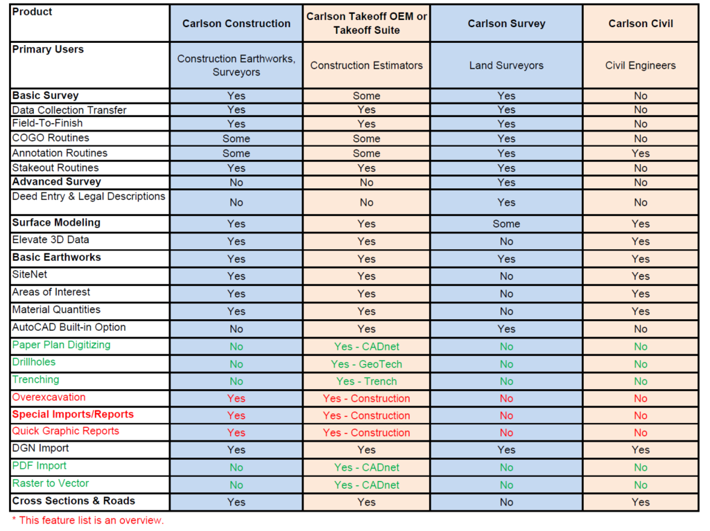
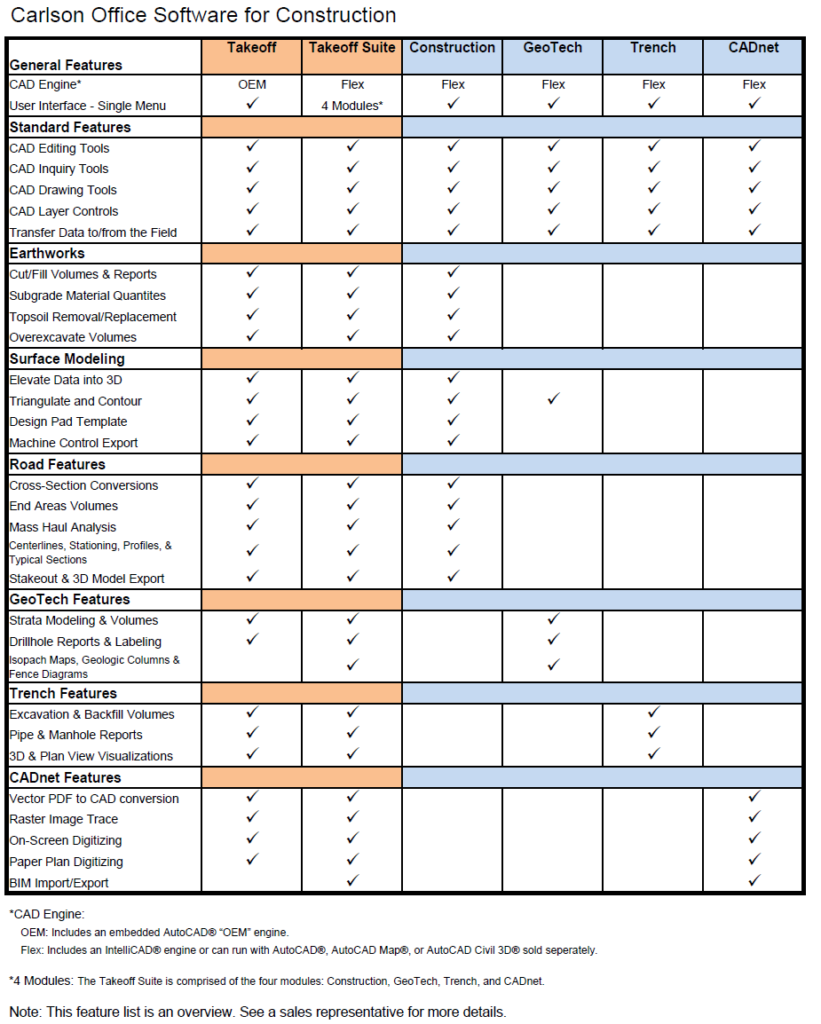
I’m a contractor and need to do takeoffs and create machine control files. What software do I need?
+The good thing about the Takeoff Suite is that you can buy the whole thing or just the pieces and parts you need. Many contractors only need the functionality of Construction and CADNet so, unless you need Trench and GeoTech as well, you could save a little money by just buying those modules. And you could always add the other pieces later if necessary.
Construction includes most of the functionality you will need for building models and doing takeoffs: tools for elevating 2D to 3D, site and roadway surface modeling (including resurfacing), quantity calcs, exporting to machine control and more.
CADNet includes the digitizing and imaging tools such as raster to vector, importing PDFs and BIM files and more.
GeoTech is for importing borehole data for analyzing subsurface conditions and materials.
Trench is for calculations related to installing pipes, sewers, or utility lines.
One other thing to note is that Construction is mostly a blend of the functionality you’ll find in Carlson Survey & Civil. Since the pricing of Civil Suite is the same as Construction, you may find that purchasing Civil Suite and CADNet is a good alternative to Construction and CADNet.
These images were current for the Carlson 2021 products but I don’t think much has changed…
Some content on this website was prepared with AI assistance. Please verify important information with the manufacturer or original source before making purchasing or financial decisions.
If you find the material on this website helpful, please consider supporting That CAD Girl by purchasing our products or services.
If you are interested in purchasing products or services we do not offer, we would love to refer you to one of our Trusted Partners. Please click here to send us a message with your request.
What should I buy if I need a basic CAD program (like AutoCAD LT)?
+In September, Carlson Software introduced a new program in their lineup: Carlson iCAD. This program is comparable to AutoCAD LT with basic drafting and inquiry tools but is built on IntelliCAD 8.3.
FAQ: What features are in Carlson iCAD? (a running thread)
View Carlson iCAD in our online store
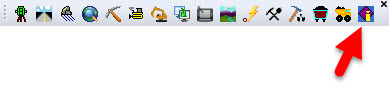
If you truly, truy only need generic-CAD functionality, I recommend purchasing Carlson GMS with IntelliCAD. It’s the cheapest of all the desktop products and you can load this basic IntelliCAD menu:

Some content on this website was prepared with AI assistance. Please verify important information with the manufacturer or original source before making purchasing or financial decisions.
If you find the material on this website helpful, please consider supporting That CAD Girl by purchasing our products or services.
If you are interested in purchasing products or services we do not offer, we would love to refer you to one of our Trusted Partners. Please click here to send us a message with your request.
What features & menus are in Carlson Point Cloud? (a running thread)
+Carlson Point Cloud 2019 - Basic and Advanced
Features and Benefits of Point Cloud 2019
Comparison: Point Cloud Basic vs Point Cloud Advanced
Commands in Point Cloud Basic and Point Cloud Advanced
Carlson Point Cloud is a modular program that provides this powerful ability to go from field scan to finished plat, all with seamless integration to Carlson Survey, Carlson Civil and Carlson Mining. Carlson Point Cloud delivers a whole new level of powerful automation for large data sets. It gives laser scanner users the ability to process millions of data points with Carlson Software ease-of-use.
Register your scan to local coordinates, filter or decimate the points, overlay raster images in 3D, snap to edges and code the descriptions for automated field-to finish processing of linework and symbols and create contours, profiles, sections, and breaklines. You will be able to read scan data from many instruments, view and process up to 1 billion points, and then perform the Field-to-Finish from the scanned data!
This Carlson Software office product allows users to export surface models, points, contours, breaklines, grid and profiles to CAD.
Carlson Point Cloud 2017
Features and Benefits of Point Cloud 2017
Register your scan to local coordinates, filter or decimate the points, overlay raster images in 3D, snap to edges and code the descriptions for automated field-to finish processing of linework and symbols and create contours, profiles, sections, and breaklines. You will be able to read scan data from many instruments, view and process up to 1 billion points, and then perform the Field-to-Finish from the scanned data!
This Carlson Software office product allows users to export surface models, points, contours, breaklines, grid and profiles to CAD.
Menus in Point Cloud 2017
Menu Bar in Point Cloud 2017

The menus below are available in Carlson Point Cloud 2017
Point Clouds Menu
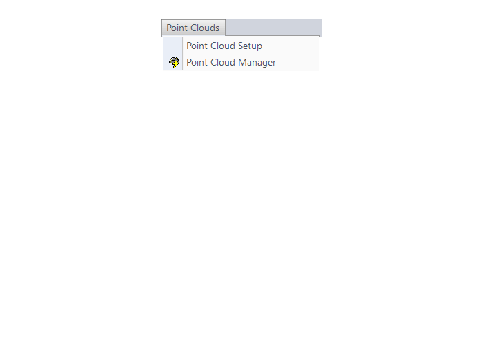
The menus below are in all non-OEM programs of Carlson 2017 desktop software
(Click image to see more)
Some content on this website was prepared with AI assistance. Please verify important information with the manufacturer or original source before making purchasing or financial decisions.
If you find the material on this website helpful, please consider supporting That CAD Girl by purchasing our products or services.
If you are interested in purchasing products or services we do not offer, we would love to refer you to one of our Trusted Partners. Please click here to send us a message with your request.
How do AutoCAD, IntelliCAD and BricsCAD compare for raster-to-vector capabilities? (a running thread)
+
This is a running thread. I’ll update it when AutoCAD, IntelliCAD or BricsCAD change what they can do natively with rasters and scans.
First, a quick definition so we’re talking about the same thing. Raster-to-vector conversion means taking a scanned picture of a drawing (pixels) and automatically turning the lines, arcs and text on that scan into real, editable CAD entities (polylines, arcs, text and so on). Attaching an image and tracing over it by hand is not conversion. Importing a vector PDF’s geometry is also not the same thing as converting a scan.
I get asked this a lot when someone has a scanned survey plat, an old topographic sheet or a blurry engineering drawing and wants that linework turned into CAD. So I lined up the three platforms people ask me about most: AutoCAD, IntelliCAD and BricsCAD.
As of October 9, 2026, this comparison is based on AutoCAD 2027, IntelliCAD 15.0 and BricsCAD V26. It covers only the native CAD platforms. It does not include third-party raster-to-vector apps or specialized toolsets. Those tools do exist and they are where the real conversion work happens.
Jump to:
- The comparison table
- What the rows actually mean
- So what do you do with a scanned drawing?
- What about third-party apps?
The comparison table
Here’s the side-by-side. “Yes” means the feature is built into the core platform. “No” means it isn’t.
| Feature | IntelliCAD 15 | BricsCAD V26 | AutoCAD 2027 |
|---|---|---|---|
| Attach raster images (JPG, PNG, TIFF) | Yes | Yes | Yes |
| Scale, rotate and position raster images | Yes | Yes | Yes |
| Manually trace raster drawings | Yes | Yes | Yes |
| Attach scanned PDFs as underlays | Yes | Yes | Yes |
| Import vector PDF geometry as CAD entities | Implementation-dependent | Yes | Yes |
| Automatically convert scanned lines to CAD entities | No | No | No |
| Convert scanned contour lines to polylines | No | No | No |
| OCR recognition of scanned text | No | No | No |
What the rows actually mean
All three platforms let you attach a JPG, PNG or TIFF, then scale, rotate and position it so you can draw over it. That’s the old-fashioned way and it still works just fine.
All three also let you attach a scanned PDF as an underlay. Same idea: the scan sits under your drawing and you trace what you need.
What none of them do natively is look at a scanned picture of lines and turn those pixels into editable polylines, arcs and text for you. No automatic line conversion. No contour-to-polyline magic. No OCR that reads the text off the scan. If you want that, you’re looking at a specialized raster-to-vector tool or a toolset that sits on top of the CAD program.
So what do you do with a scanned drawing?
For scanned survey plats, topographic maps and legacy engineering drawings, all three platforms land in the same place:
- Attach the image or PDF underlay.
- Scale and position it so it matches your coordinate system or known distances.
- Trace the linework you actually need… or run the scan through a dedicated raster-to-vector program first, then bring the resulting CAD entities in.
In other words, don’t pick AutoCAD, IntelliCAD or BricsCAD expecting a built-in “turn this scan into CAD” button. Pick them for the CAD work. Handle the conversion with a specialized tool when the volume of tracing would make you crazy.
What about third-party apps?
Yes, there are third-party apps (and a few specialized toolsets) that actually do raster-to-vector conversion. They are built for that job: reading scanned linework, cleaning it up and turning it into editable CAD geometry, sometimes with OCR for the text.
If conversion is a big part of your workflow, look at those tools separately. The comparison table above is about what the three CAD platforms themselves can and cannot do without that help.
Some content on this website was prepared with AI assistance. Please verify important information with the manufacturer or original source before making purchasing or financial decisions.
If you find the material on this website helpful, please consider supporting That CAD Girl by purchasing our products or services.
If you are interested in purchasing products or services we do not offer, we would love to refer you to one of our Trusted Partners. Please click here to send us a message with your request.
How Does BricsCAD Handle GIS and Online Map Services?
+This post covers BricsCAD Pro V26. We’ll update it when BricsCAD V27 comes out.
As of October 8, 2026, the current release is BricsCAD V26.2.08 (September 15, 2026).
Short answer: yes! BricsCAD can pull in imagery from public map servers, show online maps behind your linework, attach your own georeferenced aerials and bring GIS data in and out with its attributes.
But if you’re looking for Bing maps, here’s the scoop… Bing Maps have been retired and can no longer be used in BricsCAD. The good news is that OpenStreetMap is free and needs no key, Esri maps work with an Esri API key (Free*) and BricsCAD Pro can connect to a Web Map Service (WMS).
* The Esri API is free up to a point. See Getting an Esri map key for the monthly tile limit and what happens after that.
Jump to:
- Can BricsCAD link to open source or government map services?
- First things first: set your geographic location
- Online maps with GEOMAP
- Getting an Esri map key
- Capturing a map image
- Importing and exporting GIS data
- Attaching your own georeferenced images
- What’s in Lite and what needs Pro?
Does BricsCAD allow users to link to open source or government services such as feature services or map services?
Yes. BricsCAD supports connecting to Web Map Service (WMS) endpoints using the MAPCONNECT command (BricsCAD Pro and higher), which lets you add map imagery from public and government-hosted WMS servers into your drawing.
Before adding WMS data, you must set the drawing’s geographic location using GEOGRAPHICLOCATION (more on that below). Then:
- Create the connection – give it a name, the server URL and version, plus a login if the server needs one.
- Pick your layers – select one or more data layers, set the ground resolution and the maximum tile size and check the estimated download size before you click Add.
BricsCAD saves the downloaded map tiles as regular image files in the same folder as your drawing, so keep that in mind when you send the drawing to someone else.
For vector GIS features with attributes, the other half of that question, see Importing and exporting GIS data.
First things first: set your geographic location
Everything map-related starts with GEOGRAPHICLOCATION (you can also type GEO, NORTH or NORTHDIR). It opens the Geographic Location dialog box, where you pick a GIS coordinate system or add coordinates manually. Under Advanced / BIM Settings you can:
- Set the real-world location of the geographic marker in decimal latitude and longitude, in degrees, minutes and seconds or as a projected Easting and Northing, plus an elevation.
- Set the marker’s position in the drawing by typing X, Y and Z values or picking a point.
- Set the north direction, which is saved to the NORTHDIRECTION system variable.
- Remove the geographic location data if you need to start over.
The GIS Coordinate System button on the status bar opens the same dialog. And for the CAD managers writing scripts or LISP, there’s a command line version: -GEOGRAPHICLOCATION.
Online maps with GEOMAP
BricsCAD also supports displaying online maps inside a drawing using GEOMAP. Your choices are:
- open street Map – free to use and doesn’t require an API key.
- esri Imagery, esri Streets, esri Light, esri Dark and esri Hybrid – available only when an Esri API key is assigned. Hybrid combines the aerial imagery with labels.
- Off – hides the map.
What about drawings that were set up with Bing? By default, BricsCAD substitutes them automatically: Bing Aerial becomes esri Imagery, Bing Road becomes open street Map and Bing Hybrid becomes esri Hybrid. You’ll see a notification in the lower right corner when that happens.
So… what is OpenStreetMap? Think of it like Wikipedia, but for maps! OpenStreetMap is a free world map built and kept up to date by volunteers all over the world. They add the roads, buildings, trails, rivers and place names, and anyone can use it for free. That’s why BricsCAD can give it to you with no key. Just keep in mind that it’s a street-style map, not aerial photos. If you want imagery, you’ll need one of the Esri styles. (Techie tip: the GEOMAPOSMMODE system variable controls where the open street Map tiles come from. The default of 1 uses OpenStreetMap’s own maps and 0 switches to Esri’s version.)
The map’s copyright and watermark show in the lower right corner of the drawing area, and you’ll see a downloading message while the map tiles load.
Getting an Esri map key
Run GEOMAPKEY to open the Online Maps Support dialog box and paste your Esri key into the Esri Key field. You create the key yourself with a free account on Esri’s ArcGIS Location Platform, giving it the Basemaps privileges (both Basemap styles service and Static basemap tiles).
Here’s the kicker… according to the BricsCAD help as of October 8, 2026:
- Free tiles – the first 2 million map tiles per month are free.
- After that – it’s $0.15 per 1,000 tiles. If you go over the free limit, the maps stop working until you turn on pay-as-you-go in your Esri dashboard or buy a voucher.
- One key per person – BricsCAD recommends that each user create their own Esri account and key to stay under the limit.
- Keys expire – the default is 90 days and the maximum is one year. After that you’ll need to generate a new key.
Esri sets that pricing, so it can change. My advice? Put a reminder on your calendar for the day your key expires!
Capturing a map image
GEOMAPIMAGE captures a rectangle of the online map (or the whole current viewport) and embeds it in the drawing as an image. A frame shows where the capture is, and if you change the frame’s size or position, the image updates. Run GEOMAP again and choose Off if you want to see only your captured image. The copyright and watermark are added to the bottom right corner of the image.
Then fine-tune it with:
- GEOMAPIMAGETYPE – changes the map style of the captured image.
- GEOMAPIMAGERESOLUTION – sets the resolution to Coarse, Optimal, Fine or VeryFine.
- GEOMAPIMAGEUPDATE – optimizes or reloads the image.
Importing and exporting GIS data
For importing vector GIS data as CAD entities with attributes, BricsCAD Pro provides:
- GISIMPORT – imports vector GIS features with their original location, shape and attributes from SHP, GML, KML/KMZ and Esri Geodatabase files. Features come in as points, lines and polylines on the drawing layers you choose, only inside the import area you set and with coordinate system transformation.
- GISEXPORT – exports vector GIS features with their location, shape and attributes to SHP, GML or KML/KMZ files.
- GISCONVERT – converts Object Data and Mpolygons in a drawing you’ve received into BricsCAD GIS data. CONVERTGISTOOBJECTDATA goes the other way and turns BricsCAD GIS data into Object Data.
- MPOLYGON – creates multi-sided polygon entities, handy for GIS polygons with holes and islands.
- MOVEBLOCKSTOELEVATION – moves each block’s insertion point to the elevation in its block attribute or GIS data.
- GEOIMPORT – imports a DWG or DXF drawing and places it based on the geographic location of both the source and target drawings.
Civil labels can also display GIS attributes, and point clouds with geographic data can set your drawing’s location (see our point cloud FAQ below).
Attaching your own georeferenced images
Have an aerial from your county or a drone flight? Attach it with IMAGEATTACH (alias IAT). In the Attach Raster Image dialog box, turn on Use Geocoding Information and BricsCAD uses the image’s position file (world file) to set its size, location and rotation for you.
What’s in Lite and what needs Pro?
Good news for Lite users: the online map basics are included in every edition.
- Included in Lite and Pro: GEOGRAPHICLOCATION, GEOMAP, GEOMAPKEY, GEOMAPIMAGE, GEOMAPIMAGETYPE, GEOMAPIMAGERESOLUTION, GEOMAPIMAGEUPDATE and IMAGEATTACH.
- Requires Pro or higher: MAPCONNECT, GISIMPORT, GISEXPORT, GISCONVERT, MPOLYGON, MOVEBLOCKSTOELEVATION, GEOIMPORT and POINTCLOUDGEOGRAPHICLOCATION.
If you need the Pro tools, talk to an authorized BricsCAD dealer about moving up from Lite.
Some content on this website was prepared with AI assistance. Please verify important information with the manufacturer or original source before making purchasing or financial decisions.
If you find the material on this website helpful, please consider supporting That CAD Girl by purchasing our products or services.
If you are interested in purchasing products or services we do not offer, we would love to refer you to one of our Trusted Partners. Please click here to send us a message with your request.
What you should know about purchasing Topcon
+
- About Topcon Positioning Systems
- About MAGNET Office, MAGNET Field and MAGNET Enterprise
- Operating System
- System Requirements
- CAD Platform
- How and Where to Purchase
- Upgrades to New Versions and Crossgrades to Different License Types or Modules
- License Options
- License Terms
- License Levels (Modules)
- Software Trials
- Support and Training Options
About Topcon Positioning Systems
Topcon Positioning Systems, headquartered in Livermore, California, develops precision positioning technology, software and workflow solutions for the construction, geomatics and agriculture markets. Its European headquarters are in Zoetermeer, Netherlands. Its parent company, Topcon Corporation, was founded in 1932 and is headquartered in Tokyo, Japan.
Click here to learn more about Topcon Positioning Systems
About MAGNET Office, MAGNET Field and MAGNET Enterprise
With the v2026.0 release, Topcon returned its office and field software to the MAGNET name. Topcon Office is now MAGNET Office, Topcon Field is now MAGNET Field and version numbers now follow the year (for example, MAGNET Office 2026.0). The products work together to move survey and construction data between the office, the field and machine control.
MAGNET Office (formerly Topcon Office) is CAD and design software for contractors and surveyors. It combines plans and survey data to build 3D digital terrain models for site survey, layout and machine control. Optional Site Prep and Survey modules add road and site design and finished survey CAD deliverables. Click here to learn more about MAGNET Office
MAGNET Field (formerly Topcon Field) is data collection software that turns a rugged tablet or compatible Android device into a field controller for Topcon GNSS receivers, robotic total stations, scanning robotic total stations and digital levels. It is used for land surveying, stakeout, construction layout, roadwork and utility mapping. Click here to learn more about MAGNET Field
MAGNET Enterprise (also called Topcon Enterprise) is a cloud service for sharing project data between office teams, field crews and machine operators. Files can be shared and converted for use in MAGNET Office, Sitelink3D and Autodesk or Bentley software. Click here for Topcon’s software eBook (PDF), which covers MAGNET Enterprise
Sitelink3D is a web-based service for managing, monitoring and supporting job sites. It syncs design data between the office, machines and field crews and offers remote view and control of connected machines. Click here to learn more about Sitelink3D
Not sure which products you need? See Which Topcon / MAGNET software do I need for the office? and Which Topcon / MAGNET software do I need in the field?
Operating System
As of October 8, 2026, these are the supported operating systems for the current releases:
- MAGNET Office 2026.0: Windows 10 and 11 (64-bit)
- MAGNET Field 2026.0: Windows tablets and compatible Android devices
- MAGNET Enterprise and Sitelink3D: Web-based services used through a web browser
System Requirements
System requirements change with each release. See our Topcon MAGNET Office system requirements FAQ for the current requirements.
CAD Platform
MAGNET Office is a standalone Windows program with its own drafting, design and surface modeling tools. It does not run on top of another CAD program. It imports and exports AutoCAD DWG and DXF files, and MAGNET Office 2026.0 added import of Revit (RVT) models.
If you also work in AutoCAD or Revit, Topcon Exchange for Autodesk adds a ribbon to those programs for creating Topcon machine control and survey files and sending them to the field through MAGNET Enterprise.
How and Where to Purchase
When purchasing Topcon software, you buy through Topcon’s network of authorized dealers and distribution partners. Pricing is subject to change without notice and varies by product, license term and selected modules.
To purchase Topcon software, please contact an authorized Topcon dealer.
Upgrades to New Versions and Crossgrades to Different License Types or Modules
New versions are included while your subscription or your Topcon Software Service Plan is current. Software downloads, activation and support resources are available through your myTopcon account.
Perpetual licenses include the first year of the Service Plan. After that, you renew the Service Plan each year to keep receiving new versions and support.
You can add the Site Prep or Survey module to MAGNET Office as your needs grow. To add modules or move between subscription and perpetual licensing, contact your Topcon dealer about your options.
To see what has changed in recent releases, see What are the recent improvements to Topcon’s MAGNET Field and Office software?
License Options
- Online Activation: MAGNET Office licenses are activated online, so you need an internet connection to activate the software.
- Check In / Check Out: Licenses managed through MAGNET Enterprise can be checked in and checked out so they can be moved between computers and shared across your team. Ask an authorized Topcon dealer how many seats you need and how offline use works for your licenses.
License Terms
- Perpetual License (Permanent License): A one-time purchase that includes the first year of the Topcon Software Service Plan for maintenance, updates and support, plus one year of MAGNET Enterprise. After the first year, the Service Plan is renewed annually for a fee.
- Subscription License: Includes the Service Plan, access to the latest features in each release and MAGNET Enterprise for the length of the subscription. Subscriptions are typically sold in 1- or 3-year terms, so check with an authorized Topcon dealer for current options.
- Sitelink3D (Service Points): Sitelink3D uses Topcon’s Service Point model. You add credit to your myTopcon account and points are used only when the service is in use.
License Levels (Modules)
MAGNET Office is sold as base software with optional modules:
- MAGNET Office: The base software for Sitelink3D and Enterprise connectivity, machine control and layout data prep and building 3D digital terrain models
- Site Prep Module: Adds road, site, corridor and resurfacing design, 2D PDF to 3D job files and takeoff and material quantities
- Survey Module: Adds finished survey CAD deliverables for property plots, subdivisions and land development and includes MAGNET Tools for processing and adjusting total station, GNSS and digital level data
Click here to learn more about MAGNET Office license levels (modules)
For help choosing a combination, see Which Topcon / MAGNET software do I need for the office?
Software Trials
To try the complete MAGNET Office or MAGNET Field software without limitation, Topcon dealers can provide a 30-day trial license.
If you would like help requesting a trial of this software, please contact an authorized Topcon dealer.
Support and Training Options
Topcon provides software downloads, documentation and support resources through myTopcon.
Click here for myTopcon support
MAGNET Office also has built-in help. Click the ? icon at the top right of a dialog or panel for context help, or use the AI chatbot added in MAGNET Office 2026.0 under Help > Chatbot.
For free and paid MAGNET Office training, see What training is available for Topcon / MAGNET Office?
Some content on this website was prepared with AI assistance. Please verify important information with the manufacturer or original source before making purchasing or financial decisions.
If you find the material on this website helpful, please consider supporting That CAD Girl by purchasing our products or services.
If you are interested in purchasing products or services we do not offer, we would love to refer you to one of our Trusted Partners. Please click here to send us a message with your request.
What can I do with point clouds in BricsCAD Pro V26?
+This post covers BricsCAD Pro V26. We’ll update it when BricsCAD V27 comes out.
As of October 8, 2026, the current release is BricsCAD V26.2.08 (September 15, 2026).
Short answer: a lot!
BricsCAD Pro doesn’t just display a scan. You can crop it, color it, classify it, trace linework from it, build a TIN surface from it and check your work against it. Many of the surveyors and engineers I talk to don’t realize all of that is in Pro.
We checked every command below against the BricsCAD V26 Help Center to make sure it works with a Pro license, not just BIM or Ultimate. The handful of point cloud tools that need a higher license are listed near the end.
Jump to:
- Getting point clouds into BricsCAD Pro
- Viewing, cropping and organizing
- The Bubble Viewer
- Drawing and modeling from a point cloud
- Classifying points
- Point clouds and geographic location
- Exporting point clouds
- What’s NOT in Pro?
- A quick hardware tip
Getting point clouds into BricsCAD Pro
- POINTCLOUDATTACH – attaches a point cloud file (or a whole folder) to the current drawing. The drawing doesn’t even have to be saved first. Supported files are .e57, .hspc, .las, .laz, .lgsx, .pack, .pts, .ptx, .rcp, .rcs, .rdbx, .rsp and .zfs. On a Mac, .lgsx, .rdbx and .rsp files aren’t supported.
- ASCII point files – you can also bring in an ASCII point cloud with almost any extension, a custom separator or a custom column layout. Choose All files in the file type list to find it.
- Point Cloud Cache Manager (POINTCLOUDREFERENCE) – BricsCAD preprocesses each scan in the background into a cache and lets you know when it’s done. In the Cache Manager you can search your cached scans, see their metadata, edit the name, unit and GIS coordinate system and then attach with an insertion point, scale, rotation and coordinate system.
- HSPC format – HSPC (Hexagon Smart Point Cloud) is the default cache format, set by the POINTCLOUDHSPC system variable. It stores metadata for each point, which is what makes regions, scan-by-scan visibility, classes and geographic data possible.
So, the first time you attach a big scan, go get a cup of coffee. If you pick the same source file again later, BricsCAD finds the existing cache and inserts it without preprocessing it all over again.
Viewing, cropping and organizing
- Point Cloud Manager panel (POINTCLOUDMANAGERPANELOPEN) – a tree of your point clouds with their scans, regions and classes. Turn any of them on or off.
- Render Settings (POINTCLOUDRENDERSETTINGSOPEN) – a tab in the same panel for bubble size, Outline rendering and the POINTCLOUDPOINTMAX setting, which is now in millions (10 = 10,000,000 points).
- POINTCLOUDCROP – crops a cloud with a rectangular, polygonal or circular boundary and shows what’s inside or outside. POINTCLOUDUNCROP removes the crop.
- POINTCLOUDCROPSOLID – turns an extruded solid or polysolid into a crop solid so you can crop in 3D. You can edit it like any other solid.
- POINTCLOUDREGION – saves a selection of points as a region. Regions are stored next to the cache, so they’re available in any drawing you attach that scan to.
- POINTCLOUDCOLORMAP – colors the points by scan color, object color, elevation, intensity, normals or classification, with color schemes like Hydro, Earth and Spectrum. There’s also an X-Ray option for transparency.
- POINTCLOUDLOAD – unloads a scan temporarily to free up resources, loads it back or relocates the cache folder.
- POINTCLOUD – opens the Point Clouds category of the Drawing Explorer, where you can see each cloud’s size, references and paths.
The Bubble Viewer
If you’ve never stood “inside” a scan, try this one first.
Scans captured with a static scanner show up with green bubbles at each scan location. Run POINTCLOUDBUBBLEVIEWER or double-click a bubble to look around from that spot.
- Hold the middle mouse button to look in any direction and use the wheel to zoom.
- Press Tab to cycle between colors, normals and distances views.
- Press Ctrl+A to sync your drawing view to the Bubble Viewer.
- When a command asks you for a point, you can snap to point cloud points right in the Bubble Viewer.
Some kinematic (mobile) scanners capture panoramic images along the way. Those show up as blue waypoints, which are for viewing only. LAS and PTS files don’t contain scanner information, so they don’t produce bubbles at all.
Drawing and modeling from a point cloud
- Point Cloud Nearest Point snap (PCNEAREST) – picks the point closest to you inside the snap aperture. It’s bit 128 of the 3DOSMODE system variable, so make sure your 3D snaps aren’t turned off.
- POINTCLOUDALIGN – rotates the cloud to line up with the X and Y axes based on its walls and other vertical surfaces, or creates a UCS aligned to it so ortho and polar tracking behave.
- POINTCLOUDTRACE – draws 2D polylines where each segment snaps to the best-fitting line through the points. It works best with a crop, a section view or Outline rendering turned on.
- Section planes (SECTIONPLANE) – live sections work on point clouds, too.
- TIN surface from a point cloud – the TIN command has a create from point Cloud option. You can let TIN Simplify thin the points by radius and elevation difference as it builds the surface.
- POINTCLOUDDEVIATION – colors the points by how closely they fit a planar entity, solid or TIN surface you select, using your own good-fit and bad-fit tolerances. Handy for checking a surface against the scan.
Classifying points
POINTCLOUDCLASSIFY assigns a class to every point using one of six models:
- Outdoor – terrain, vegetation, building, paved road and noise.
- Roads – 30 classes for scans from a car-mounted scanner, such as road surface, curbstone, guard rails and sign posts.
- Construction – 15 classes for construction sites, such as trenching, fencing and construction material.
- indoorBasic, indoorSimplified and indoorFull – 10, 20 or 40 classes for indoor scans.
Now, the fine print. The classifier runs on Windows only, needs a CUDA-compatible NVIDIA graphics card with the latest driver and only works on scans preprocessed in HSPC format. You also have to download the classifier libraries separately, copy them into the BricsCAD installation folder and restart BricsCAD.
If your LAS or LAZ file already has classification data, the classes show up in the Point Cloud Manager panel and you can turn each class on or off.
Point clouds and geographic location
- Geolocate property – when the original scan has geographic information, it’s kept in the HSPC cache and shows in the Properties panel under Misc. Turn Geolocate on to use it for the drawing’s geographic location. This only works when the scan and the drawing use the same coordinate system.
- POINTCLOUDGEOGRAPHICLOCATION – for LAS and LAZ files, sets the drawing’s geographic marker from the scan, moves the scan to match the drawing’s geographic location or lines up two geolocated scans with each other.
Exporting point clouds
POINTCLOUDEXPORT saves the visible part of a point cloud to a PTS, HSPC or LAZ file. Bubbles are included when you export to HSPC. In other words… crop first, export second!
What’s NOT in Pro?
These point cloud commands require BricsCAD BIM or Ultimate:
- POINTCLOUDSCAN2BIM and the rest of the Scan to BIM workflow
- POINTCLOUDDETECTFLOORS and POINTCLOUDDETECTROOMS
- POINTCLOUDFITPLANAR, POINTCLOUDFITCYLINDER and POINTCLOUDFITROOMS
- POINTCLOUDPROFILESWEEP and POINTCLOUDPROJECTSECTION
- POINTCLOUDMODIFYCLASS (adding points to a class by hand), POINTCLOUDMODIFYBUILDING and POINTCLOUDMODIFYFLOOR
And if you’re on BricsCAD Lite, you can’t attach point clouds at all. POINTCLOUDATTACH needs Pro. If you want to start working with scans, talk to an authorized BricsCAD dealer about moving up to Pro.
A quick hardware tip
Point clouds are hungry! BricsCAD recommends setting BricsCAD to High Performance in your Windows Graphics settings when you work with point clouds and large models. Check our BricsCAD system requirements FAQ for the recommended memory and graphics card.
Some content on this website was prepared with AI assistance. Please verify important information with the manufacturer or original source before making purchasing or financial decisions.
If you find the material on this website helpful, please consider supporting That CAD Girl by purchasing our products or services.
If you are interested in purchasing products or services we do not offer, we would love to refer you to one of our Trusted Partners. Please click here to send us a message with your request.
What are the system requirements to run Topcon MAGNET Office?
+
Note: With the v2026.0 release, Topcon returned its office and field software to the MAGNET name. Topcon Office is now MAGNET Office, Topcon Field is now MAGNET Field and version numbers now follow the year (for example, MAGNET Office 2026.0).
This is a running list of the minimum system requirements for the current release of Topcon MAGNET Office. We update it as Topcon releases new versions. Last updated October 2026.
Good news: MAGNET Office runs on modest hardware by today’s standards. The one item to check closely is the processor. Topcon calls for a 64-bit quad-core processor with AVX support. Most recent Intel Core and AMD Ryzen processors support AVX, but some older or budget processors do not.
Per Topcon’s system requirements, MAGNET Office needs an internet connection for online activation and for some features.
As of October 9, 2026, these are the requirements for MAGNET Office 2026.0 (formerly Topcon Office, release notes dated July 2026).
- Windows 11 64-bit or Windows 10 64-bit
- Internet connection for online activation and some features
Minimum hardware:
- 64-bit quad-core processor with AVX support
- 2 GB RAM or more recommended
- 2 GB or more of local hard drive space recommended
- 1280 x 1024 display resolution
Notes: Topcon lists one set of requirements for MAGNET Office, including the Site Prep and Survey modules. Topcon lists 2 GB of RAM, but large surfaces, point clouds and background images will likely run better with more memory.
Topcon resources:
Want to know what’s changed in recent releases? See our running thread on recent improvements to MAGNET Office.
Some content on this website was prepared with AI assistance. Please verify important information with the manufacturer or original source before making purchasing or financial decisions.
If you find the material on this website helpful, please consider supporting That CAD Girl by purchasing our products or services.
If you are interested in purchasing products or services we do not offer, we would love to refer you to one of our Trusted Partners. Please click here to send us a message with your request.
What you should know about purchasing BricsCAD
+
About BricsCAD
BricsCAD is a DWG-compatible CAD platform built for 2D drafting, 3D modeling, mechanical design and building information modeling (BIM). BricsCAD is now part of Octave, the software company spun off from Hexagon.
Click here to learn more about Octave
About BricsCAD-Based Software
BricsCAD supports 2D drafting, 3D modeling, mechanical design and BIM workflows. BricsCAD offers multiple editions built on the same platform:
- BricsCAD Lite – 2D drafting
- BricsCAD Pro – 2D and 3D modeling
- BricsCAD BIM
- BricsCAD Mechanical
- BricsCAD Ultimate – all-in-one suite
The applications offer a familiar AutoCAD-like interface and full compatibility with DWG, DXF, DGN, IFC and point cloud formats. BricsCAD runs on Windows, macOS and Linux and includes smart tools such as Blockify and CopyGuided.
Click here for a BricsCAD vs AutoCAD comparison
System Requirements
System requirements change with each release. See our BricsCAD system requirements FAQ for the current requirements on Windows, macOS and Linux.
CAD Platform
All BricsCAD applications (Lite, Pro, BIM, etc.) are built on the same BricsCAD core platform.
How and Where to Purchase
BricsCAD is available directly from BricsCAD and through authorized BricsCAD dealers. Pricing varies by edition and add-ons.
To purchase BricsCAD, please contact an authorized BricsCAD dealer.
Upgrades and Crossgrades
Perpetual licenses can be kept current with BricsCAD Maintenance, which includes automatic upgrades and support, or by purchasing version upgrades.
Subscription licenses include Priority Support and access to all new versions during the subscription term.
If you want to move between editions (e.g. Lite to Pro or Pro to BIM), contact an authorized BricsCAD dealer about your upgrade options.
License Options (License Modes)
- Academic License: Free 12-month access for students and faculty, renewable annually with valid academic ID
- Single-User License: One computer, one user, one OS
- Network License: Shared access on LAN (Local Area Network); available for perpetual or subscription licenses with 1-year maintenance
- Volume License: One license key used across a defined user base; available for perpetual or subscription licensing and includes a 1-year maintenance contract
Click to learn more about BricsCAD license options (license modes)
License Terms (License Types)
- Perpetual License
- Subscription License
Click to learn more about BricsCAD license terms (license types)
License Levels
- BricsCAD Lite: 2D drafting; no 3D modeling; supports LISP and APIs
- BricsCAD Pro: Adds full 3D modeling, rendering, constraints and 3rd-party application support
- BricsCAD BIM: All Pro features plus streamlined BIM workflow using DWG
- BricsCAD Mechanical: All Pro features plus complete mechanical toolset including sheet metal
- BricsCAD Ultimate: Combines BIM and Mechanical in one platform
Click here to learn more about BricsCAD license levels
Software Trials
You can trial BricsCAD Ultimate for 30 days. All features are enabled during this period. Use the SETLICENSELEVEL command to test other levels. After 30 days, a valid commercial license is required.
Click here to learn more about BricsCAD trial mode
If you would like help requesting a trial of this software, please contact an authorized BricsCAD dealer.
Support and Training Options
BricsCAD provides onboarding and learning resources through the BricsCAD Learning portal.
Technical support is available via the BricsCAD Help Center, including their knowledge base and ticket system.
Some content on this website was prepared with AI assistance. Please verify important information with the manufacturer or original source before making purchasing or financial decisions.
If you find the material on this website helpful, please consider supporting That CAD Girl by purchasing our products or services.
If you are interested in purchasing products or services we do not offer, we would love to refer you to one of our Trusted Partners. Please click here to send us a message with your request.
What you should know about purchasing MicroSurvey
+
About MicroSurvey Software
MicroSurvey Software, based in West Kelowna, British Columbia, has been developing survey and mapping software since 1985. MicroSurvey is part of Hexagon and serves surveyors, public safety and mapping professionals, with customers in over 100 countries. Its software is used for land surveying, mapping, law enforcement, forensics and accident reconstruction.
Click here to learn more about MicroSurvey Software
About the MicroSurvey Line of Products
MicroSurvey develops specialized software for land surveyors, civil engineers and construction professionals. Its products cover the workflow from field data collection through drafting, network adjustments and final deliverables, using industry-standard file formats such as DWG, DXF and LandXML.
MicroSurvey’s survey CAD software provides field to finish drafting, COGO, traverse adjustments, surface modeling, volume calculations and alignment design tools. It runs on your choice of CAD platform:
- MicroSurvey CAD runs standalone on an included IntelliCAD engine. Click here to learn more about MicroSurvey CAD
- MicroSurvey embeddedCAD runs standalone on an included AutoCAD OEM engine from Autodesk. Click here to learn more about MicroSurvey embeddedCAD
- MicroSurvey inCAD is a subscription-based plugin that adds MicroSurvey’s survey tools to your current Autodesk AutoCAD, Civil 3D or Map 3D subscription. Click here to learn more about MicroSurvey inCAD
- SurveyTools for BricsCAD is a subscription-based plugin that installs on top of a separately purchased license of BricsCAD. Click here to learn more about SurveyTools for BricsCAD
STAR*NET is least squares adjustment software that adjusts and analyzes 1D, 2D and 3D survey networks. It combines total station, level, GNSS and gyroscope data and supports GPS vectors, geoid modeling and detailed statistical reporting. Click here to learn more about STAR*NET
FieldGenius is field data collection software for total stations and GNSS receivers, with a map-based view, COGO, staking lists and cutsheet reporting. It runs on Windows and Android. Click here to learn more about FieldGenius
FieldGenius Legacy runs on Windows-based data collectors, tablets and desktop PCs. Click here to learn more about FieldGenius Legacy
Operating System
As of October 8, 2026, these are the supported operating systems for the current releases:
- MicroSurvey CAD 2027: Windows 11 (64-bit)
- MicroSurvey embeddedCAD 2027: Windows 11 (64-bit)
- MicroSurvey inCAD 2027: Windows 11 (64-bit)
- SurveyTools for BricsCAD V26: Windows 11 (64-bit)
- STAR*NET 14: Windows 10 and 11 (64-bit)
- FieldGenius: Windows 10 and 11 or Android
- FieldGenius Legacy: Windows 10, Windows Mobile and Windows CE
System Requirements
System requirements change with each release. See our MicroSurvey system requirements FAQ for the current requirements of each MicroSurvey desktop program.
CAD Platform
- MicroSurvey CAD: Standalone with an included IntelliCAD engine
- MicroSurvey embeddedCAD: Standalone with an included AutoCAD OEM engine
- MicroSurvey inCAD: Add-on for a current Autodesk AutoCAD, Civil 3D or Map 3D
- SurveyTools for BricsCAD: Add-on for BricsCAD (SurveyTools for BricsCAD V26 requires the latest BricsCAD V26)
How and Where to Purchase
When purchasing MicroSurvey software, you can buy directly from MicroSurvey or through its authorized dealer network. Pricing is subject to change without notice and varies by product, edition and license option.
To purchase MicroSurvey software, please contact MicroSurvey or an authorized MicroSurvey dealer.
Upgrades to New Versions and Crossgrades to Different License Types or Editions
New versions are included while your Customer Care Package (CCP) is current. With an active CCP you can update from inside the software by going to Help > Check for Updates. If you let your CCP lapse and renew more than 3 months after it expires, MicroSurvey prices the renewal as an upgrade.
MicroSurvey also offers an upgrade path for switching from USB key or network licenses to a floating license. To move between editions or products, contact MicroSurvey or an authorized MicroSurvey dealer about your options.
Click here to learn more about MicroSurvey maintenance and upgrades
License Options (License Types)
- USB License Key: The license is stored on a USB key plugged into the computer running the software. The key is activated after purchase and updated with MicroSurvey’s USB License Manager when new versions are released.
- Network License: The USB license key plugs into a license server computer on your network that runs MicroSurvey’s Network License Server software.
- Floating License: An internet-activated license that an administrator deploys, monitors and updates from an online MicroSurvey account. A floating license can be checked out for offline use, but nobody else can use that seat until it is checked back in or the checkout period ends.
Click here to learn more about MicroSurvey license options (license types)
License Terms
- Perpetual License: New perpetual licenses include a 12-month Customer Care Package (CCP). If your CCP expires, you can keep running the last version released before your CCP end date, but you lose access to new versions and MicroSurvey technical support until you renew. FieldGenius is available as a perpetual or subscription license.
- Subscription License: MicroSurvey inCAD and SurveyTools for BricsCAD are sold by subscription only and are activated with a License ID and Password. Without a current subscription, you can’t run new versions.
Refer to MicroSurvey’s End-User License Agreement (EULA) for the full license terms.
License Levels
Some MicroSurvey products are offered in more than one edition, each with different functionality. MicroSurvey’s pricing pages currently list:
- MicroSurvey CAD: Standard, Premium and Ultimate. The MicroSurvey CAD 2027 release notes also mention a Studio edition. Click here for the MicroSurvey CAD feature table
- MicroSurvey embeddedCAD: Premium. Click here for the MicroSurvey embeddedCAD feature table
- MicroSurvey inCAD: One level, sold by subscription. Click here for the MicroSurvey inCAD feature table
- SurveyTools for BricsCAD: One level, sold by subscription. Click here for the SurveyTools for BricsCAD feature table
- STAR*NET: Plus, Pro and Ultimate. Click here for the STAR*NET feature table
- FieldGenius: One level, sold as a subscription or perpetual license. Click here for the FieldGenius feature table
- FieldGenius Legacy: Premium. Click here for the FieldGenius Legacy feature table
Software Trials
MicroSurvey offers free 30-day demos of MicroSurvey CAD and FieldGenius. Its demo request page lists every MicroSurvey product. The MicroSurvey CAD demo is a complete, unrestricted version of the software. SurveyTools for BricsCAD also needs BricsCAD V26 installed, which you can try free for 30 days.
Click here to request a MicroSurvey demo
If you would like help requesting a trial of this software, please contact MicroSurvey or an authorized MicroSurvey dealer.
Support and Training Options
New MicroSurvey licenses include a 12-month Customer Care Package (CCP), formerly called the Annual Maintenance Subscription (AMS), which includes:
- Software updates and new versions
- Technical support from MicroSurvey’s experts
- Discounts on MicroSurvey live training and its on-demand online school
- Compatibility updates for the latest operating systems, IntelliCAD and AutoCAD versions
Click here to learn more about MicroSurvey’s Customer Care Package
MicroSurvey also offers self-paced online training courses, some of which are free.
Some content on this website was prepared with AI assistance. Please verify important information with the manufacturer or original source before making purchasing or financial decisions.
If you find the material on this website helpful, please consider supporting That CAD Girl by purchasing our products or services.
If you are interested in purchasing products or services we do not offer, we would love to refer you to one of our Trusted Partners. Please click here to send us a message with your request.
What are the system requirements to run BricsCAD?
+
BricsCAD Lite, Pro, BIM, Mechanical and Ultimate all share the same platform, so the requirements below apply to every edition. Disk space is listed for Ultimate, the largest install.
Jump to:
- BricsCAD on Windows
- BricsCAD on macOS
- BricsCAD on Linux
- BricsCAD hardware (all platforms)
- Communicator for BricsCAD
BricsCAD on Windows
As of October 7, 2026, these are the requirements.
BricsCAD V26 (current release V26.2.08)
- Windows 11 (x86-64)
- Windows 10 (x86-64) is still listed but Microsoft ended Windows 10 support on October 14, 2025
- Built and supported for x86-64 (AMD64) processors only
BricsCAD on macOS
As of October 7, 2026, these are the requirements.
BricsCAD V26
- macOS 12 (Monterey) or higher, including macOS 26 (Tahoe)
- Apple silicon Macs run BricsCAD through Rosetta 2 (a native Apple silicon build is planned)
- Native Apple display hardware is supported; Retina (4K and 5K) displays are recommended
BricsCAD on Linux
As of October 7, 2026, these are the requirements.
BricsCAD V26
- Ubuntu 22.04 LTS or higher versions still supported by Canonical
- openSUSE builds later than April 2022 with glibc 2.35 or higher
- Fedora builds later than April 2022 with glibc 2.35 or higher
- x86-64 (AMD64) processors only
- Most NVIDIA and AMD graphics are supported. 3D hardware acceleration is not supported on Intel graphics or on laptops with dual graphics adapters.
BricsCAD hardware (all platforms)
As of October 7, 2026, these are the requirements.
BricsCAD V26
- Minimum CPU: Intel Core i5 or AMD Ryzen 5
- Recommended CPU: Intel Core Ultra 7 or Ultra 9 or AMD Ryzen 7 or Ryzen 9 (highest single-thread performance matters most)
- Minimum memory: 8 GB
- Recommended memory: 16 GB
- Disk space: 3 GB for BricsCAD Ultimate installed; an SSD is strongly recommended for the system drive
- Minimum display: Full HD (1920 x 1080) True Color with a graphics card with 4 GB VRAM
- Recommended display: multiple UHD (3840 x 2160) or 4K displays with a PCIe graphics card and 8 GB VRAM
Notes: on Windows most NVIDIA, AMD and Intel graphics are supported and mid-range gaming cards are recommended. Install the latest graphics drivers. For point clouds and large models, set BricsCAD to High Performance in Windows Graphics settings.
BricsCAD help center:
Communicator for BricsCAD
As of October 7, 2026, these are the requirements.
Communicator for BricsCAD V26
- Requires BricsCAD Pro or higher
- Starting with V26 the minor version must match your BricsCAD version (for example Communicator V26.2.x with BricsCAD V26.2.x)
- Hardware: follow the BricsCAD V26 requirements above (no separate official hardware specs are published)
BricsCAD help center:
Need help with an older version? Visit the BricsCAD Help Center.
Some content on this website was prepared with AI assistance. Please verify important information with the manufacturer or original source before making purchasing or financial decisions.
If you find the material on this website helpful, please consider supporting That CAD Girl by purchasing our products or services.
If you are interested in purchasing products or services we do not offer, we would love to refer you to one of our Trusted Partners. Please click here to send us a message with your request.
What are the system requirements to run MicroSurvey software?
+
Good news: MicroSurvey CAD runs on fairly light-duty machines. If you’re running inCAD on top of AutoCAD or Civil 3D, or using embeddedCAD (which runs on an embedded AutoCAD engine), plan your computer around Autodesk (AutoCAD 2027 specifications). If you’re running SurveyTools on top of BricsCAD, check the requirements for your BricsCAD version.
All MicroSurvey desktop programs need full administrator rights to install and must be run once with “Run as administrator.” After that, limited user accounts can run them. Programs licensed with a USB License Key need a free USB port on the workstation or on the network license server.
Jump to:
- MicroSurvey CAD
- MicroSurvey embeddedCAD
- MicroSurvey inCAD
- SurveyTools for BricsCAD
- MicroSurvey STAR*NET
MicroSurvey CAD
As of October 7, 2026, these are the requirements.
MicroSurvey CAD 2027 (version 27.0.3.9964, released July 29, 2026)
- Windows 11 64-bit
- A free USB port for the USB License Key
- The Ultimate and Studio editions need Leica Cyclone Viewer (free download from Leica) at a minimum to work with point clouds
- Built on the IntelliCAD 14.1 engine
Minimum hardware:
- Intel Pentium 4 or comparable x64 processor
- 4 GB RAM
- 10 GB of free disk space
- 1024 x 768 or higher resolution
- Graphics card compatible with OpenGL 1.4 or higher
Recommended (and the minimum MicroSurvey suggests for surface, animation and point cloud work):
- Intel Core i5-8500 3.00 GHz or newer
- 8 to 16 GB RAM
- 10 GB of free disk space
- 1024 x 768 or higher resolution with a graphics driver that supports OpenGL ES
- NVIDIA GeForce GTX 1050 or newer, with dedicated graphics memory
Notes: the processor must be x64. ARM processors (such as some Snapdragon chips) are not supported. If you use NVIDIA custom profiles, see MicroSurvey’s article on restoring the defaults.
MicroSurvey help desk:
MicroSurvey embeddedCAD
As of October 7, 2026, these are the requirements.
embeddedCAD 2027 (version 27.0.2.9991, released July 28, 2026)
- Windows 11 64-bit
- A free USB port for the USB License Key
- Runs on the embedded AutoCAD OEM 2027 engine, so plan hardware around AutoCAD 2027’s requirements
MicroSurvey help desk:
MicroSurvey inCAD
As of October 7, 2026, these are the requirements.
inCAD 2027 (version 27.0.2.10036, released July 28, 2026, subscription only)
- Windows 11 64-bit
- Requires a separately licensed copy of AutoCAD 2027, Civil 3D 2027 or Map 3D 2027 (not AutoCAD LT)
- Hardware: follow Autodesk’s requirements for your AutoCAD product
MicroSurvey help desk:
SurveyTools for BricsCAD
As of October 7, 2026, these are the requirements.
SurveyTools for BricsCAD V26 (version 26.0.2.9121, released February 17, 2026)
- Windows 11 64-bit
- Requires the latest version of BricsCAD V26 to be installed first
- Hardware: follow the BricsCAD V26 requirements
MicroSurvey help desk:
MicroSurvey STAR*NET
As of October 7, 2026, these are the requirements.
STAR*NET 14 (released February 19, 2026)
- Windows 10 or Windows 11 64-bit
- A free USB port for the USB License Key
- New “No Graphics” mode lets STAR*NET run on virtual machines or servers without a dedicated graphics card
MicroSurvey help desk:
Need an older version? See MicroSurvey’s Release History and Download Links.
Some content on this website was prepared with AI assistance. Please verify important information with the manufacturer or original source before making purchasing or financial decisions.
If you find the material on this website helpful, please consider supporting That CAD Girl by purchasing our products or services.
If you are interested in purchasing products or services we do not offer, we would love to refer you to one of our Trusted Partners. Please click here to send us a message with your request.
What features & menus are in Carlson Hydrology? (a running thread)
+Carlson Hydrology 2017

Features and Benefits of Hydrology 2017
Here are some of the things you can do with Carlson Hydrology:
- Use it to perform all of your stormwater modeling and design or use it to compile data that can then be used in other hydrology programs,
- Link directly to other hydrology programs including HydroCAD®, Pizer HYDRA®, TR-20, SEDCAD, HEC-RAS and HEC-2,
- Analyze and design using either SCS or Rational method,
- Determine runoff volumes with easy-to-use, layer-based tools
- Track runoff and analyze watershed data within the entire watershed or just above a selected point – such as a catch basin,
- Create surface model files with CAD support for existing and proposed conditions
- Design and then report storage volumes for bench and valley ponds that can be designed using various design criteria such as adding multiple interior benches and automatically removing the berm in cut conditions,
- Create custom fields for pipe structures and inlet libraries,
- Tap extensive libraries for rainfall data, inlets, manholes and outlet structures,
- Pick a button to “Process” or have updates automatically occur when changes to road designs surfaces affect storm or sewer structures,
- Design sanitary sewer or storm pipe runs in a dockable palette or in a spreadsheet editor,
- Tie pipe design criteria to surfaces, centerlines and profiles
- Calculate inlet intercepted and bypass flows, gutter spread and depth, pipe flow depth and velocity, and hydraulic and energy grade lines
- Choose to match stormwater pipes at the crown or at the flowline
- Receive warnings for collisions and when pipe length, cover, slope, flow rates or other design criteria do not fall within an acceptable, customizable range
- Design ponds, spillways, orifices, weirs, multiple outlets, channels, culverts, pipes and lift stations
- Draft sewer pipe dynamically in plans, profiles and 3D
Menus in Hydrology 2017
Menu Bar in Hydrology 2017

The menus below are available in Carlson Hydrology 2017
Surface Menu
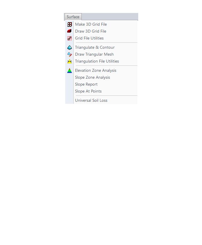
Watershed Menu
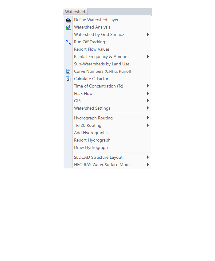
Structure Menu
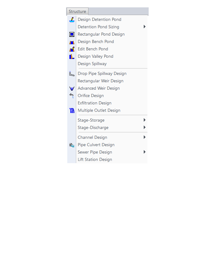
Network Menu
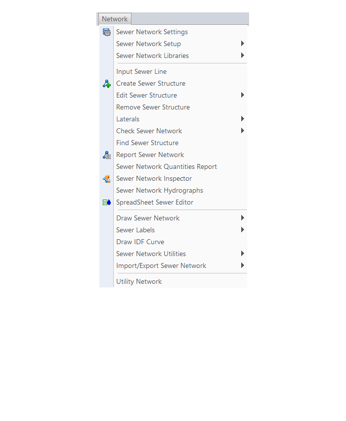
HydroCAD Menu
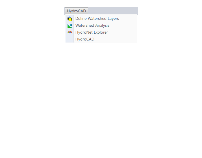
The menus below are in all non-OEM programs of Carlson 2017 desktop software
(Click image to see more)
Some content on this website was prepared with AI assistance. Please verify important information with the manufacturer or original source before making purchasing or financial decisions.
If you find the material on this website helpful, please consider supporting That CAD Girl by purchasing our products or services.
If you are interested in purchasing products or services we do not offer, we would love to refer you to one of our Trusted Partners. Please click here to send us a message with your request.
What features & menus are in Carlson Civil? (a running thread)
+Carlson Civil 2017

Features and Benefits of Civil 2017
- Utilize the very best Carlson software support tools for all your design build, site design & site grading, subdivision design & subdivision grading and road design & road grading needs,
- Perform tasks associated with civil BIM (Building Information Modeling),
- Use the Lot Network feature to create a dynamic subdivision design that takes into account road centerline and right of way, building setbacks, wetland or poor soils areas and inserts one or more building footprints onto each lot,
- Use vehicle path tracking to ensure adequate roadway clearance,
- Create, define, edit and draw centerline alignments using a variety of methods including best fit,
- Easily elevate 2d, zero-elevation polylines from points, text or text with a leader for detailed site grading,
- Label elevation, slope and other properties of polylines,
- Design a centerline and profile along a surface that maintains a maximum slope,
- Import surfaces from Civil 3d and Google Earth®,
- Create surface model files for existing and proposed conditions,
- Design and balance cut and fill for one or more building pads at a time,
- Edit the contours generated from a surface model and automatically update the underlying TIN file,
- Calculate earthwork volumes between two surfaces including building pads, stockpiles and borrow pits,
- Report storage volumes for bench and valley ponds that can be designed using various design criteria such as adding multiple interior benches and automatically removing the berm in cut conditions,
- Use the layer-based SiteNet commands to calculate and report volumes and/or quantities:
- Of an entire site or within a perimeter Polyline,
- Of cut & fill dirt; of topsoil removal & replacement; of materials such as asphalt, stone, concrete and curb; and of pipe and structure depth,
- That can be exported directly to Microsoft Excel®,
- Create cut & fill color maps or a grid of cut and fill labels,
- Create, define, edit and draw profiles using a variety of methods including best fit,
- Create, define, edit and draw cross sections using a variety of methods,
- Define, edit and draw typical cross sections to create a library of roadway templates that meet detailed design standards,
- Use the Road Network feature to dynamically design a network of highways or roads that automatically tie intersections together, allow detailed grading at each intersection and cul-de-sac and allow real-time volume determination as the road profile is adjusted,
- Design roads that that incorporate varying roadway widths, multiple templates, super elevation, topsoil removal & replacement, road rehabilitation including overlays after leveling or milling operations and more,
- Automatically elevate building pads and property lot lines using grading rules applied to a road design,
- Process Road Design for final sections, final contours and volumes,
- Pick a button to “Process” or have updates automatically occur when changes to centerlines or surfaces affect profiles, changes to profiles affect cross sections or changes to surfaces affect storm or sewer structures,
- Automatically generate a Carson software support plan and profile sheets in model or paper space where the plan and profile views can be shifted or rotated incrementally with the pick of a button,
- View your entities or surfaces in 3d or drive through them in a humvee, police car or school bus.
Menus in Civil 2017
Menu Bar in Civil 2017

The menus below are available in Carlson Civil 2017
3D Data Menu
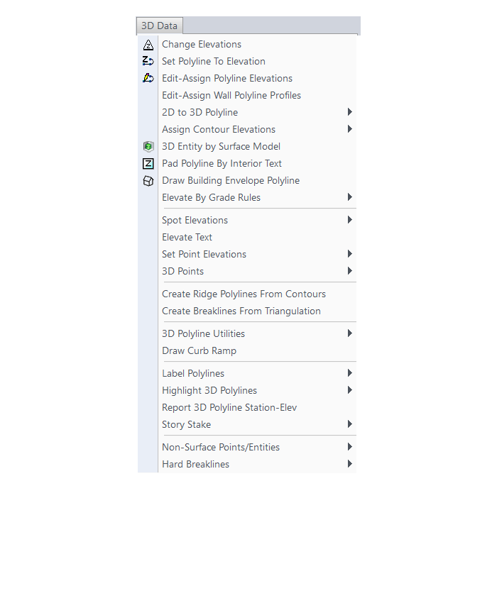
Surface Menu
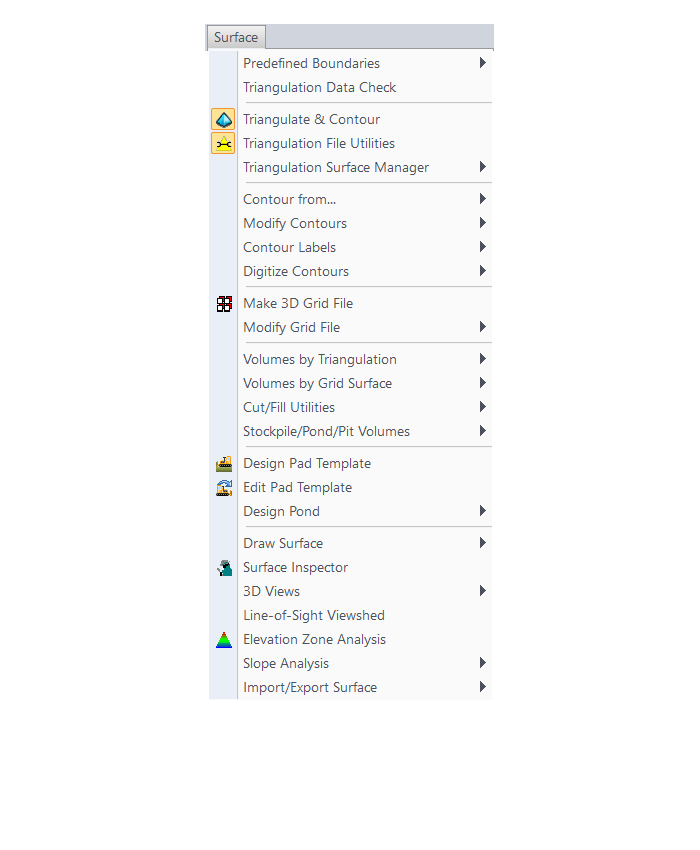
SiteNet Menu
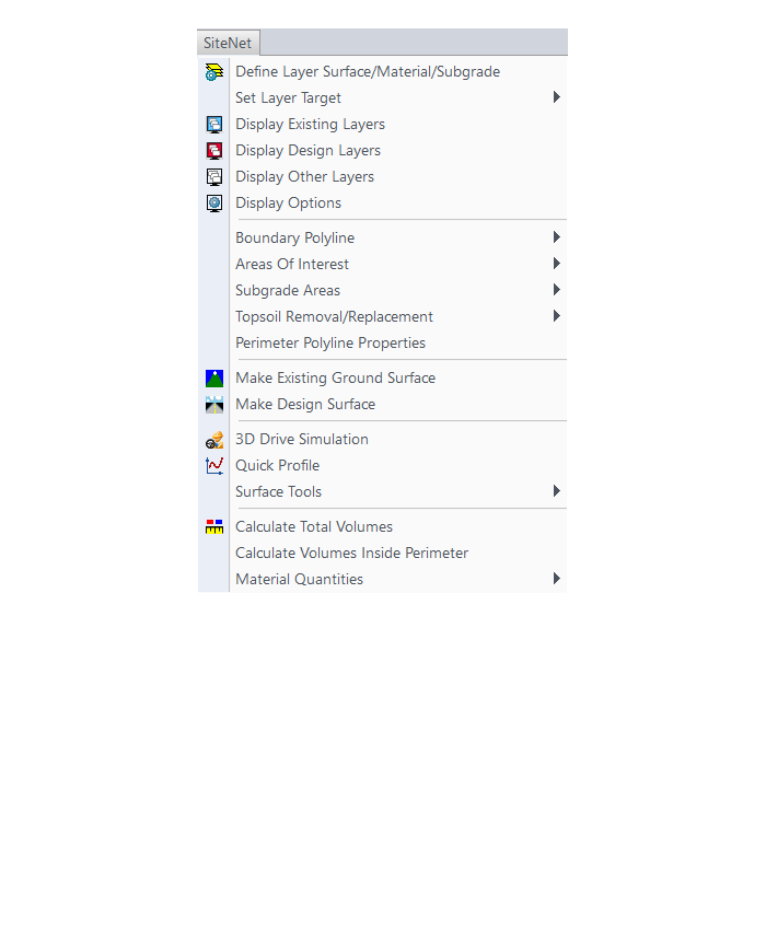
Centerline Menu
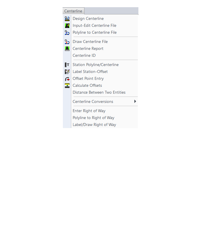
Profiles Menu
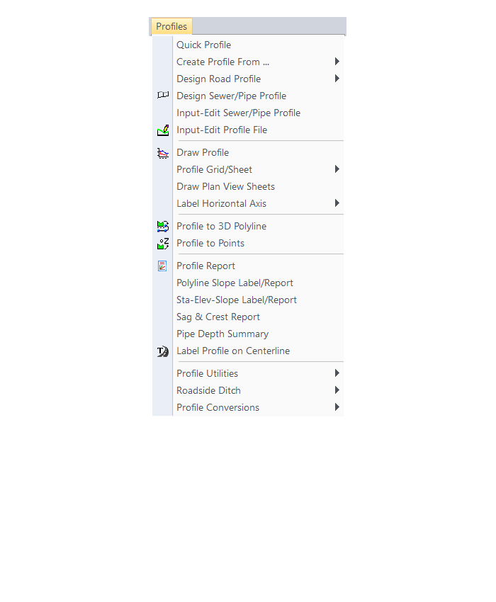
Sections Menu
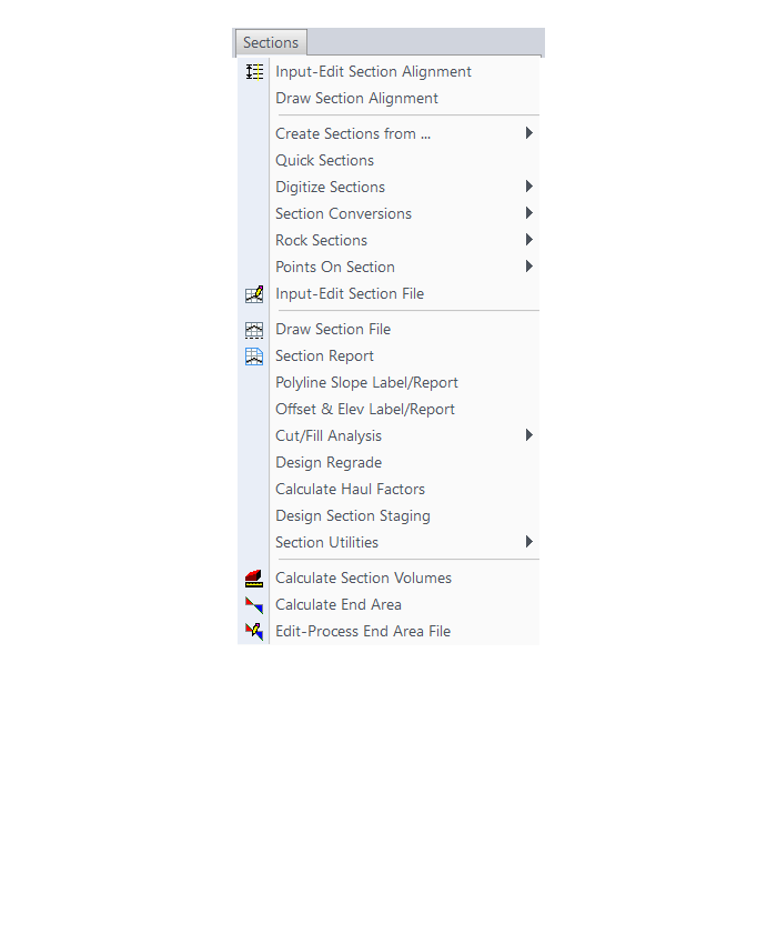
Roads Menu
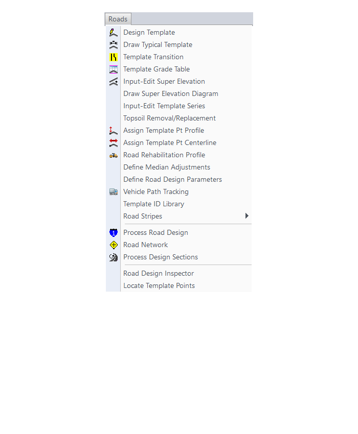
Area Layout Menu
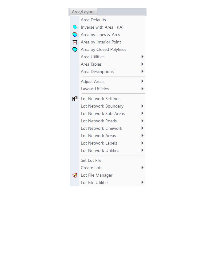
Annotate Menu
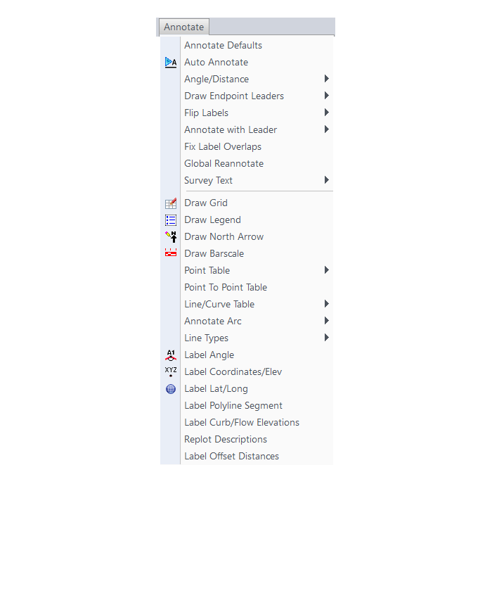
The menus below are in all non-OEM programs of Carlson 2017 desktop software
(Click image to see more)
Some content on this website was prepared with AI assistance. Please verify important information with the manufacturer or original source before making purchasing or financial decisions.
If you find the material on this website helpful, please consider supporting That CAD Girl by purchasing our products or services.
If you are interested in purchasing products or services we do not offer, we would love to refer you to one of our Trusted Partners. Please click here to send us a message with your request.
What features & menus are in Carlson Survey with embedded AutoCAD (OEM)? (a running thread)
+Survey 2017 with embedded AutoCAD (OEM)

Features and Benefits of Survey 2017 with embedded AutoCAD (OEM)
Carlson Survey is a comprehensive program containing all of the tools that a surveyor needs. Here are some of the things you can do with Carlson Survey:
- Access both the Carlson Survey and the full C & G menus,
- Utilize the very best software tools for all your site design & subdivision design needs,
- Enter deed descriptions and generate a variety of lot reports including fully customizable legal descriptions,
- Enter deed descriptions and correlate field located property corners with deed property corners to find the best fit orientation & alignment,
- Use the Deed Reader command to extract deed line and curve data from a text file (the text file can sometimes be generated using the OCR feature of scanning software),
- Use the Lot Network feature to create a dynamic subdivision design that takes into account road centerline and right of way, building setbacks, wetland or poor soils areas and inserts one or more building footprints onto each lot,
- Have full point CAD management capabilities including data collector download/upload, import/export points in text and most other formats including Civil 3d,
- Process raw data files using various methods including SurvNet Least Squares,
- Perform dozens of COGO functions,
- Use Field to Finish (F2F) to process automatic linework and description key/description code definitions,
- Utilize dozens of time-saving point stake out commands,
- Import surfaces from Civil 3d and Google Earth®,
- Create surface model files for existing and proposed conditions,
- Edit the contours generated from a surface model and automatically update the underlying TIN file,
- Design and balance cut and fill for one or more building pads at a time,
- Calculate earthwork volumes between two surfaces including building pads, stockpiles and borrow pits,
- Create, define, edit and draw centerline alignments using a variety of methods including best fit,
- Create, define, edit and draw profiles using a variety of methods,
- Automatically update stationing when centerlines change, profiles when centerlines or surfaces change, etc,
- Automatically generate plan and profile sheets in model or paper space,
- Import, edit and export GIS shape files,
- Import a variety of image files including MrSid and geo-referenced TIF and JPG files.
Menus in Survey 2017 with embedded AutoCAD (OEM)
Menu bar in Survey 2017 showing the compact version of the CG-Survey menu

The menus below are available in Carlson Survey 2017 with embedded AutoCAD (OEM)
File Menu
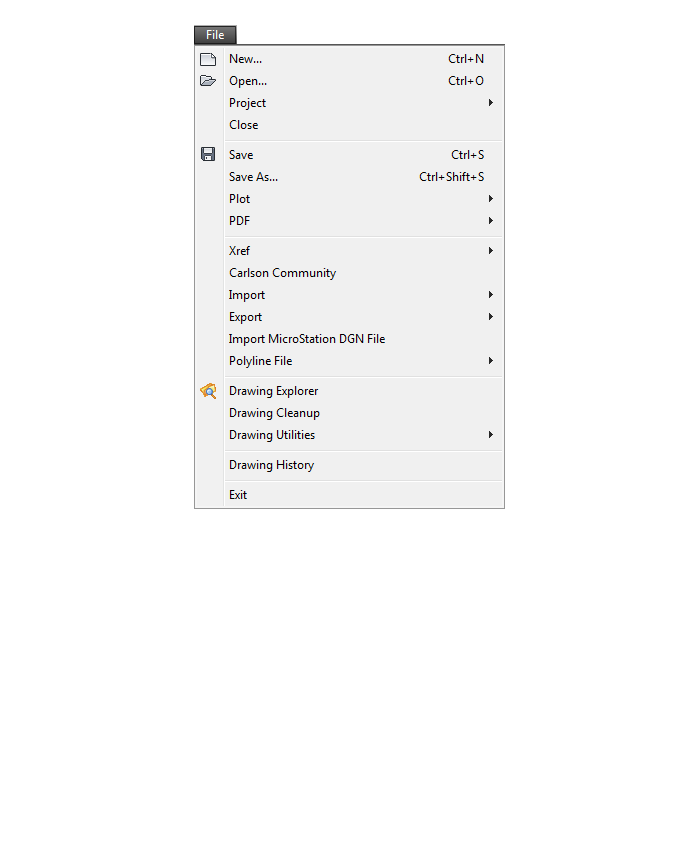
Edit Menu
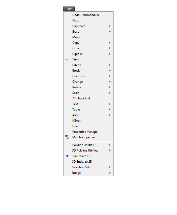
View Menu
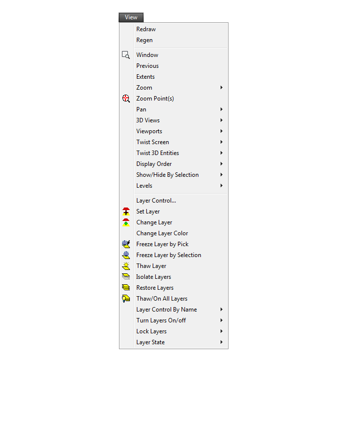
Draw Menu
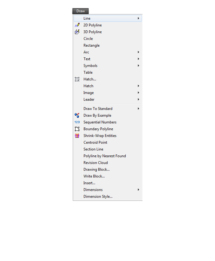
Inquiry Menu
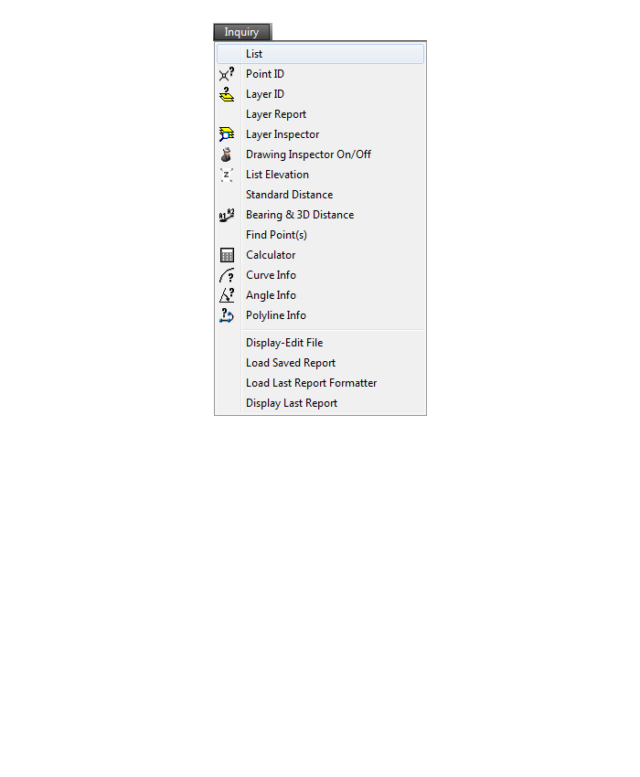
Settings Menu
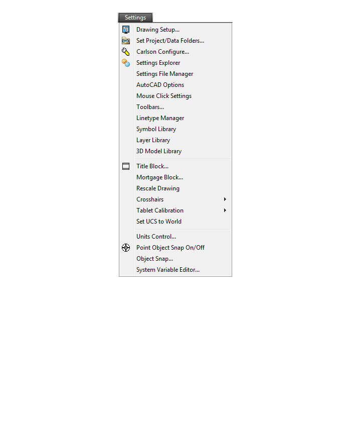
Points Menu
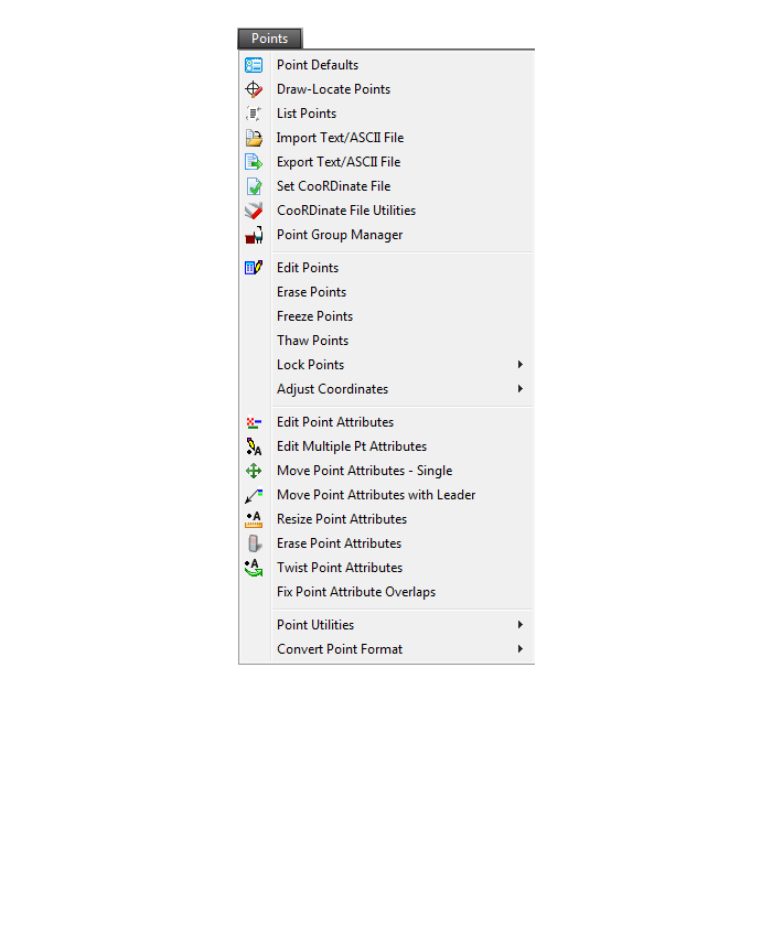
Survey Menu
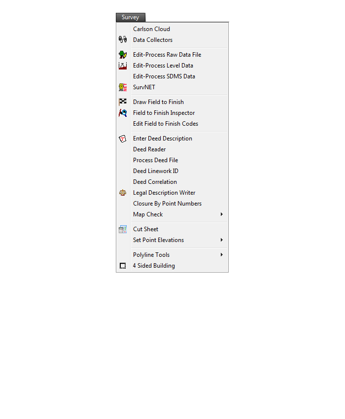
COGO Menu
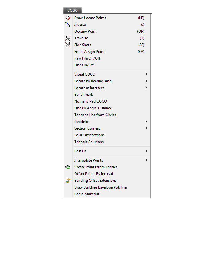
Centerline Menu
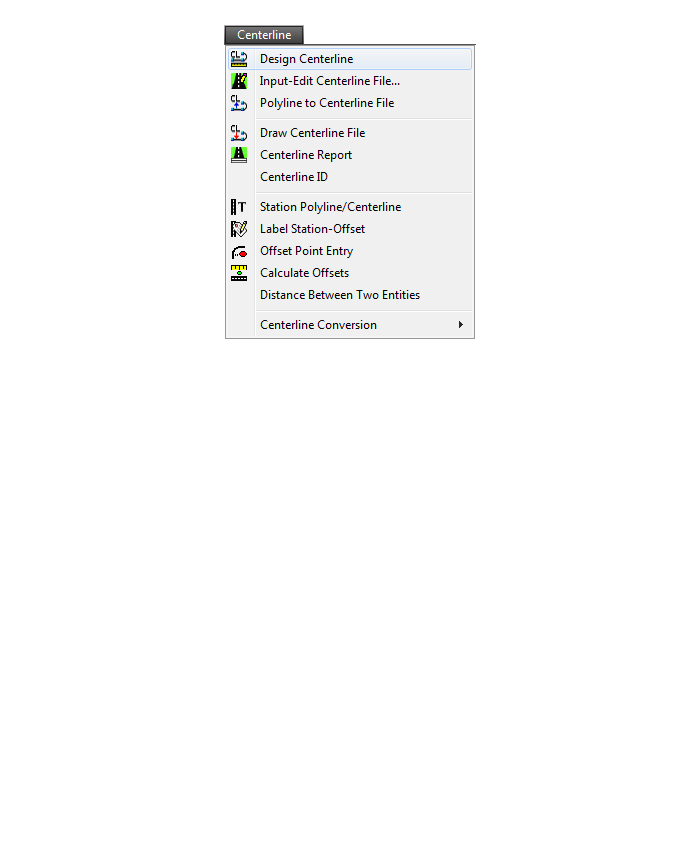
Area/Layout Menu
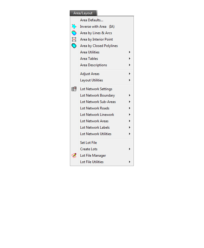
Annotate Menu
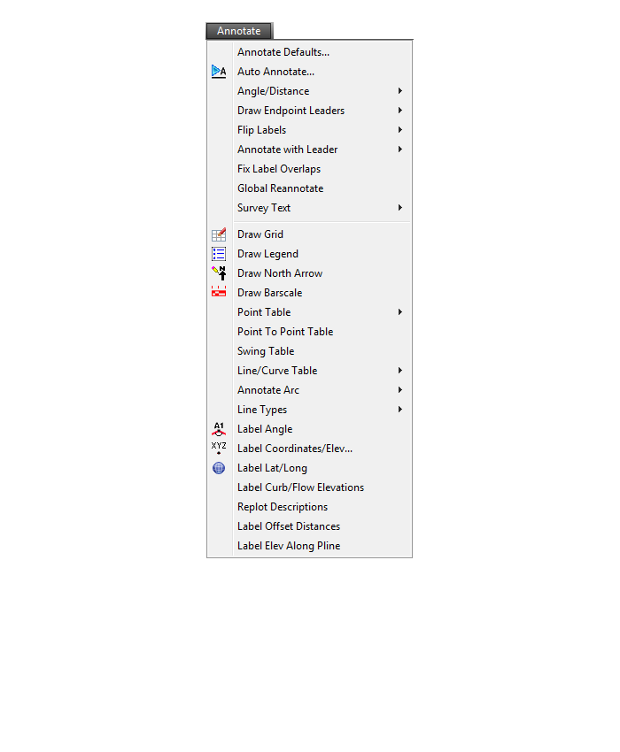
Surface Menu
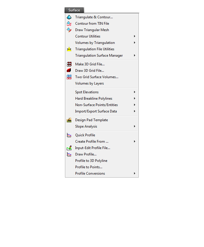
GIS Menu
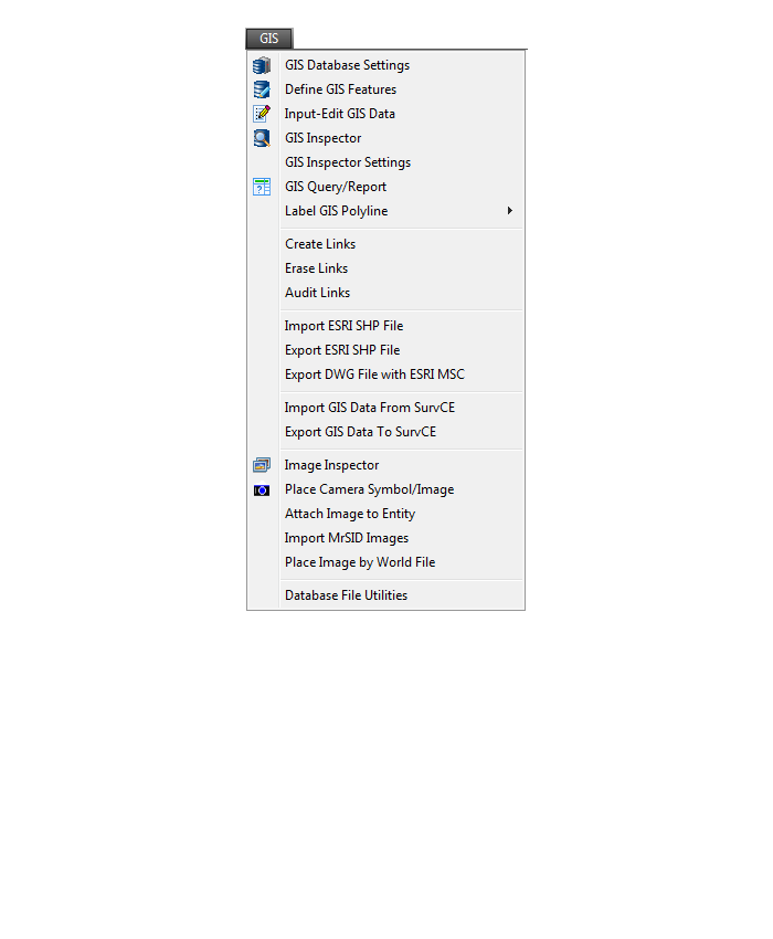
CG-Survey Menu
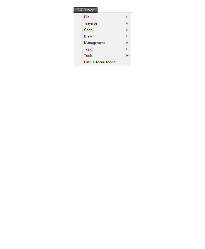
Window Menu
Help Menu
Menu bar in Survey 2017 showing the expanded version of the CG-Survey menu

The menus below are available when using the expanded version of the CG-Survey menu
CG File Menu
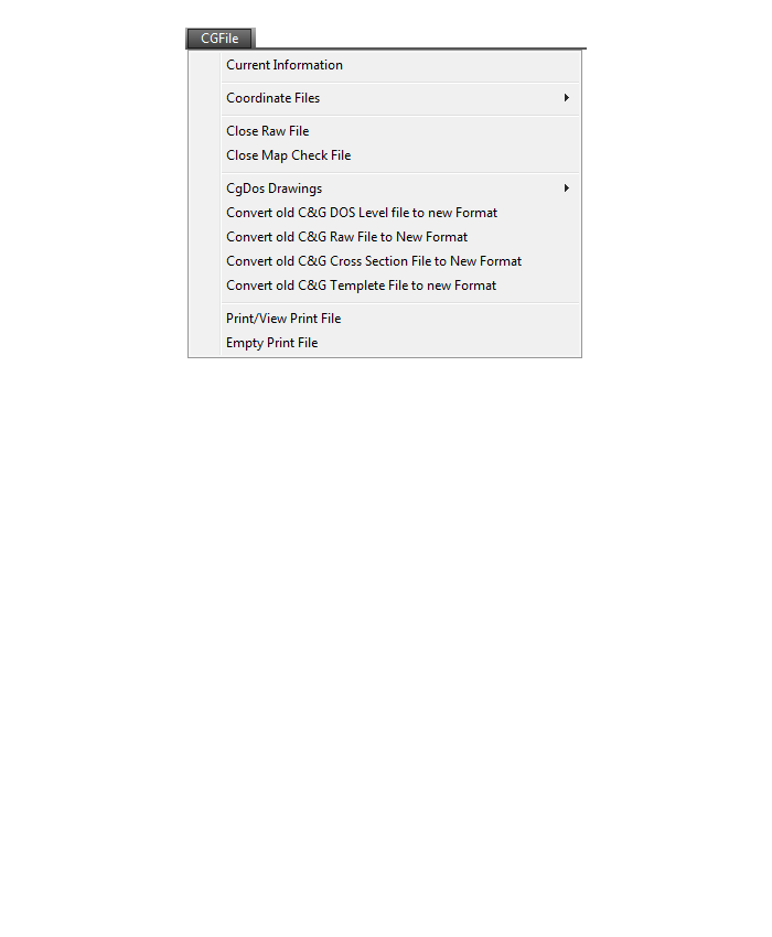
CG Trav Menu
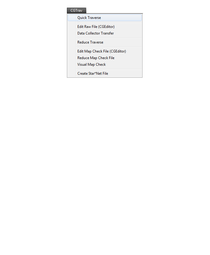
CG Cogo Menu
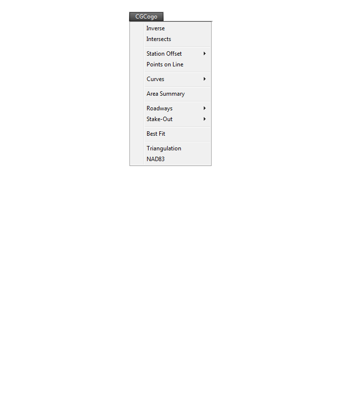
CG Draw Menu
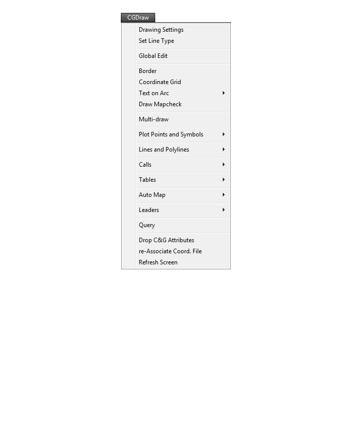
CG Mngmt Menu
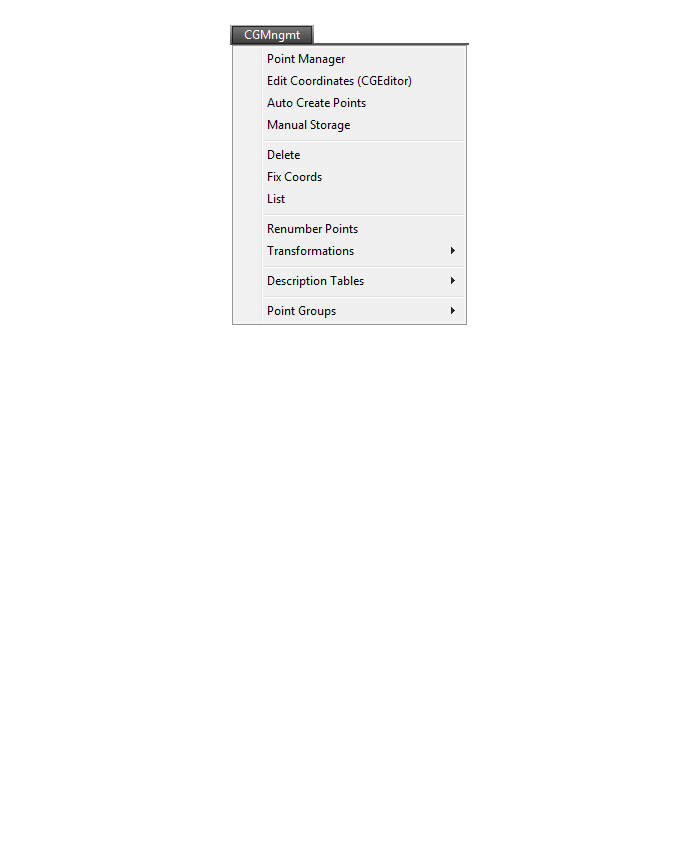
CG Topo Menu

CG Tools Menu
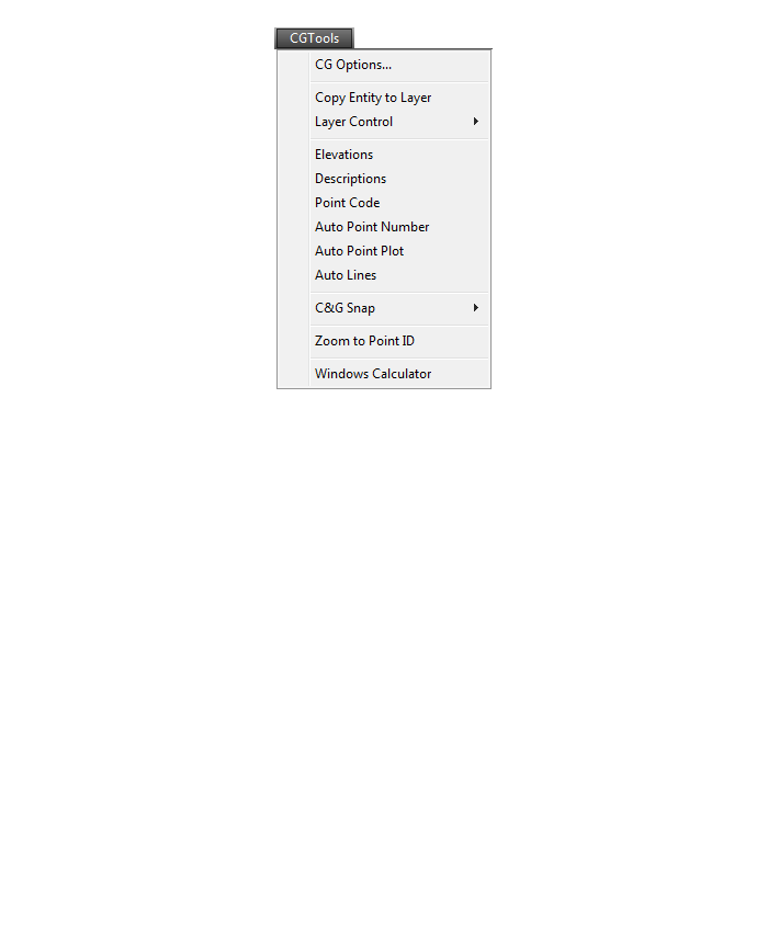
Some content on this website was prepared with AI assistance. Please verify important information with the manufacturer or original source before making purchasing or financial decisions.
If you find the material on this website helpful, please consider supporting That CAD Girl by purchasing our products or services.
If you are interested in purchasing products or services we do not offer, we would love to refer you to one of our Trusted Partners. Please click here to send us a message with your request.
What features & menus are in the non-OEM Carlson Survey program? (a running thread)
+Survey 2017 with IntelliCAD or for your AutoCAD

Features and Benefits of Survey 2017
Carlson Survey is a comprehensive, CAD software program containing all of the tools that a surveyor needs. Here are some of the things you can do with Carlson Survey:
- Access both the Carlson Survey and the full C & G menus,
- Utilize the very best software tools for all your site design & subdivision design needs,
- Enter deed descriptions and generate a variety of lot reports including fully customizable legal descriptions,
- Enter deed descriptions and correlate field located property corners with deed property corners to find the best fit orientation & alignment,
- Use the Deed Reader command to extract deed line and curve data from a text file (the text file can sometimes be generated using the OCR feature of scanning software),
- Use the Lot Network feature to create a dynamic subdivision design that takes into account road centerline and right of way, building setbacks, wetland or poor soils areas and inserts one or more building footprints onto each lot,
- Have full point management capabilities including data collector download/upload, import/export points in text and most other formats including Civil 3d,
- Process raw data files using various methods via CAD software including SurvNet Least Squares,
- Perform dozens of COGO functions,
- Use Field to Finish (F2F) to process automatic linework and description key/description code definitions,
- Utilize dozens of time-saving point stake out commands,
- Import surfaces from Civil 3d and Google Earth®,
- Create surface model files for existing and proposed conditions,
- Edit the contours generated from a surface model and automatically update the underlying TIN file,
- Design and balance cut and fill for one or more building pads at a time,
- Calculate earthwork volumes between two surfaces including building pads, stockpiles and borrow pits,
- Create, define, edit and draw centerline alignments using a variety of methods including best fit,
- Create, define, edit and draw profiles using a variety of methods,
- Automatically update stationing when centerlines change, profiles when centerlines or surfaces change, etc,
- Automatically generate plan and profile sheets in model or paper space,
- Import, edit and export GIS shape files,
- Import a variety of image files including MrSid and geo-referenced TIF and JPG files.
Menus in Survey 2017
Menu bar in Survey 2017 showing the compact version of the CG Survey menu

Survey Menu
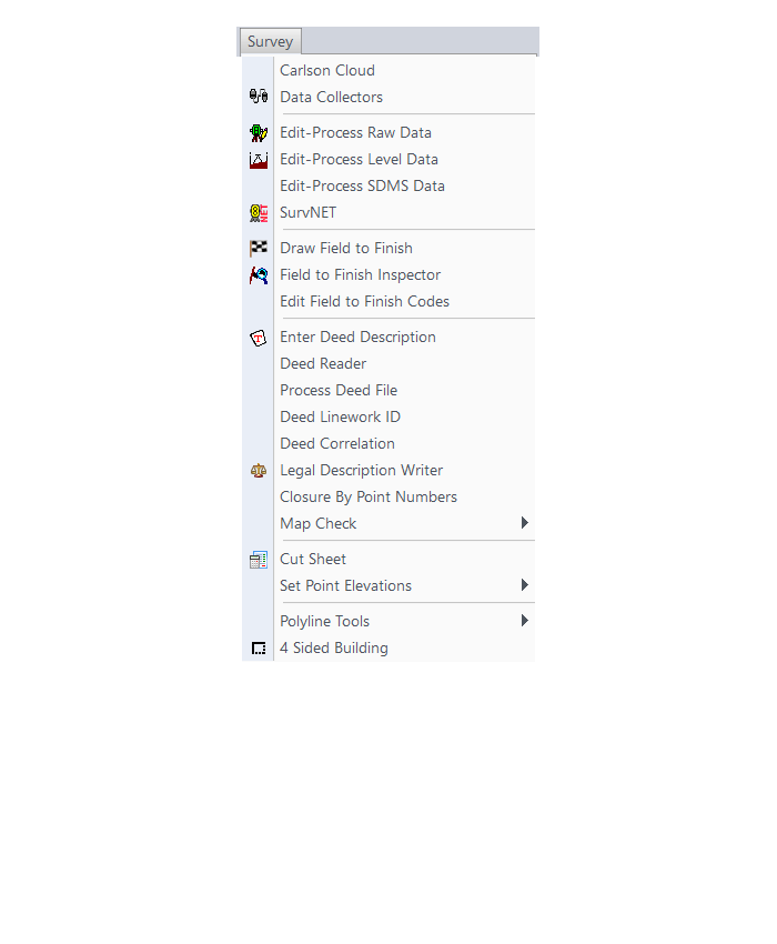
COGO Menu
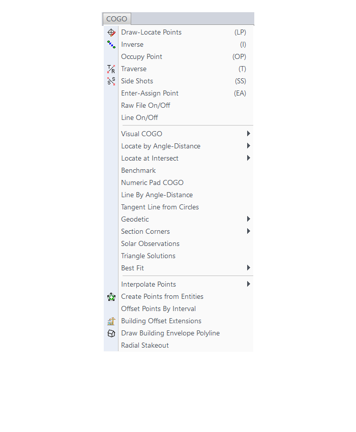
Centerline Menu
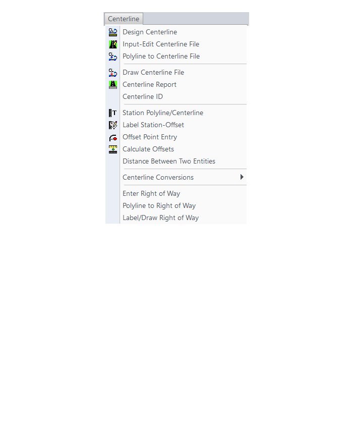
Area/Layout Menu
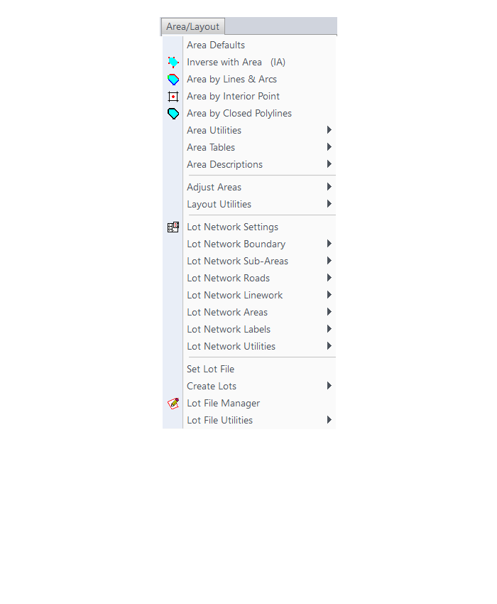
Annotate Menu
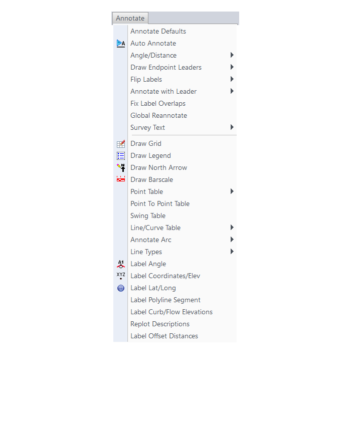
Surface Menu
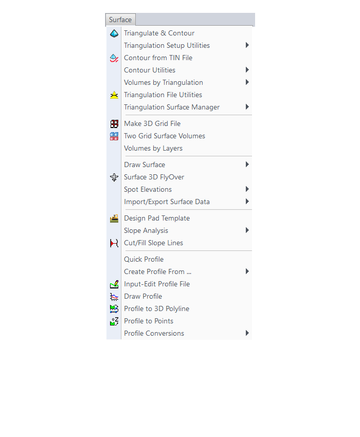
GIS Menu
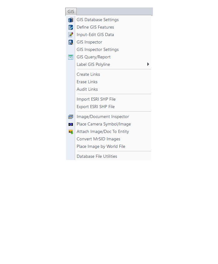
CG-Survey Menu
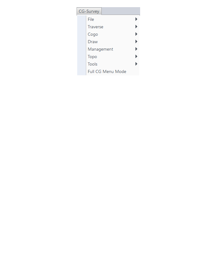
Menu bar in Survey 2017 showing the expanded version of the CG-Survey menu

The menus below are available when using the expanded version of the CG-Survey menu
CG File Menu
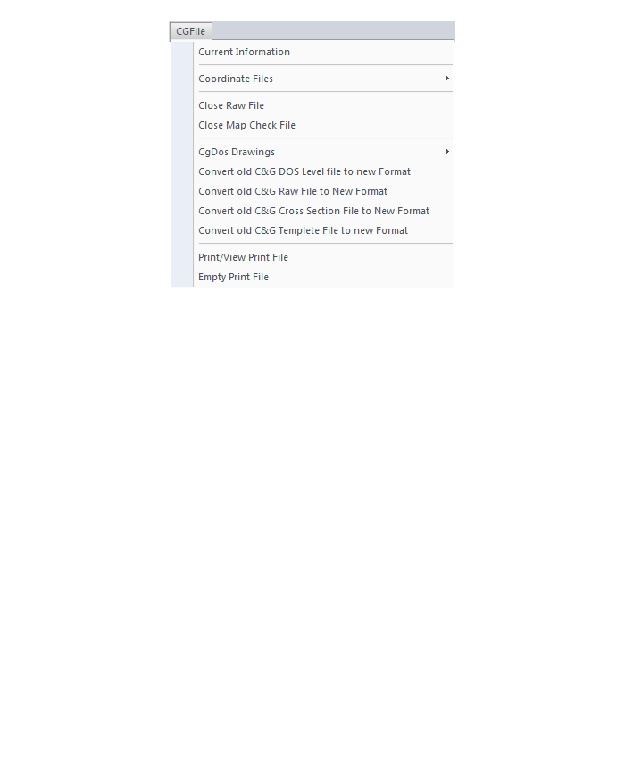
CG Trav Menu
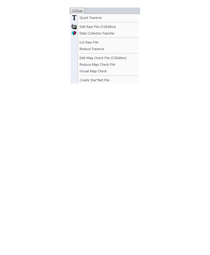
CG Cogo Menu
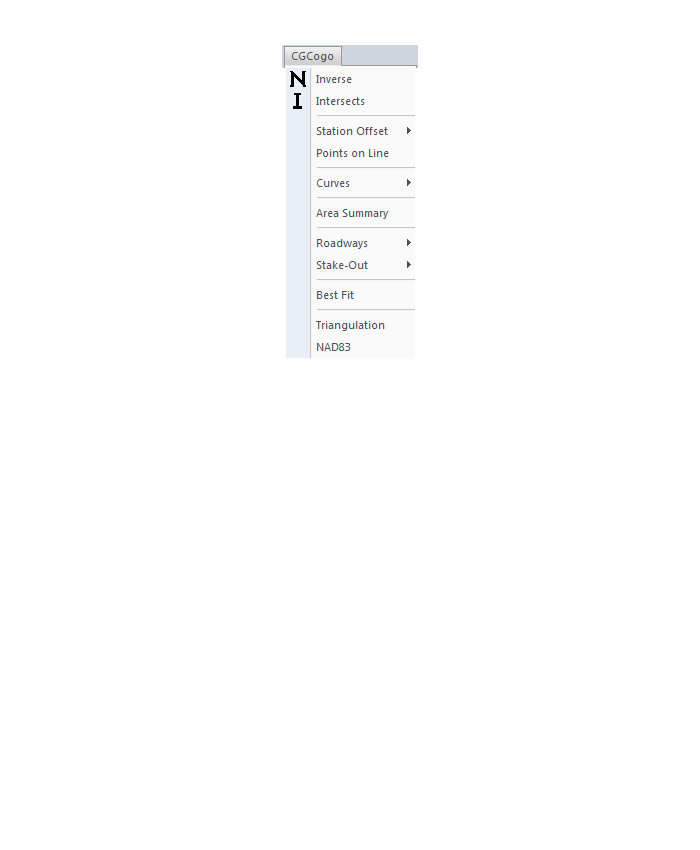
CG Draw Menu
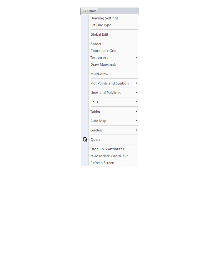
CG Mngmt Menu
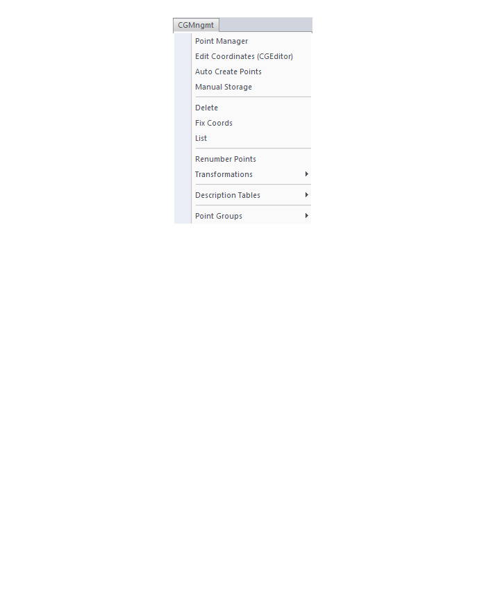
CG Topo Menu

CG Tools Menu
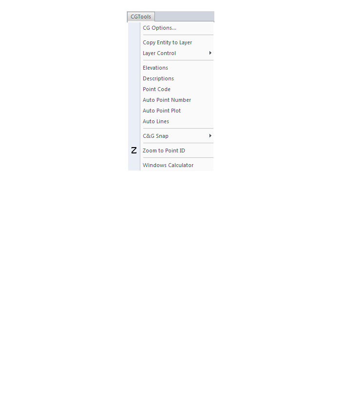
The menus below are in all non-OEM programs of Carlson 2017 desktop software
(Click image to see more)
Some content on this website was prepared with AI assistance. Please verify important information with the manufacturer or original source before making purchasing or financial decisions.
If you find the material on this website helpful, please consider supporting That CAD Girl by purchasing our products or services.
If you are interested in purchasing products or services we do not offer, we would love to refer you to one of our Trusted Partners. Please click here to send us a message with your request.
What features & menus are in ALL Carlson, non-OEM, desktop software programs? (a running thread)
+Carlson 2017
Features and Benefits of all Carlson desktop programs
- Work natively in DWG format files – whether using the IntelliCAD or AutoCAD platform,
- Import DGN, DXF, DWF files,
- Import and Export LandXML/RoadXML files,
- Export Google Earth KML/KMZ files,
- Export files to be used in GPS guided machine control systems,
- Export DTM, Google, Idan, Microstation, MOSS, Peabody, Topcon, and 12D polyline files
- Customize project folders and sub-folders to organize your project data,
- Incorporate your own CAD Standards Tools into basic drafting functions,
Import, export and convert points using text or most any other format including Civil 3d, - Access to the entirety of the Carlson software File, Edit, View, Draw, Inquiry, Settings, Points and 3D Solids menus including these popular commands:
- Drawing cleanup
- 2d and 3d polyline editing commands to reverse polylines, add/remove segments or vertices, etc.
- Shrinkwrap entities
- Boundary polyline
- Erase and Copy by layer
- 3d Viewer Window
- Surface 3d Viewer
- Search Published Control – an Esri-powered command
Menus in all non-OEM Carlson desktop programs
File Menu
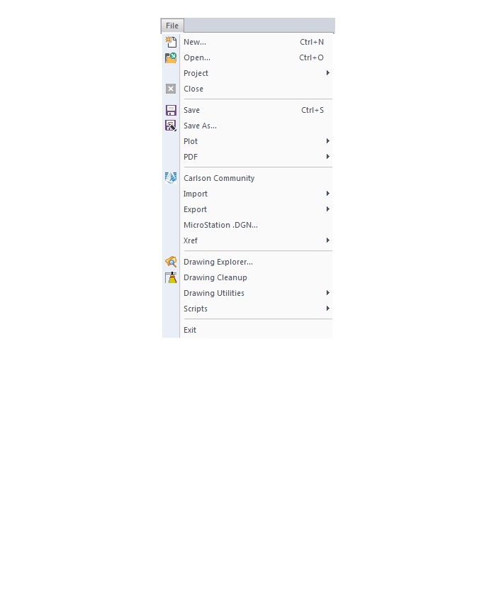
Edit Menu
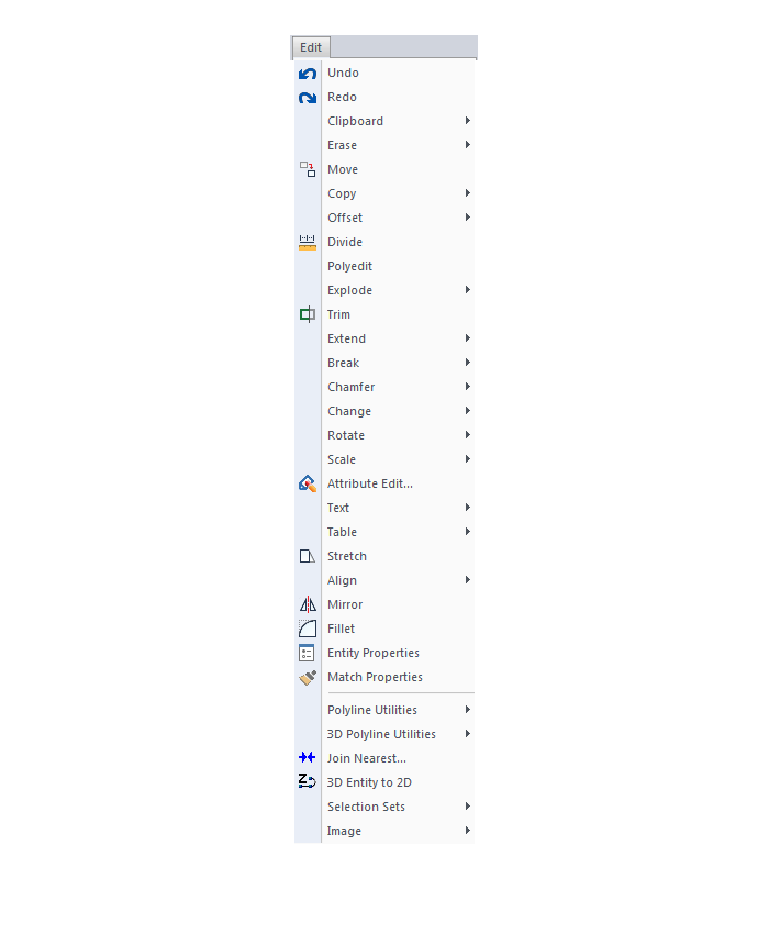
View Menu
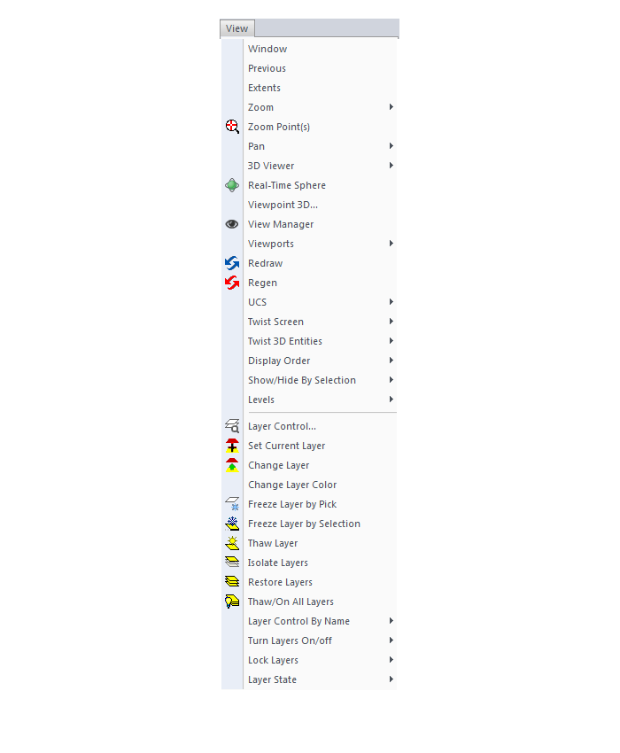
Draw Menu
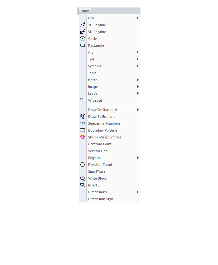
Inquiry Menu
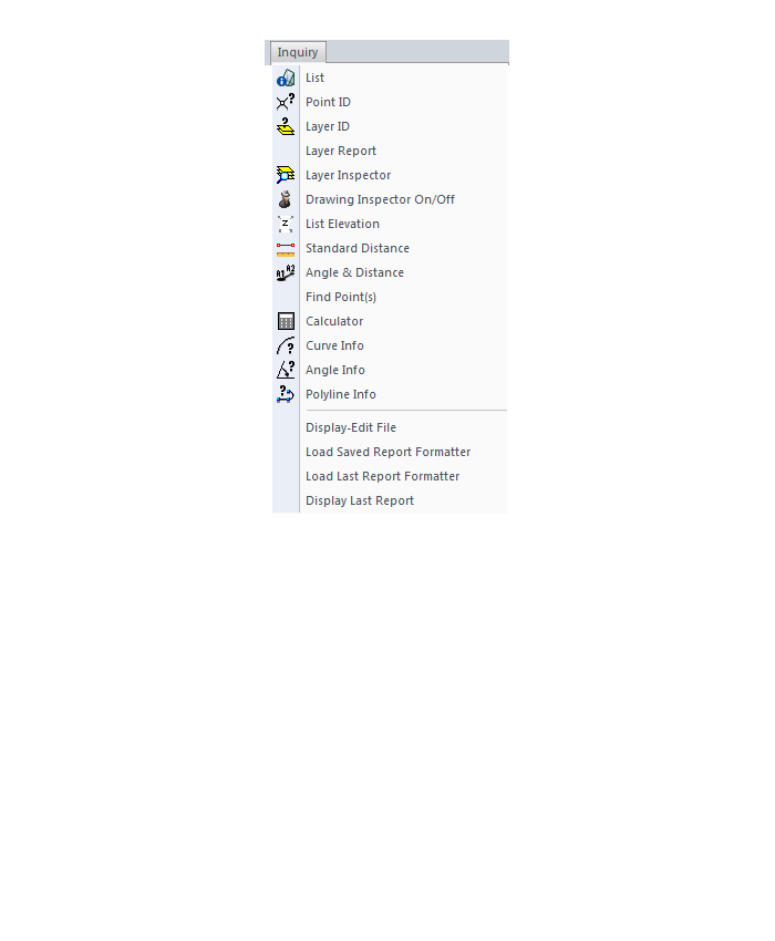
Settings Menu
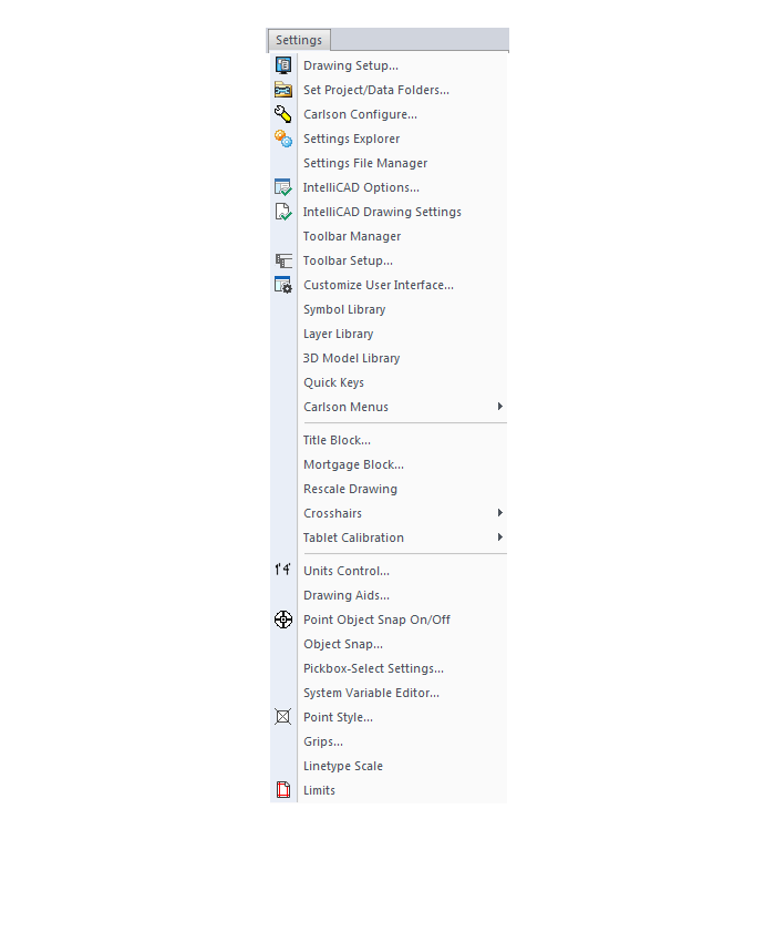
Points Menu
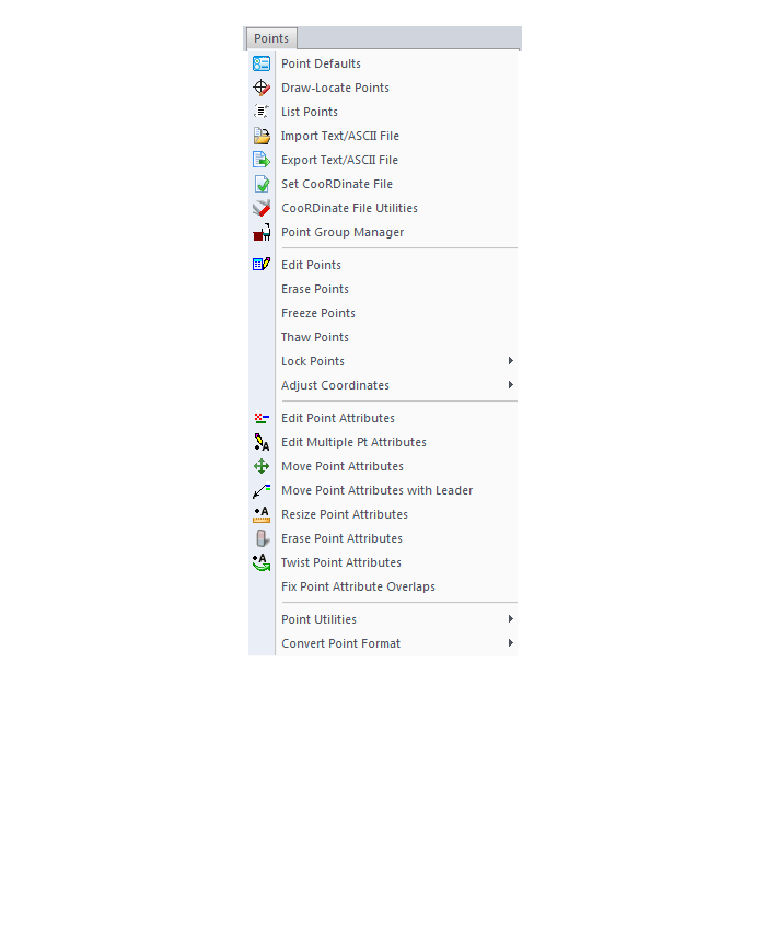
3D Solids Menu
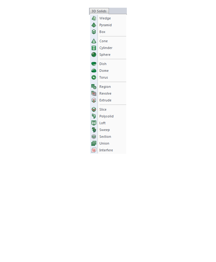
Window Menu
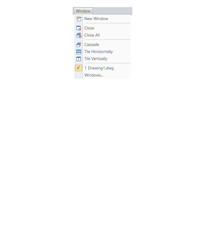
Help Menu
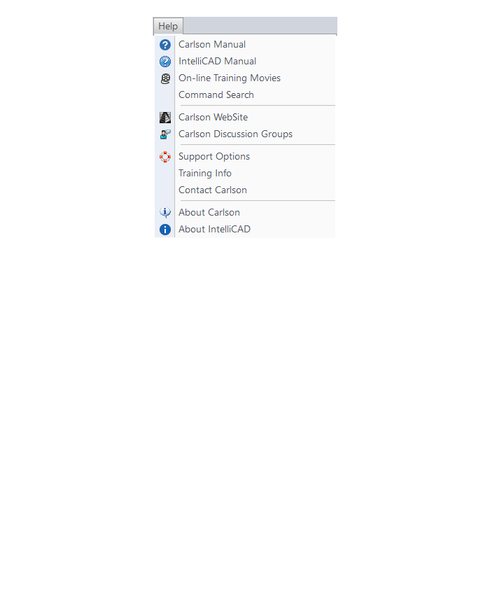
Some content on this website was prepared with AI assistance. Please verify important information with the manufacturer or original source before making purchasing or financial decisions.
If you find the material on this website helpful, please consider supporting That CAD Girl by purchasing our products or services.
If you are interested in purchasing products or services we do not offer, we would love to refer you to one of our Trusted Partners. Please click here to send us a message with your request.
Is embedded AutoCAD (OEM) more like AutoCAD or AutoCAD LT?
+
Some content on this website was prepared with AI assistance. Please verify important information with the manufacturer or original source before making purchasing or financial decisions.
If you find the material on this website helpful, please consider supporting That CAD Girl by purchasing our products or services.
If you are interested in purchasing products or services we do not offer, we would love to refer you to one of our Trusted Partners. Please click here to send us a message with your request.
Does Carlson run on a Mac?
+
Some content on this website was prepared with AI assistance. Please verify important information with the manufacturer or original source before making purchasing or financial decisions.
If you find the material on this website helpful, please consider supporting That CAD Girl by purchasing our products or services.
If you are interested in purchasing products or services we do not offer, we would love to refer you to one of our Trusted Partners. Please click here to send us a message with your request.
What versions of AutoCAD & IntelliCAD & Windows does Carlson run on top of? Does it run on AutoCAD LT? (a running thread)
+
Carlson Desktop Software with IntelliCAD or for Your AutoCAD
Carlson can be installed on top of any full-AutoCAD-based program such as AutoCAD, AutoCAD Map, Land Desktop or Civil 3d.
Carlson cannot be installed on top of any version AutoCAD LT.
| Carlson Version | AutoCAD & IntelliCAD Platforms | Windows Platforms |
|---|---|---|
| 2024 | AutoCAD 2018-2024, IntelliCAD 10.1a and 11.1 | 64 bit Windows |
| 2023 | AutoCAD 2018-2023, IntelliCAD 10.1a and 11.0 | 64 bit Windows |
| 2022 | AutoCAD 2017-2022, IntelliCAD 10.0a and 10.1a | 64 bit Windows 10 |
| 2021 | AutoCAD 2017-2021, Intellicad 10.0a | 64 bit Windows 10 |
| 2020 | AutoCAD 2015-2020, IntelliCAD 9.2 | 64 bit Windows 10 |
| 2019 | AutoCAD 2010-2019, IntelliCAD 9 | 32 or 64 bit Windows Vista, 7, 8, 8.1, and 10 |
| 2018 | AutoCAD 2010-2018, IntelliCAD 8.2 | 32 or 64 bit Windows Vista, 7, 8, 8.1, and 10 |
| 2017 | AutoCAD 2010-2017, IntelliCAD 8.2 | 32 or 64 bit Windows Vista, 7, 8, 8.1, and 10 |
| 2016 | AutoCAD 2007-2016, IntelliCAD 8.1 | 32 or 64 bit Windows Vista, 7, 8, 8.1, and 10 |
| 2015 | AutoCAD 2007-2015, IntelliCAD 8.0 | XP, 32 or 64 bit Windows Vista, 7, 8 and 8.1 |
| 2014 | AutoCAD 2004-2014, IntelliCAD 7.2 | XP, 32 or 64 bit Windows Vista, 7, 8 and 8.1 |
Carlson Desktop Software with Embedded AutoCAD (OEM)
| Carlson Version | Embedded AutoCAD Engine | Windows Platforms |
|---|---|---|
| Survey 2024 | 20222 | 64 bit Windows |
| Survey 2023 | 2022 | 64 bit Windows |
| Survey 2022/Takeoff R12 | 2022 | 64 bit Windows |
| Survey 2021 | 2018 | 64 bit Windows |
| Survey 2020 | 2018 | 64 bit Windows |
| Survey 2019/Takeoff R11 | 2018 | 64 bit Windows |
| Survey 2018/Takeoff R10 | 2018 | Windows 7, 8, 8.1, and 10 |
| Survey 2017/Takeoff R9 | 2013 | Windows XP, 7, 8, 8.1, and 10 |
| Survey 2016 | 2013 | Windows XP, 7, 8, 8.1, and 10 |
| Survey 2015/Takeoff R8 | 2013 | Windows XP, 7, 8, 8.1, and 10 |
| Survey 2014/Takeoff R7 | 2013 | Windows XP, 7, 8, 8.1, and 10 |
Some content on this website was prepared with AI assistance. Please verify important information with the manufacturer or original source before making purchasing or financial decisions.
If you find the material on this website helpful, please consider supporting That CAD Girl by purchasing our products or services.
If you are interested in purchasing products or services we do not offer, we would love to refer you to one of our Trusted Partners. Please click here to send us a message with your request.
That CAD Girl’s top reasons to purchase Carlson Software
+Click here to watch our Carlson Software: All Substance, No Styles webinar
for an overview of the program
1
You have options as to the platform: embedded AutoCAD (OEM), on top of full-AutoCAD or IntelliCAD
2
Carlson has Free Technical Support regardless of whether your software is 1 year or 10 years old or even if you’re still trying it out before buying.
3
Carlson gives you the ability to design dynamically but does it with basic CAD entities such as lines, polylines, text and blocks which makes it easy to share drawings with others.
No more proxy entities or AECC Objects to fight with!
4
Carlson doesn’t retire their products and never forces you to upgrade. Their annual maintenance is optional.
5
Carlson Plays Well With Others: Their goal is to have their software be compatible with as many other software and hardware manufacturers as possible. There is a seemingly endless list of “Import from…” and “Export to…” commands in the software.
6
Carlson gives you the tools you need.
The first 7 or 8 menus in all programs are identical and have all the basic tools you need to be more productive. Here are just some of the things you can do in every program:
| Work natively in DWG files and import/export DGN, DXF & DWF |
| Import and Export LandXML/RoadXML/Google Earth files |
| Full management and editing of point data including point groups and edit tracking |
| Esri-powered Search Published Control feature |
| Export files for many GPS-guided machine control systems |
| Customize project folders & sub-folders to organize project data |
| Drawing Cleanup |
| Join Nearest |
| Drawing Inspector |
| Layer Inspector |
| Shrinkwrap Entities |
| Twist Screen |
| 2D and 3D Polyline utilities such as reverse polyline, add/remove segments, add/remove vertices, daylight polyline to surface, etc |
| Layer Tools such as Erase and Copy by layer, Isolate, Restore |
| 3D Viewer Window |
| Surface 3D Viewer |
Some content on this website was prepared with AI assistance. Please verify important information with the manufacturer or original source before making purchasing or financial decisions.
If you find the material on this website helpful, please consider supporting That CAD Girl by purchasing our products or services.
If you are interested in purchasing products or services we do not offer, we would love to refer you to one of our Trusted Partners. Please click here to send us a message with your request.
Compared to AutoCAD or IntelliCAD, what would I miss in the embedded AutoCAD (OEM) versions of Survey & Takeoff? (a running thread)
+Some AutoCAD commands, such as the Layer Tools that used to be in Express Tools and are now in the Layers II toolbar of AutoCAD, have been built into the Carlson menus. So even though you may not find the Layers II toolbar you can still freeze and isolate layers by picking entities on the screen.
I’ll keep this post as a running thread and will add to it as I come across functions or features you may miss.
- In OEM – Can’t load LSP files (verified in 2016). This is possible in AutoCAD and IntelliCAD.
- In OEM – Can’t change command aliases (acad.pgp) or Carlson QuickKeys (verified in 2016) – although you may find a workaround in this Carlson KB Article:Bits and Pieces. This is possible in AutoCAD and IntelliCAD.
- In OEM – The command REGEN is available but REGENALL is not (verified in 2016). This is possible in AutoCAD and IntelliCAD.
- In OEM – Carlson Startup Settings (aka Launch Options) such as setting a default template (.dwt) file are not available in the OEM (verified in 2016). This is possible in AutoCAD and IntelliCAD.
- In OEM and IntelliCAD – Express Tools aren’t available. However, you can use Carlson’s Layer Tools and Layer Toolbar as a workaround to replace the Express Tools Layers commands and the Layers II toolbar.
Some content on this website was prepared with AI assistance. Please verify important information with the manufacturer or original source before making purchasing or financial decisions.
If you find the material on this website helpful, please consider supporting That CAD Girl by purchasing our products or services.
If you are interested in purchasing products or services we do not offer, we would love to refer you to one of our Trusted Partners. Please click here to send us a message with your request.
If I buy Carlson, should I go with the embedded AutoCAD (OEM)? Or with IntelliCAD? or just buy AutoCAD?
+
Some content on this website was prepared with AI assistance. Please verify important information with the manufacturer or original source before making purchasing or financial decisions.
If you find the material on this website helpful, please consider supporting That CAD Girl by purchasing our products or services.
If you are interested in purchasing products or services we do not offer, we would love to refer you to one of our Trusted Partners. Please click here to send us a message with your request.
I can’t seem to keep up with my Carlson maintenance – Can you help?
+Carlson generates and sends renewal notices automatically but they are only sent to you and the Carlson reseller located nearest to you geographically. However, you are free to purchase new licenses, upgrades or maintenance directly from Carlson or any Authorized Reseller.
If you’ve recently received a Maintenance Renewal or OEM Upgrade notice from Carlson Software, you can forward that report to your Dealer of Choice and ask for them to provide a custom proposal.
Some content on this website was prepared with AI assistance. Please verify important information with the manufacturer or original source before making purchasing or financial decisions.
If you find the material on this website helpful, please consider supporting That CAD Girl by purchasing our products or services.
If you are interested in purchasing products or services we do not offer, we would love to refer you to one of our Trusted Partners. Please click here to send us a message with your request.
Does Carlson have student or academic licenses?
+Carlson Software provides unlimited desktop licensing to qualified colleges and universities around the world.
Some content on this website was prepared with AI assistance. Please verify important information with the manufacturer or original source before making purchasing or financial decisions.
If you find the material on this website helpful, please consider supporting That CAD Girl by purchasing our products or services.
If you are interested in purchasing products or services we do not offer, we would love to refer you to one of our Trusted Partners. Please click here to send us a message with your request.
Is it better to network Carlson than use standalone licenses?
+The only time I’d recommend networking individual licenses such as Survey, Survey OEM, Civil, etc. is if you have 2 or more people who can literally share a license. For instance, if you have a technician who works in one office or on one computer from 8-12 and another who works in a different office or computer from 1-5 then, yes, network away!
Using this example, only one license will ever be in use at any one time so you would only need to buy one networked license that can be shared on multiple computers.
Networking one or more licenses of individual seats can also be beneficial if you have several people using the software part-time. Maybe you buy 3 licenses for 4 to share because only 3 people will ever be using it at the same time.
All that being said, networking one of Carlson’s Suites (Civil or Takeoff) can potentially save a lot of money. Civil Suite includes 4 programs: Survey, Civil, Hydrology and GIS. Takeoff Suite includes 4 as well: Construction, CADNet, GeoTech and Trench. If you network either of the Suites, each of those programs acts like an individual license. Sweet Suite!
So, if you buy one standalone license of Civil Suite, that license is registered to one user who can access any of the 4 programs at will. But, if you network that Civil Suite, you can have one person working in Survey at the same time someone else is working in Civil, while a 3rd person is working in Hydrology and a 4th is in GIS.
Even though this sounds like a great way to save money, you should also be aware that sharing licenses can also become a headache to your staff and lead to some loss in productivity. It’s like anything else, networking the Suites has its pros and cons.
You may also want to refer to this updated FAQ: Working with Carlson’s network license manager for more information.
Some content on this website was prepared with AI assistance. Please verify important information with the manufacturer or original source before making purchasing or financial decisions.
If you find the material on this website helpful, please consider supporting That CAD Girl by purchasing our products or services.
If you are interested in purchasing products or services we do not offer, we would love to refer you to one of our Trusted Partners. Please click here to send us a message with your request.
If I use Carlson Survey in the office, do I have to use SurvCE on my data collector?
+
Carlson Survey allows you to import, export and convert points and raw data from dozens of different formats and from a wide variety of manufacturers. Carlson Software, as a company, does everything within their power to make their software and hardware compatible with as many other manufacturers’ products as possible. Carlson wants their users to have the option of mixing and matching their software and equipment in a way that works best for their individual needs.
Here are just two examples of many throughout the program allowing you to import, export or convert external data.
The Convert Point Format menu:
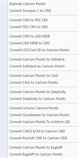
The Import Raw File menu:
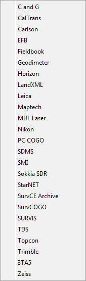
Some content on this website was prepared with AI assistance. Please verify important information with the manufacturer or original source before making purchasing or financial decisions.
If you find the material on this website helpful, please consider supporting That CAD Girl by purchasing our products or services.
If you are interested in purchasing products or services we do not offer, we would love to refer you to one of our Trusted Partners. Please click here to send us a message with your request.
What data collectors, GPS and total stations can I run with my Carlson SurvCE or SurvPC?
+
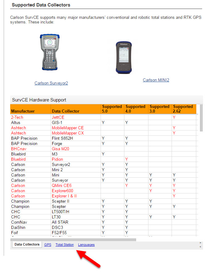
Some content on this website was prepared with AI assistance. Please verify important information with the manufacturer or original source before making purchasing or financial decisions.
If you find the material on this website helpful, please consider supporting That CAD Girl by purchasing our products or services.
If you are interested in purchasing products or services we do not offer, we would love to refer you to one of our Trusted Partners. Please click here to send us a message with your request.
What are the system requirements to run Carlson Software in the office? Do I need a monster computer?
+
But, Carlson’s core product and IntelliCAD can run on pretty light-duty machines.
The minimum system requirements for running Carlson with embedded AutoCAD (OEM), on top of AutoCAD and with IntelliCAD are posted here.
Updated for 2020: Carlson 2020 software will no longer run on 32 bit machines.
Note: If you are using an Nvidia video card, you will want to make sure you get the driver and updates directly from Nvidia.com and not just let Windows search for updates.
See also: Carlson KB1123: Changing graphics card settings to use your dedicated GPU on a Windows computer
See also: Carlson KB1131: NVidia video card: visual artifacts, pixelized lines, wrong text display
Some content on this website was prepared with AI assistance. Please verify important information with the manufacturer or original source before making purchasing or financial decisions.
If you find the material on this website helpful, please consider supporting That CAD Girl by purchasing our products or services.
If you are interested in purchasing products or services we do not offer, we would love to refer you to one of our Trusted Partners. Please click here to send us a message with your request.
Is IntelliCAD more like AutoCAD or AutoCAD LT?
+Now, you also shouldn’t expect IntelliCAD to be the equivalent of today’s AutoCAD. IntelliCAD is a generic version of AutoCAD and will have the feel of an older “model” of AutoCAD and be missing some of the bells and whistles included in newer releases of AutoCAD.
But, it’s more customizable, supports LISP routines and 3D drafting.
Follow these links to see my FAQs that explain the differences between AutoCAD, Carlson’s IntelliCAD and the embedded AutoCAD (OEM) platforms.
You may also want to read this Software Review: AutoCAD and IntelliCAD that I wrote for Professional Surveyor Magazine several years ago.
Some content on this website was prepared with AI assistance. Please verify important information with the manufacturer or original source before making purchasing or financial decisions.
If you find the material on this website helpful, please consider supporting That CAD Girl by purchasing our products or services.
If you are interested in purchasing products or services we do not offer, we would love to refer you to one of our Trusted Partners. Please click here to send us a message with your request.
What’s the difference between Carlson with IntelliCAD and with the embedded AutoCAD (OEM) platform?
+Whether you’re using Carlson Survey or Takeoff on the IntelliCAD or embedded AutoCAD (OEM) platform, the Survey and Takeoff functionality will be identical. Any differences are going to be strictly limited to the underlying engine – IntelliCAD or embedded AutoCAD.
- From a feature and functionality standpoint, IntelliCAD will be closer to a full AutoCAD and embedded AutoCAD (OEM) will be closer to an AutoCAD LT.
- IntelliCAD is generic version of AutoCAD and tracks closer to a 4-5 year old version of AutoCAD. See this FAQ comparing IntelliCAD and AutoCAD
- Embedded AutoCAD (OEM) will look more like today’s AutoCAD and may have more of the current bells and whistles – but it’ll also be missing some key functionality such as the ability to create aliases (command shortcuts) and load LISP routines. See this FAQ comparing embedded AutoCAD (OEM) and AutoCAD
It’s a work in progress but you can check out this FAQ where I’m starting a list of the differences between the two programs.
Some content on this website was prepared with AI assistance. Please verify important information with the manufacturer or original source before making purchasing or financial decisions.
If you find the material on this website helpful, please consider supporting That CAD Girl by purchasing our products or services.
If you are interested in purchasing products or services we do not offer, we would love to refer you to one of our Trusted Partners. Please click here to send us a message with your request.
What features & menus are in Carlson GIS? (a running thread)
+Carlson GIS 2017
Features and Benefits of GIS 2017
- Take advantage of the Carlson/Esri® partnership with these and other CAD software commands:
- Import/Export Esri SHP files
- Export DWG file with Esri MSC data
- Export Esri Projection file
- Import and Export GIS Data between Carlson GIS and Carlson SurvCE
- Work with many image formats including:
- Geo-referenced images
- Google Earth images
- CAD software images
- MrSID images
- Convert GIS data to and from AutoCAD Map
- Query and Report GIS generated entities
- Hatch & Label GIS generated polylines
- Create, Audit and Erase links to GIS database
- Define Note file prompts for data collection
Menus in GIS 2017
Menu Bar in GIS 2017

The menus below are available in Carlson GIS 2017
GIS Data Menu
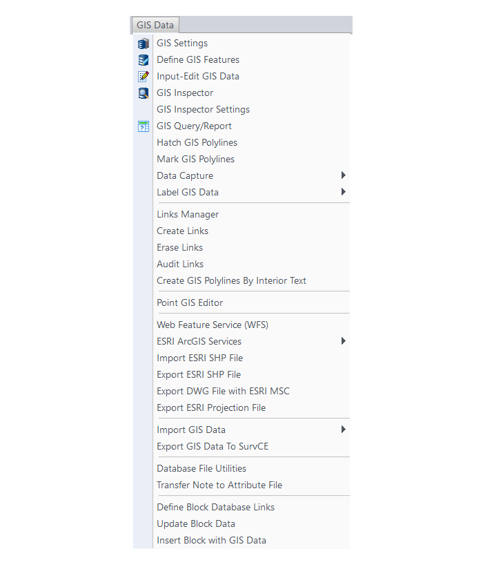
GIS Tools Menu
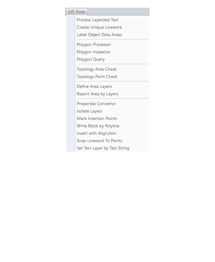
Images Menu
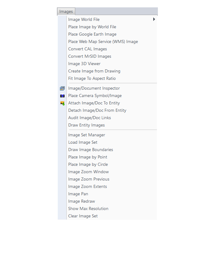
The menus below are in all non-OEM programs of Carlson 2017 desktop software
(Click image to see more)
Some content on this website was prepared with AI assistance. Please verify important information with the manufacturer or original source before making purchasing or financial decisions.
If you find the material on this website helpful, please consider supporting That CAD Girl by purchasing our products or services.
If you are interested in purchasing products or services we do not offer, we would love to refer you to one of our Trusted Partners. Please click here to send us a message with your request.
What features & menus are in Carlson Construction? (a running thread)
+Carlson Construction 2017

Features and Benefits of Construction 2017
Fully supporting all of the major 3D Machine Control formats for today’s heavy equipment with 3D Machine Control Systems, Carlson Construction gives you the tools you need for taking your data into the 3D environment. Whether your Carlson software need is “Data Preparation,” “Site Preparation,” or specifically creating Machine Control Guidance Models, Carlson Construction will get the job done for you.
Menus in Construction 2017
Menu Bar in Construction 2017

The menus below are available in Carlson Construction 2017
Elevate Menu
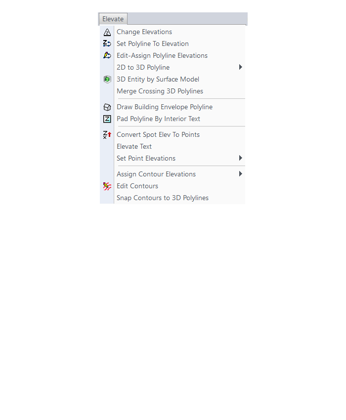
Surface Menu
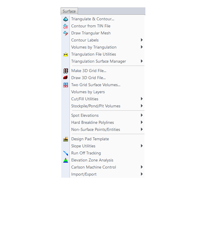
Takeoff Menu
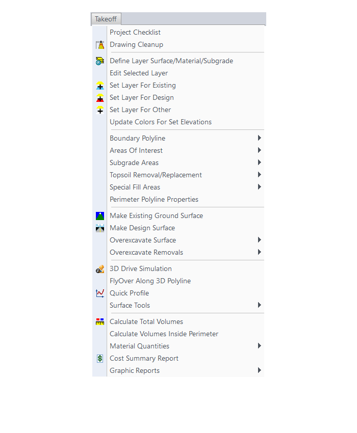
Roads Menu
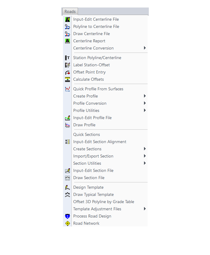
Survey Menu
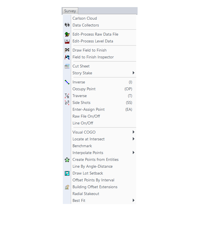
Annotate Menu
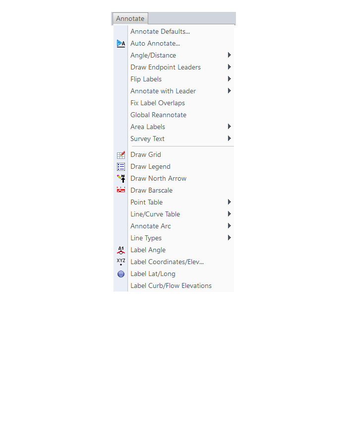
Display Menu
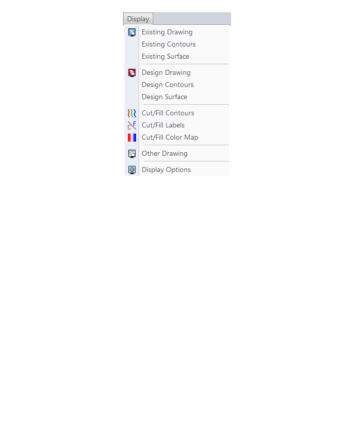
The menus below are in all non-OEM programs of Carlson 2017 desktop software
(Click image to see more)
Some content on this website was prepared with AI assistance. Please verify important information with the manufacturer or original source before making purchasing or financial decisions.
If you find the material on this website helpful, please consider supporting That CAD Girl by purchasing our products or services.
If you are interested in purchasing products or services we do not offer, we would love to refer you to one of our Trusted Partners. Please click here to send us a message with your request.
What features & menus are in Carlson CADNet? (a running thread)
+Carlson CADNet 2017

Features and Benefits of CADNet 2017
Carlson CADnet, introduced in 2014, allows users to import faster images and PDF files and, if needed, even to merge multiple images into one file that can be digitized or otherwise converted by CAD software using a variety of raster-to-vector routines. CADNet also gives you many tools to help clean up text and linework generated from raster images.
Recent updates to CADNet gives you the ability to export drawing entities to 3D PDF files, import Sketchup files and import and export BIM models (doors, windows, walls, roofs, etc.) and bring them into CAD as CAD software entities; plus, CADnet includes a routine to export surfaces into BIM.
Menus in CADNet 2017
Menu Bar in CADNet 2017

The menus below are available in Carlson CADNet 2017
Digitize Menu
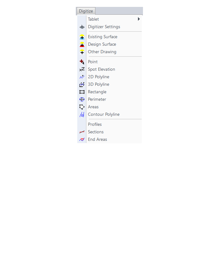
Raster Menu
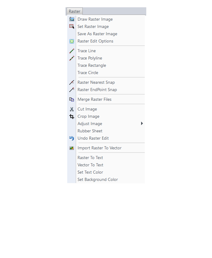
PDF Menu
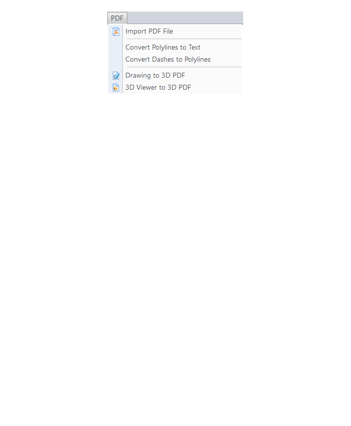
BIM Menu
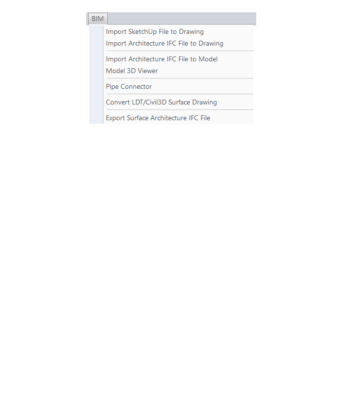
The menus below are in all non-OEM programs of Carlson 2017 desktop software
(Click image to see more)
Some content on this website was prepared with AI assistance. Please verify important information with the manufacturer or original source before making purchasing or financial decisions.
If you find the material on this website helpful, please consider supporting That CAD Girl by purchasing our products or services.
If you are interested in purchasing products or services we do not offer, we would love to refer you to one of our Trusted Partners. Please click here to send us a message with your request.
What features & menus are in Carlson GeoTech? (a running thread)
+FAQ: What are the improvements to Carlson over previous versions? (a running thread)
Carlson GeoTech 2025
Features and Benefits of GeoTech 2025
“GeoTech will model all core samples and produce a detailed, easy-to-read report for drill logs, cross sections, and plan view,” says Dave Carlson, V.P. of Development for Carlson Software.
In addition, this information is fully integrated with Carlson Civil, for determining site stability and suitability, and also Carlson Construction, for accurate strata takeoff estimation.
FAQ: What are the improvements to Carlson over previous versions? (a running thread)
Carlson GeoTech 2017
Features and Benefits of GeoTech 2017
“GeoTech will model all core samples and produce a detailed, easy-to-read report for drill logs, cross sections, and plan view,” says Dave Carlson, V.P. of Development for Carlson Software.
In addition, this information is fully integrated with Carlson Civil, for determining site stability and suitability, and also Carlson Construction, for accurate strata takeoff estimation.
Menus in GeoTech 2025
Menu Bar in GeoTech 2025

The menus below are available in Carlson GeoTech 2025
Menus in GeoTech 2017
Menu Bar in GeoTech 2017

The menus below are available in Carlson GeoTech 2017
Drillhole Menu
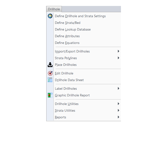
StrataCalc Menu
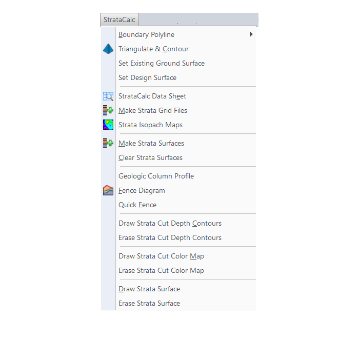
Grids Menu
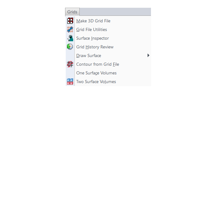
Map Menu
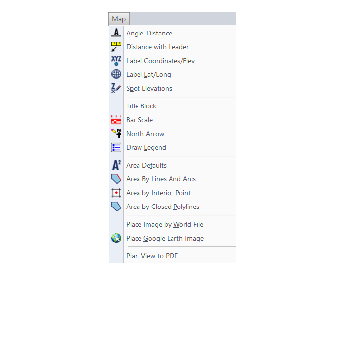
Drillhole Menu
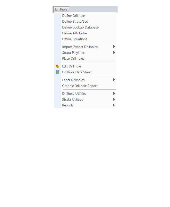
StrataCalc Menu
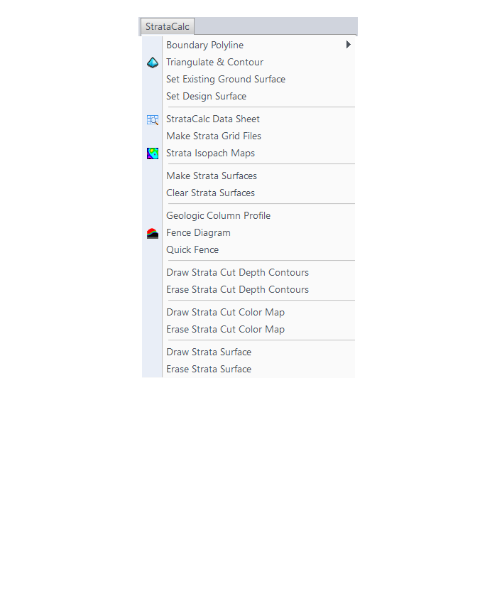
Grids Menu
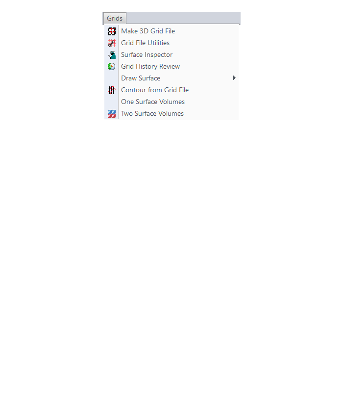
Map Menu
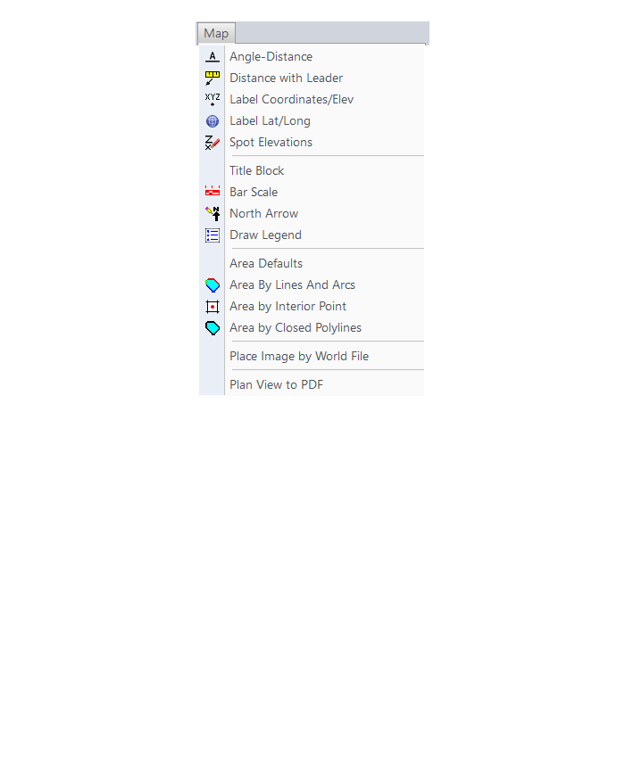
The menus below are in all non-OEM programs of Carlson 2017 desktop software
(Click image to see more)
The menus below are in all non-OEM programs of Carlson 2017 desktop software
(Click image to see more)
Some content on this website was prepared with AI assistance. Please verify important information with the manufacturer or original source before making purchasing or financial decisions.
If you find the material on this website helpful, please consider supporting That CAD Girl by purchasing our products or services.
If you are interested in purchasing products or services we do not offer, we would love to refer you to one of our Trusted Partners. Please click here to send us a message with your request.
What features & menus are in Carlson Takeoff with embedded AutoCAD (OEM)? (a running thread)
+Takeoff 2017 (R9) with embedded AutoCAD (OEM)

Features and Benefits of Takeoff 2017 (R9) with embedded AutoCAD (OEM)
Key features include:
- Calculate site cut & fill and topsoil
- Differentiate strata volumes & dirt vs. rock
- Accurately determine subgrade quantities
- Estimate trench and pipe quantities
- Estimate roadways from cross-sections
- Prepare the design info for exact staking
- Create a 3D model for machine control
Menus in Takeoff 2017 (R9) with embedded AutoCAD (OEM)
Menu bar in Takeoff 2017 (R9)

The menus below are available in Carlson Takeoff 2017 (R9) with embedded AutoCAD (OEM)
File Menu
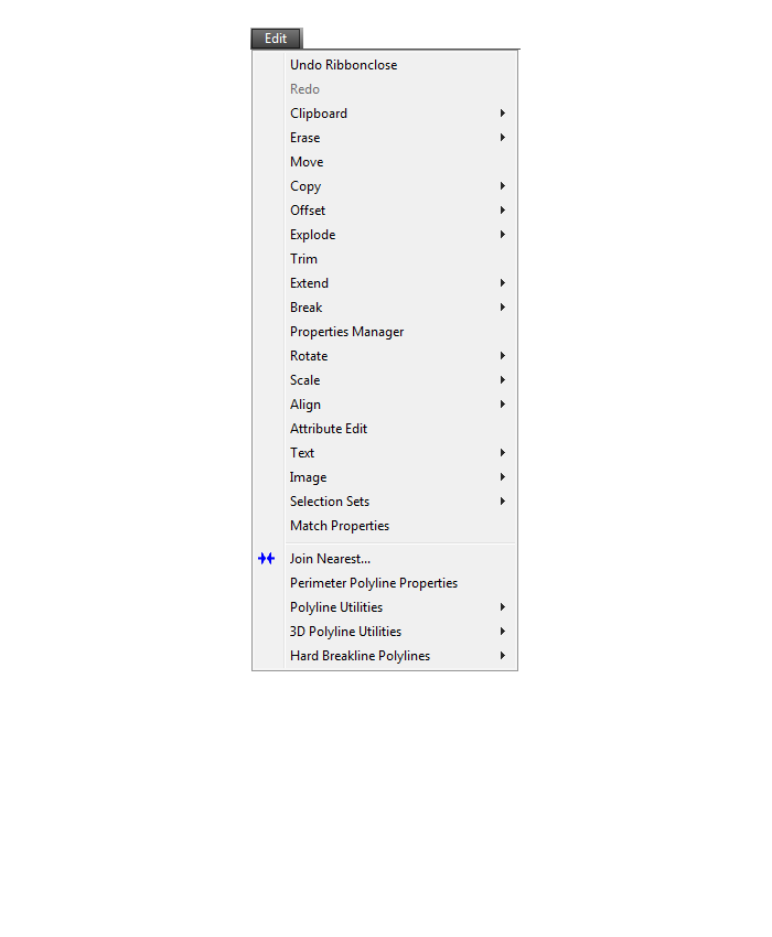
Edit Menu
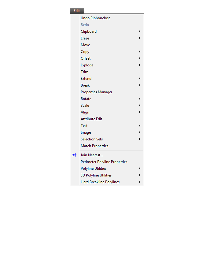
View Menu
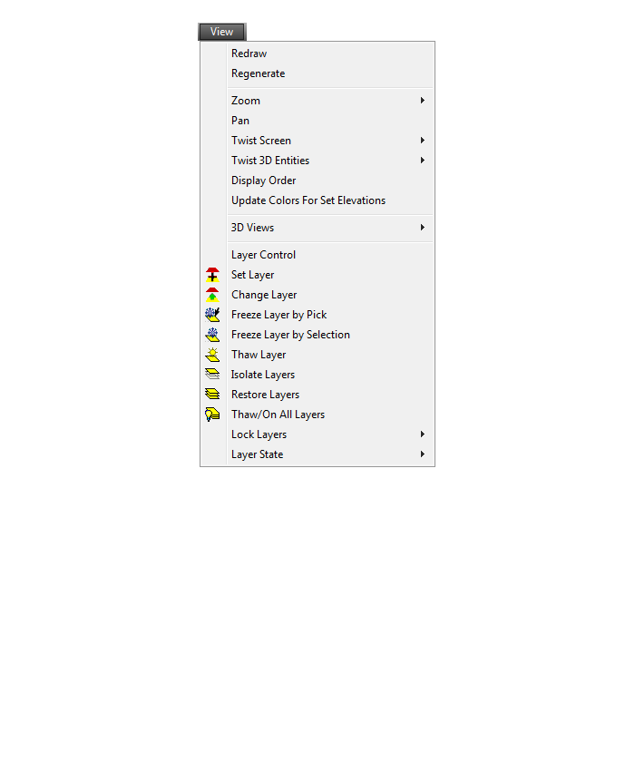
Draw Menu
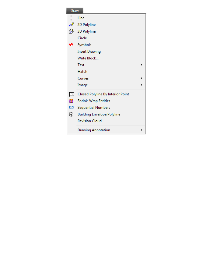
Digitize Menu
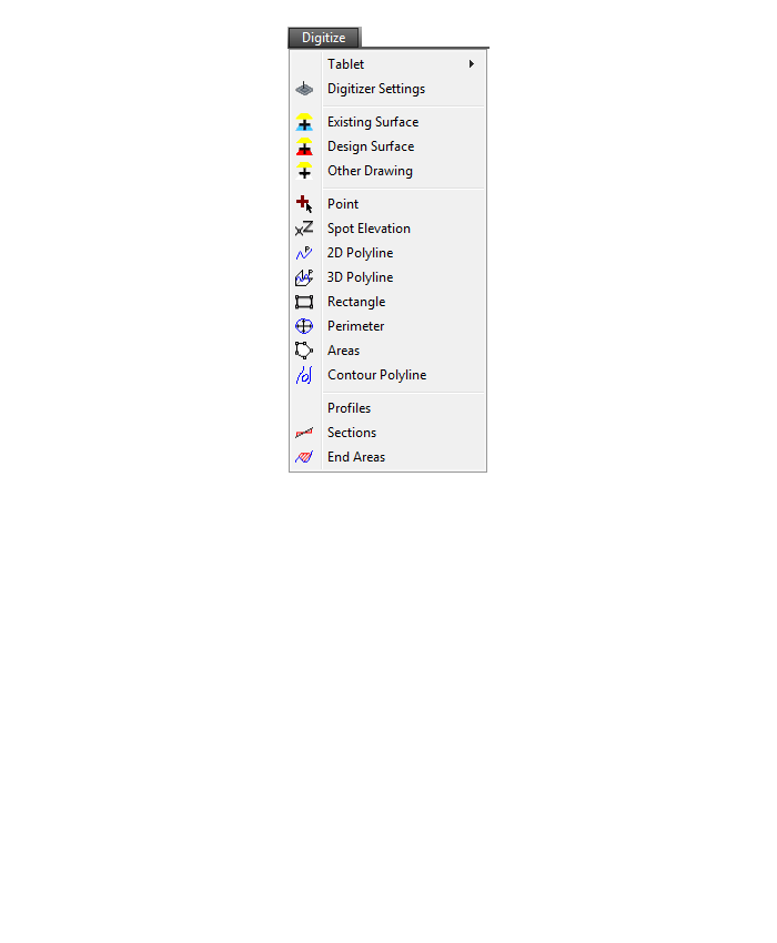
Raster Menu
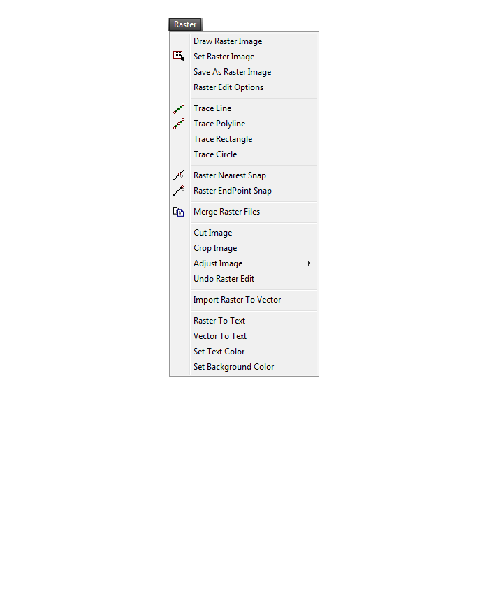
Elevate Menu
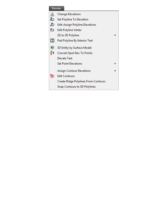
Takeoff Menu
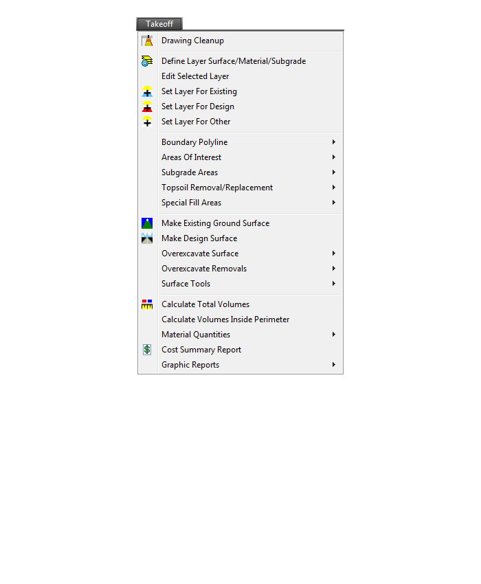
Drillhole Menu
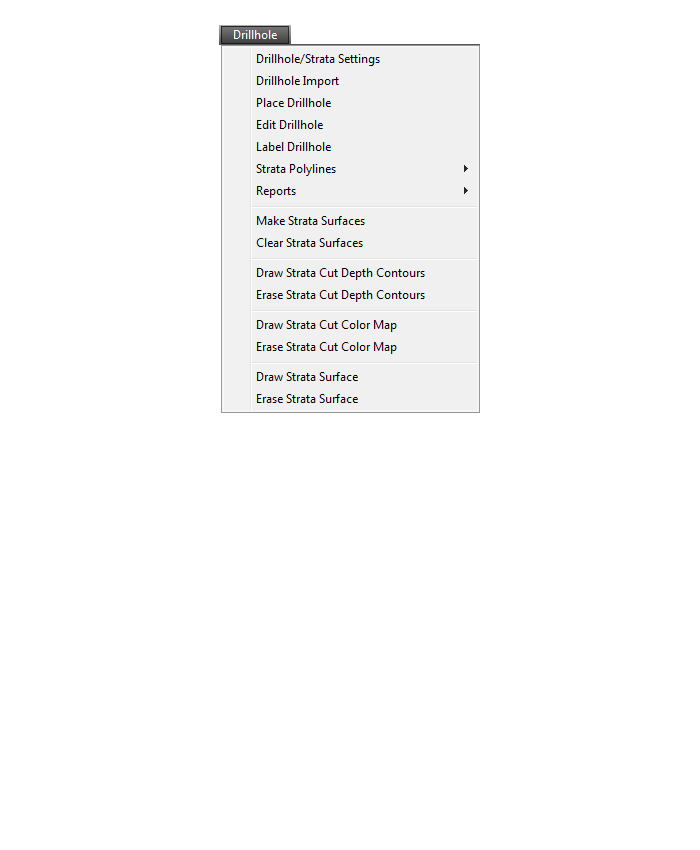
Trench Menu
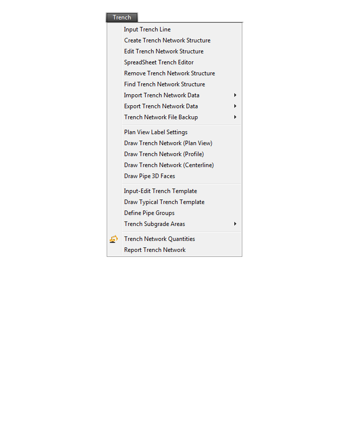
Roads Menu
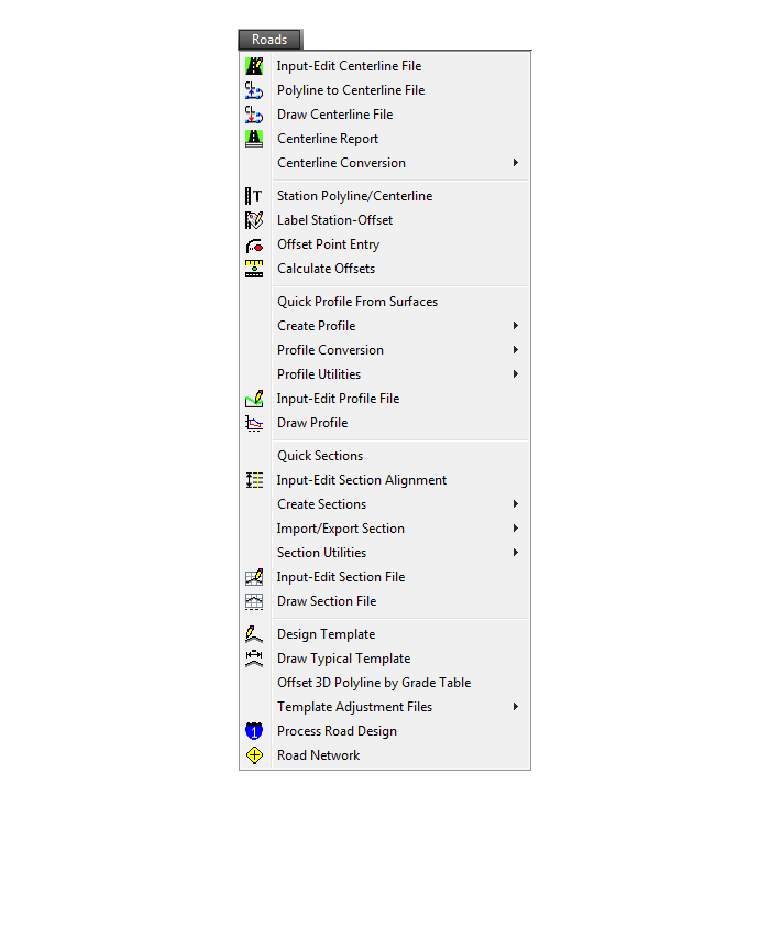
Points Menu
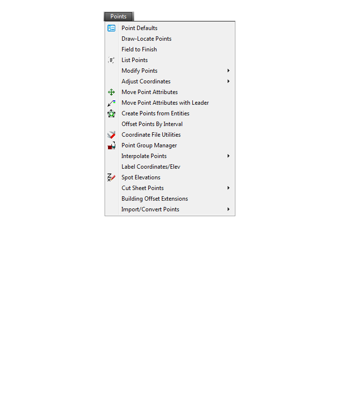
Surface Menu
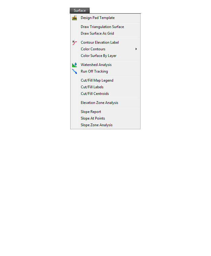
Inquiry Menu
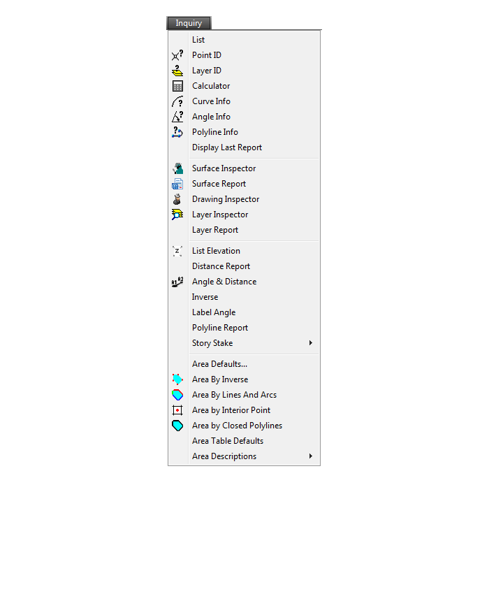
Settings Menu
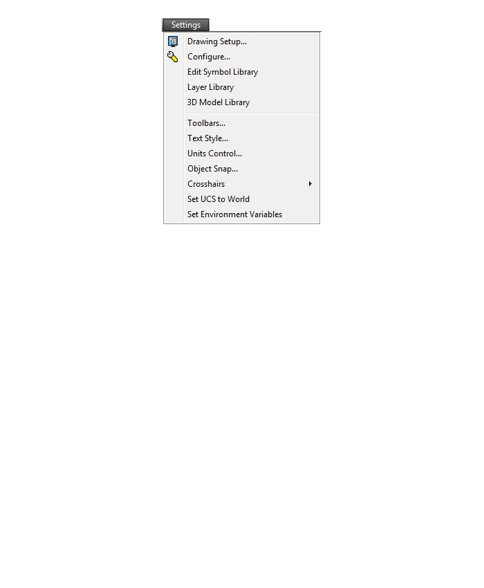
Display Menu
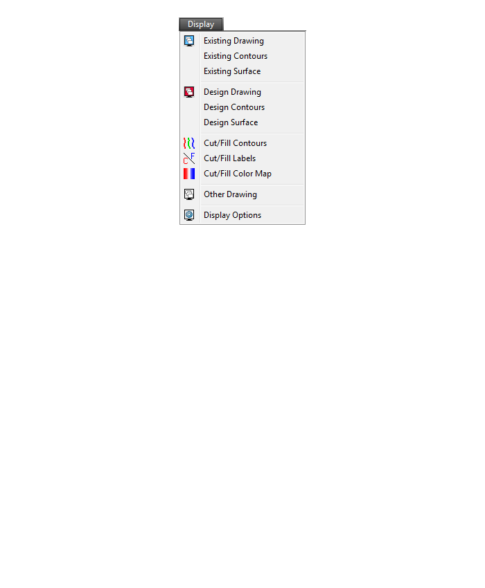
Window Menu
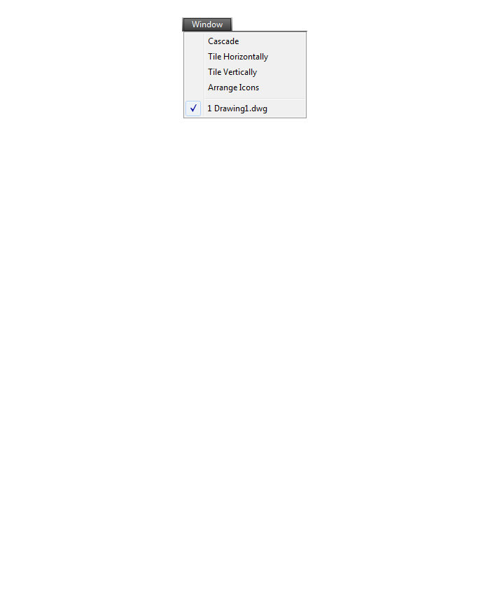
Help Menu
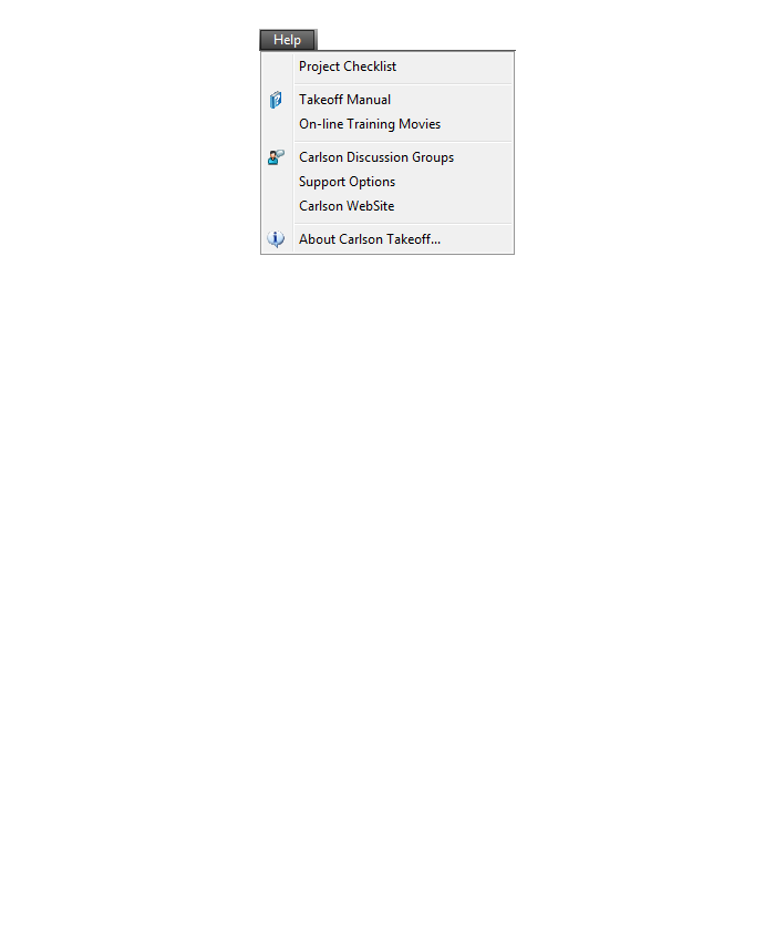
Some content on this website was prepared with AI assistance. Please verify important information with the manufacturer or original source before making purchasing or financial decisions.
If you find the material on this website helpful, please consider supporting That CAD Girl by purchasing our products or services.
If you are interested in purchasing products or services we do not offer, we would love to refer you to one of our Trusted Partners. Please click here to send us a message with your request.
Are Express Tools available in Carlson?
+Carlson Layer Tools are highlighted in the View menu below:
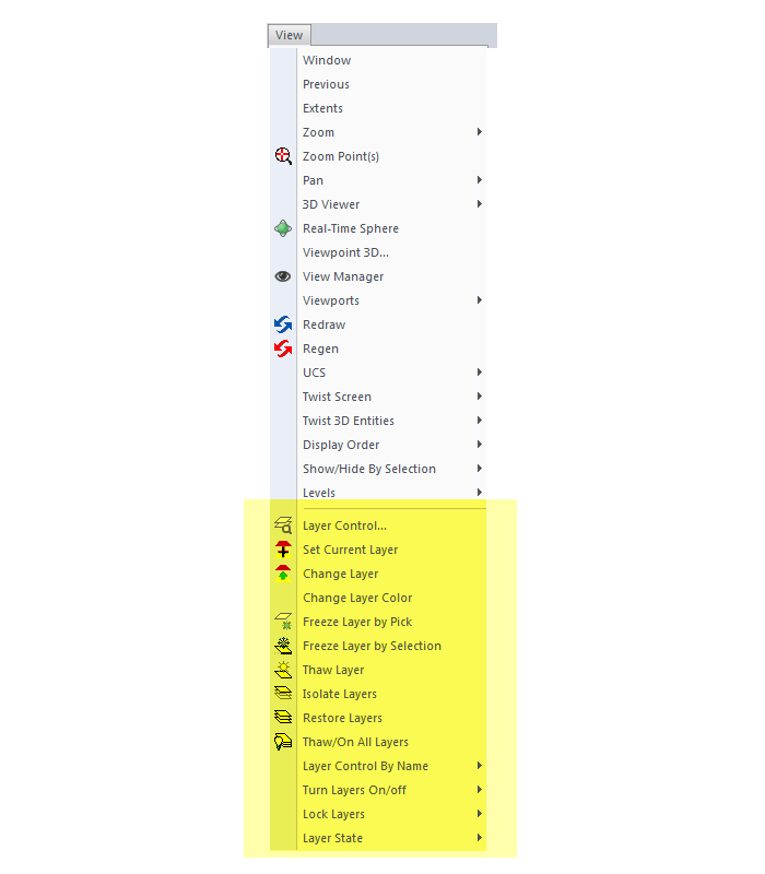

Some content on this website was prepared with AI assistance. Please verify important information with the manufacturer or original source before making purchasing or financial decisions.
If you find the material on this website helpful, please consider supporting That CAD Girl by purchasing our products or services.
If you are interested in purchasing products or services we do not offer, we would love to refer you to one of our Trusted Partners. Please click here to send us a message with your request.
What features & menus are in Carlson SurvCE and SurvPC? (a running thread)
+SurvCE and SurvPC 5.xx

Features and Benefits of SurvCE and SurvPC 5.x
- Get the software that supports a wide variety of equipment, old or new.
- Enjoy excellent, free (and prompt) technical support
- Be heard – Carlson listens to its customers’ input for new features or drivers for all of its products
Carlson SurvCE is a complete data collection system for Real Time (RTK) GPS and Total Stations with in-field coordinate geometry. It supports the widest range of popular and new release RTK GPS and conventional/robotic total stations.
SurvCE and its full-windows companion SurvPC can be configured with various combinations of 4 modules: Total Station (Basic), Robotics (requires Basic), Carlson GPS and Advanced Roading (Requires Basic or other Carlson GPS).
Refer to this FAQ to see if your hardware is supported in SurvCE & SurvPC
Menus in SurvCE and SurvPC 5.x
File Menu
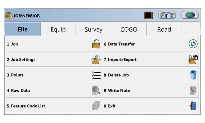
Equip Menu
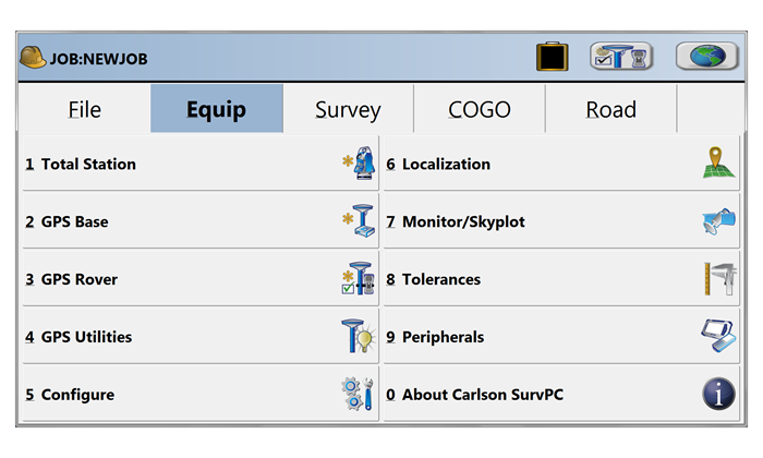
Survey Menu
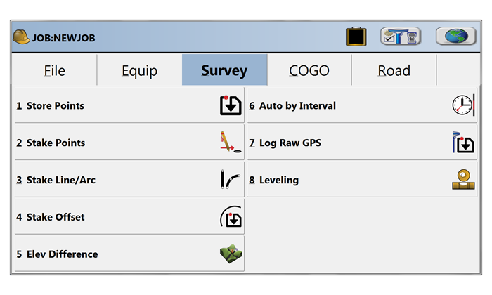
COGO Menu
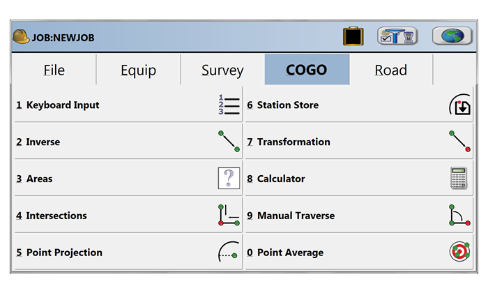
Road Menu
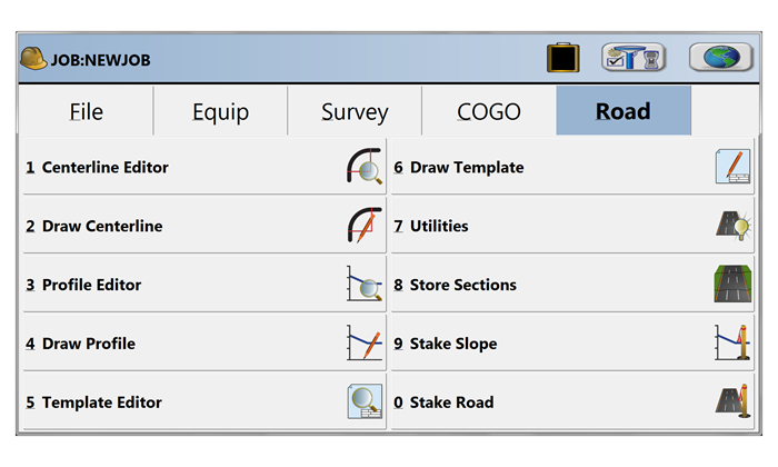
Select Equipment
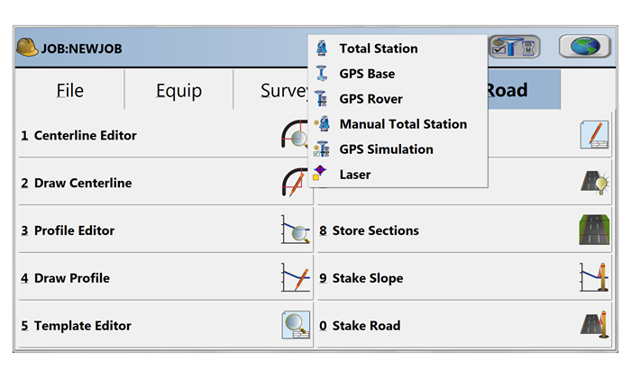
Map View | FILE Menu
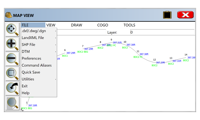
Map View | VIEW Menu
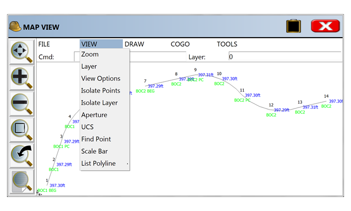
Map View | DRAW Menu
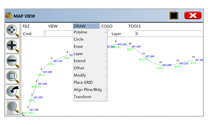
Map View | COGO Menu
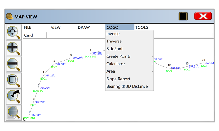
Map View | TOOLS Menu
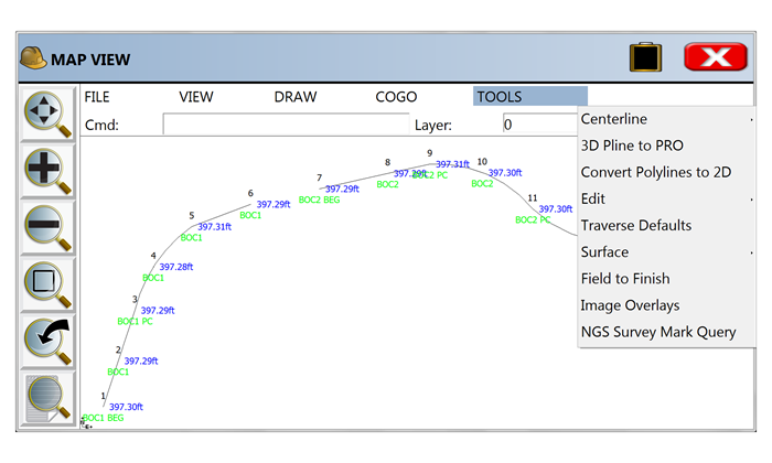
Some content on this website was prepared with AI assistance. Please verify important information with the manufacturer or original source before making purchasing or financial decisions.
If you find the material on this website helpful, please consider supporting That CAD Girl by purchasing our products or services.
If you are interested in purchasing products or services we do not offer, we would love to refer you to one of our Trusted Partners. Please click here to send us a message with your request.
What are the system requirements to run Carlson SurvPC?
+
Click here to review the minimum system requirements for SurvPC.
Some content on this website was prepared with AI assistance. Please verify important information with the manufacturer or original source before making purchasing or financial decisions.
If you find the material on this website helpful, please consider supporting That CAD Girl by purchasing our products or services.
If you are interested in purchasing products or services we do not offer, we would love to refer you to one of our Trusted Partners. Please click here to send us a message with your request.
What features are in Carlson Precision 3D? (a running thread)
+Refer to this FAQ to see the latest improvements to Carlson’s desktop software products
Carlson Precision 3d Topo 2017
Features and Benefits of Precision 3D 2017
Carlson Precision 3D Topo’s editing ability of digital terrain models (DTMs) offers many benefits:
- Load and review the two most common formats for surfaces: LandXML and DXF files of 3D Faces, in addition to TIN and Grd files from Carlson Software.
- Overlay other LandXML file types such as points, alignments, parcels, storm and sanitary sewers, culvert pipes and other piping systems.
- View the 3D Surface with user-controlled textures to quickly spot errors in the DTM.
- Fix the errors in the DTM for re-saving and use in CAD programs, or for direct output for machine control and survey stakeout.
Never before has there been such an array of tools to locate and correct DTM errors, all in a sharp 3D interface. Surveyors, contractors and engineers alike can use the software to make sure the final DTM surface is of the highest quality. Editing tools include surface blending, spike and dimple removal, DTM vertex editing and surface pad placement by defined polygon and outslope conditions. Multiple undoes and redoes allow you to study your changes and makes things perfect.
Some content on this website was prepared with AI assistance. Please verify important information with the manufacturer or original source before making purchasing or financial decisions.
If you find the material on this website helpful, please consider supporting That CAD Girl by purchasing our products or services.
If you are interested in purchasing products or services we do not offer, we would love to refer you to one of our Trusted Partners. Please click here to send us a message with your request.
Does Carlson Software Still Offer Perpetual Licenses?
+The change from a perpetual license model (you purchase once and continue to use it forever) to a subscription license model (you pay by the month or by the year for access) in our little CAD corner of the world has sparked a lot of questions, debate and heartburn.
In 2015 Autodesk announced they would be shifting toward a subscription model of delivery for their AutoCAD-based products. Although some Autodesk accounts and products were grandfathered in, any new purchases of AutoCAD are now available by subscription only. And, the kicker, you stop paying, you can’t access the software or your data.
Carlson Software remains committed to the perpetual license model where you, the user, never have to worry about losing access to your software or data. Carlson’s desktop software includes a license of IntelliCAD so, if you ever stop paying for your AutoCAD, Carlson with IntelliCAD can give you another option to open your DWG files. If you want to ensure you have “perpetual” access to all your other data such as points, surfaces, road designs and more – make sure you archive your project data to Land XML files so that it can be retrieved with other land development, survey, civil and construction software programs.
See also: How can I access and use my old Civil 3d, Land Desktop, Eagle Point or Terra Model data?
See also: Get a Perpetual License with Carlson or download PDF
See also: Robert Green’s CAD Manager’s Newsletter #350 Autodesk Goes Subscription-Only in 2016 or download PDF
See also: Autodesk Courtesy Notice: End of Perpetual Licenses Sales, including individual products and suites
Some content on this website was prepared with AI assistance. Please verify important information with the manufacturer or original source before making purchasing or financial decisions.
If you find the material on this website helpful, please consider supporting That CAD Girl by purchasing our products or services.
If you are interested in purchasing products or services we do not offer, we would love to refer you to one of our Trusted Partners. Please click here to send us a message with your request.
My Maintenance is Current… Where’s My Upgrade?
+With the building out of your That CAD Girl Customer Portal, we are doing our best to have all the information you need about your serial numbers easily accessible and available to you.
As soon as possible after a new release, we will post your new, upgraded serial number(s) to your Customer Portal and will upload a new maintenance report showing your new serial number(s). However, if you get to this before we do… you can use the Carlson Software Serial Number Upgrade Lookup site to get your new serial number as soon as it’s released.
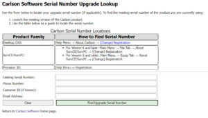
You will need the items listed below. Your serial number and Carlson Customer ID can be found on your That CAD Girl Customer Portal:
- Your current serial number
- Your Carlson Customer ID
- Phone Number
- Email Address
Some content on this website was prepared with AI assistance. Please verify important information with the manufacturer or original source before making purchasing or financial decisions.
If you find the material on this website helpful, please consider supporting That CAD Girl by purchasing our products or services.
If you are interested in purchasing products or services we do not offer, we would love to refer you to one of our Trusted Partners. Please click here to send us a message with your request.
When I upgrade, do I immediately lose access to the older version of my software?
+Actually, when you purchase your upgrade or receive a new serial number by virtue of a maintenance upgrade, nothing happens until you want it to.
Whenever you’re ready to install the upgrade, you can do so on the same computer or on a different computer. When you install and register the license with the new serial number, a 60-day “clock” starts counting down on the older installation. When the 60-days expire, the old license will de-activate and will revert to running in trial mode.
Some content on this website was prepared with AI assistance. Please verify important information with the manufacturer or original source before making purchasing or financial decisions.
If you find the material on this website helpful, please consider supporting That CAD Girl by purchasing our products or services.
If you are interested in purchasing products or services we do not offer, we would love to refer you to one of our Trusted Partners. Please click here to send us a message with your request.
Is BricsCAD Lite truly 2D only? What can I do in Lite? What can’t I do in Lite?
+The main difference is:
BricsCAD Lite can work with basic geometry in 3D space, but BricsCAD Pro is required for true 3D modeling, terrain surfaces and civil design.
Can I draw linework with different elevations?
Yes. The standard LINE command accepts X, Y and Z coordinates. For example, a line can begin at 100,200,10 and end at 150,250,25.
Lite also includes the 3DPOLY command. This creates a connected series of line segments whose vertices can each have different X, Y and Z values.
What civil and survey work can I do in BricsCAD Lite?
| Civil or Survey Task | Available in Lite? |
|---|---|
| Enter X, Y and Z coordinates | Yes |
| Draw lines between points at different elevations | Yes |
| Draw 3D polylines | Yes |
| Create survey breaklines | Yes |
| Draw utility or pipe centerlines in 3D | Yes |
| Connect measured XYZ points with linework | Yes |
| Use 3D object snaps and coordinate systems | Yes |
| Orbit around and view drawings from different angles | Yes |
| Open and view DWG files containing 3D objects | Yes |
| Create individual 3D faces or basic faceted meshes | Yes |
A 3D polyline, 3D face or faceted mesh is still basic drawing geometry. It is not an intelligent terrain surface and does not provide automatic contouring, slope analysis or volume calculations.
What civil and survey work can’t I do in BricsCAD Lite?
BricsCAD Lite does not include BricsCAD’s civil modeling and design tools.
| Civil or Survey Task | Available in Lite? |
|---|---|
| Automatically create a TIN surface from points or breaklines | No |
| Generate contours from a terrain surface | No |
| Calculate cut and fill volumes | No |
| Create intelligent civil points | No |
| Create grading objects | No |
| Create alignments or profiles | No |
| Create corridors | No |
| Create civil section views and labels | No |
| Create or edit true 3D solids and modern surfaces | No |
These tools require BricsCAD Pro or a higher BricsCAD license level.
Can Lite open drawings that contain 3D objects?
Yes. Lite can open and display DWG files containing 3D solids, surfaces and other 3D objects. You can orbit around the drawing, inspect the model and generally move, copy, rotate or scale complete objects.
However, Lite does not include the full tools needed to create or remodel those objects. For example, you cannot extrude a boundary into a solid, push or pull a solid face or cut one solid from another.
Are BricsCAD Lite and BricsCAD Pro separate programs?
No. Lite and Pro are different license levels of the same BricsCAD program. They use the same installer for the same BricsCAD version, operating system, processor platform and language.
The activated license controls which commands and features are available. If you upgrade from Lite to Pro, you generally do not need to uninstall BricsCAD or download a separate Pro installer. You can activate the Pro license in the existing installation and restart BricsCAD if necessary.
Bottom Line
BricsCAD Lite is not strictly 2D. It can create elevated lines, 3D polylines, survey breaklines and other basic XYZ geometry.
BricsCAD Lite may be sufficient when you need to draft or exchange civil and survey linework with elevations; but, choose BricsCAD Pro when you need terrain surfaces, contours, volumes, grading, alignments, profiles, corridors or true 3D modeling.
Some content on this website was prepared with AI assistance. Please verify important information with the manufacturer or original source before making purchasing or financial decisions.
If you find the material on this website helpful, please consider supporting That CAD Girl by purchasing our products or services.
If you are interested in purchasing products or services we do not offer, we would love to refer you to one of our Trusted Partners. Please click here to send us a message with your request.
What you should know about purchasing progeCAD by progeSOFT
+
About the Companies
About progeSOFT
progeSOFT, founded in 1985 and based in Chiasso Switzerland, is a privately owned company known for delivering low cost 2D and 3D CAD software for Windows and macOS. The company develops both progeCAD for Windows and iCADMac, a native DWG CAD solution for macOS, giving users on either platform powerful tools for drafting and design at a competitive price.
As a founding member of the IntelliCAD Technology Consortium, progeSOFT has helped shape the direction of DWG-based CAD development. Today, it serves a global user base across industries like construction, engineering and manufacturing, with major clients including Boeing, Samsung and ABB Group.
Click here to learn more about progeSOFT
About progeCAD USA
progeCAD USA is the North American distributor for progeSOFT’s CAD products.
Headquartered in Clackamas Oregon, the company provides support and resources for users of DWG-based CAD software in the United States and surrounding regions.
progeCAD USA also develops progeEARTH, a civil and survey add-on suite designed for land development professionals working in coordinate geometry, terrain modeling and road design.
The company has been involved in CAD software development since 1985 and was one of the founding members of the IntelliCAD Technology Consortium (ITC) in 1999.
Click here to learn more about progeCAD USA
About the Software
About progeCAD
progeCAD is a DWG-native 2D and 3D CAD application developed by progeSOFT. Built on the IntelliCAD engine, it works natively in DWG format and includes a wide set of design tools and libraries.
Available through a try and buy model, progeCAD is used by over 250,000 professionals worldwide across industries such as construction, automotive and technology. It delivers high performance CAD at a competitive price.
Click here to learn more about progeCAD
Click here for a feature comparison between progeCAD, AutoCAD and AutoCAD LT
About iCADMac
iCADMac is the first DWG-native 2D/3D CAD solution designed specifically for macOS, compatible with AutoCAD files up to the 2025 version.
It offers a familiar AutoCAD-like interface and provides tools such as PDF import/export, gradient hatches, tables, ACIS® solid modelling, constraints, custom blocks, extensive hatch patterns and powerful rendering capabilities.
Click here to learn more about iCADMac
Click here for a list of features in iCADMac
About progeEARTH
progeEARTH is a civil and survey add-on suite for progeCAD Professional. It includes tools for coordinate geometry (COGO), digital terrain modeling (DTM) and simple road corridor design.
The suite is organized into modules—Survey/Cogo, DTM and Roads—each tailored to support topographic mapping, site planning and field-to-finish workflows.
Click here to learn more about progeEARTH
Operating System
progeCAD
Windows 10 and 11 (64-bit only)
iCADMac
macOS v13 (Ventura), v14 (Sonoma), v15 (Sequoia)
System Requirements
progeCAD
- Processor: 2.2 GHz or faster (2.5 GHz recommended)
- RAM: Minimum 4 GB (8 GB recommended)
- Disk: At least 4 GB free disk space
- Graphics: Dedicated NVIDIA GeForce or compatible; Artisan Render does not support AMD graphics cards
iCADMac
- Intel® Core™ i5 or superior
- ARM: Apple M1 ARM or superior
- 8 GB RAM (16 GB recommended)
- 8 GB free disk space for download and installation
- mac OS X-compliant printer
Click here to learn more about progeCAD System Requirements
Click here to learn more about iCADMac System Requirements
CAD Platform
All application software developed by progeSOFT and progeCAD USA are built on the IntelliCAD CAD platform.
How and Where to Purchase
progeCAD and progeEARTH can be purchased directly from the progeCAD USA or through their authorized dealer network.
Pricing is subject to change without notice and varies depending on software edition and add-ons.
If you would like a referral from That CAD Girl to one of our trusted partners, please click here to Send Us a Message with your request
Upgrades to New Versions, Competitive Upgrades and Crossgrades to Different License Types
progeCAD and iCADMac can be upgraded to the most current version at a reasonable, reduced rate versus the cost of a new license. An active subscription to iCARE includes updates and upgrades to newly released versions.
Users of other CAD programs, such as AutoCAD, are eligible for discounted competitive upgrades to Single or Network licenses of progeCAD Professional.
Click here to learn more about progeCAD upgrades and crossgrades
Click here to learn more about iCADMac upgrades
Click here to learn more about iCARE
License Types and License Terms
License Terms
Both progeCAD and iCADMac sell with perpetual licenses which do not expire and no annual fee required. The licensed software version will run for as long as your hardware and operating system support it.
License Types
iCADMac
Offers only a SL – Single license deployment.
progeCAD
Offers both Single License and Network License deployment options.
- SL – Single license
These licenses are assigned to individual users and can’t be shared. The Single License allows the same user to keep the software installed simultaneously on a desktop and a laptop for more flexibility. - NLM – Network Licenses
Network licenses aren’t assigned to individual users and can be shared. Network licenses do not require an internet connection to activate or use. progeCAD NLM can be installed on as many computers as you want. However, you can use the software simultaneously only on the number of purchased seats. License Take-Away included: thanks to this feature NLM licenses can be temporarily moved on laptops or a remote PC to be used offline. Max flexibility!
Click here AND
Click here to learn more about progeCAD licensing
Click here to learn more about iCADMac licensing
Software Trials
progeCAD, progeEARTH and iCADMac can run in trial mode for 30 days. After this period, you need to activate a valid commercial license.
If you would like our help requesting a trial of this software from an authorized dealer, please click here to Send Us a Message with your request
Support & Training Options
iCARE support and maintenance program includes free technical assistance via the web with the new help desk service through ticket, email, live chat and remote support.
Free video recordings and tutorials for progeCAD and iCADMac are available from progeSOFT’s website here: https://www.progesoft.com/video-tutorial/progeCAD-professional-media-video
Some content on this website was prepared with AI assistance. Please verify important information with the manufacturer or original source before making purchasing or financial decisions.
If you find the material on this website helpful, please consider supporting That CAD Girl by purchasing our products or services.
If you are interested in purchasing products or services we do not offer, we would love to refer you to one of our Trusted Partners. Please click here to send us a message with your request.
Does BricsCAD Offer a 30 day Trial?
+
Can I run BricsCAD without a license?
Yes. If you do not own a license, you can run BricsCAD in trial mode.
How long does the BricsCAD trial last?
The BricsCAD trial lasts 30 days from the time it is activated.
Is the BricsCAD trial fully functional?
Yes. During the trial period, BricsCAD runs as a fully functional version with no feature limitations.
What happens when I open BricsCAD in trial mode?
When BricsCAD is opened in trial mode, the BricsCAD Launcher opens automatically and displays how many days remain in your trial.
What options do I have when the BricsCAD Launcher opens?
You have two options:
- Continue to launch BricsCAD in trial mode
- Enter License to activate a Single user Volume or Network license
What license level does BricsCAD use during the trial?
By default, BricsCAD runs in Ultimate mode during the trial, giving you access to all available features.
Can I test different BricsCAD license levels during the trial?
Yes. You can switch between license levels while in trial mode to evaluate which edition best fits your needs.
How do I change the license level during a BricsCAD trial?
Use the SETLICENSELEVEL command within BricsCAD to change the active license level.
What license levels are available in BricsCAD?
BricsCAD offers five license levels:
- BricsCAD Lite
- BricsCAD Pro
- BricsCAD BIM
- BricsCAD Mechanical
- BricsCAD Ultimate
Can I apply a purchased license to a trial installation?
Yes. If you purchase a license during or after the trial, you can activate it without reinstalling BricsCAD.
Some content on this website was prepared with AI assistance. Please verify important information with the manufacturer or original source before making purchasing or financial decisions.
If you find the material on this website helpful, please consider supporting That CAD Girl by purchasing our products or services.
If you are interested in purchasing products or services we do not offer, we would love to refer you to one of our Trusted Partners. Please click here to send us a message with your request.
What Licensing Options Does BricsCAD Offer?
+
What is a BricsCAD perpetual license?
A perpetual license is a one time purchase that gives you ownership of the software.
What is BricsCAD Maintenance?
BricsCAD Maintenance is an optional annual plan for perpetual licenses. It provides:
- Priority Support
- Access to product updates
- Access to future major release versions
What is a BricsCAD subscription license?
A subscription license allows you to use the latest version of BricsCAD for one year. While active it includes Priority Support and access to all new versions released during the subscription term.
What is a BricsCAD single user license?
A single user license is assigned to one person. It is intended for individual use and is not a floating license.
A single user license may be installed on two computers, such as a desktop workstation and a laptop. However, the software may only be used on one computer at a time. Concurrent use is not permitted.
Single user licensing is available for both perpetual and subscription licenses.
Can I use my BricsCAD license on two machines?
Yes. If you own a single user BricsCAD license, you may install it on two machines for the same user. Typical examples include an office computer and a home or field laptop.
This dual install allowance does not apply to network or volume licenses unless expressly permitted by Bricsys.
What is a BricsCAD network license?
A network license is a floating license that allows multiple users to access BricsCAD within a local area network. Licenses are checked out from a central license server when BricsCAD is launched.
The number of network licenses purchased determines how many users can run BricsCAD at the same time.
Network licenses are available as perpetual or subscription licenses and include one year of BricsCAD Maintenance.
What is a BricsCAD volume license?
A volume license allows BricsCAD to be used within a defined group of users using the same license key.
Volume licenses are available as perpetual or subscription licenses and include one year of BricsCAD Maintenance.
Volume licenses do not include the dual install rights provided with single user licenses unless explicitly authorized by Bricsys.
What is a BricsCAD academic license?
BricsCAD academic licenses are free for 12 months and available to students instructors faculty and educational institutions.
Students may renew annually with a valid student ID.
What license types are available for academic use?
Academic licensing is available in single user network or volume formats.
Some content on this website was prepared with AI assistance. Please verify important information with the manufacturer or original source before making purchasing or financial decisions.
If you find the material on this website helpful, please consider supporting That CAD Girl by purchasing our products or services.
If you are interested in purchasing products or services we do not offer, we would love to refer you to one of our Trusted Partners. Please click here to send us a message with your request.
What you should know about purchasing CMS IntelliCAD
+
About CAD-Manufacturing Solutions (CMS)
CAD-Manufacturing Solutions Inc (CMS), based in Azle Texas, has over 30 years of experience in the CAD industry. Originally known for its proprietary ProCADD software, CMS now develops and markets CMS IntelliCAD which is built on the powerful customizable IntelliCAD Technology Consortium (ITC) platform.
The team behind CMS has been deeply involved in CAD software development for decades and continues to rely on CMS IntelliCAD internally, including at a partner corporation focused on advanced crane innovation and design.
Click here to learn more about CAD-Manufacturing Solutions (CMS)
About CMS IntelliCAD
CMS IntelliCAD is a DWG-native CAD application offering 2D drafting, 3D modeling and BIM underlay capabilities. It includes support for AutoCAD-like menus, ribbon interface, advanced rendering and custom development via LISP, VBA, .NET, IRX and SDS.
The software is designed to support users transitioning from AutoCAD or IntelliCAD-based platforms and includes customizable workspaces, menus, toolbars and command-line access.
All editions support CAD standards, external references (Xrefs), DGN overlay and interoperability with other CAD and GIS formats.
Click here to learn more about CMS IntelliCAD
Click here for a comparison between CMS IntelliCAD and AutoCAD
Operating System
CMS IntelliCAD runs on 64-bit Microsoft Windows systems.
System Requirements for CMS IntelliCAD 10 and Higher
- Processor: Intel Pentium 4 or faster, or comparable processor
- System Memory: 2 GB RAM minimum (more recommended for large files)
- Hard Disk Space: 4 GB free disk space recommended
- Display and Graphics: 1024 x 768 resolution or higher, OpenGL ES support
- Input Devices: Keyboard and mouse or other pointing device
For the most stable performance, users should install the 64-bit version of CMS IntelliCAD on 64-bit systems. The 64-bit version offers better handling of large drawings by accessing more system memory.
Click here to learn more about System Requirements for CMS IntelliCAD
CAD Platform
All CMS IntelliCAD applications (PE, PE Plus, Easy-Run) are built on the IntelliCAD platform.
How and Where to Purchase
CMS IntelliCAD products can be purchased directly from CMS IntelliCAD or through their authorized dealer network.
Pricing is subject to change without notice and varies depending on software edition and add-ons.
If you would like a referral from That CAD Girl to one of our trusted partners, please click here to Send Us a Message with your request.
Upgrades to New Versions, Competitive Upgrades and Crossgrades
CMS IntelliCAD offers upgrades from previous versions, crossgrades between editions and competitive upgrades for users of other CAD programs. A valid serial number is required for any upgrade or crossgrade.
License Types, License Terms & Editions
License Type
- Single
- Network license: Available in quantities of 3, 5, 10 and 20 for concurrent users
- Easy Run: Premium Edition only, accessed through a browser using Turbo.net technology
License Terms
- Perpetual license: One-time payment
- Subscription: Annual license with updates and support
Editions
- Premium Edition (PE): 2D/3D drafting, DWG compatibility, LISP/VBA/.NET customization
- Premium Edition Plus (PE Plus): Adds 3D ACIS solids, BIM underlay and Artisan rendering
Software Trials
CMS IntelliCAD can run in trial mode for 30 days. After this period, a valid commercial license is required for continued use.
If you would like our help requesting a trial of this software from an authorized dealer, please click here to Send Us a Message with your request.
Support & Training Options
- Community forum: forums.intellicadms.com
- Optional annual Paid Support Pack for activation help and priority access
- Phone support: +1 (817) 221-8855
- Training resources: Free course, videos, webinars and documentation included with purchase
Click here for more information about CMS IntelliCAD training and support
Some content on this website was prepared with AI assistance. Please verify important information with the manufacturer or original source before making purchasing or financial decisions.
If you find the material on this website helpful, please consider supporting That CAD Girl by purchasing our products or services.
If you are interested in purchasing products or services we do not offer, we would love to refer you to one of our Trusted Partners. Please click here to send us a message with your request.